 |
|
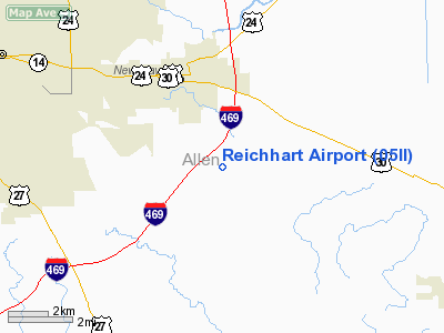
Location
& QuickFacts
|
FAA Information Effective: |
2008-06-05 |
|
Airport
Identifier: |
05II |
|
Airport
Status: |
Operational |
|
Longitude/Latitude: |
084-59-49.8820W/41-01-43.1740N
-84.997189/41.028659 (Estimated) |
|
Elevation: |
795 ft / 242.32 m (Estimated) |
|
Land: |
4
acres |
|
From
nearest city: |
3 nautical miles S of New Haven, IN |
|
Location: |
Allen County, IN |
|
Magnetic
Variation: |
04W (1985) |
Owner
& Manager
|
Ownership: |
Privately
owned |
|
Owner: |
Leullyn Reichhart |
|
Address: |
6627 Minich Rd
New
Haven, IN 46774 |
|
Phone
number: |
219-749-4725 |
|
Address: |
|
Airport Operations
and Facilities
|
Airport Use: |
Private |
|
Wind
indicator: |
Yes |
|
Segmented
Circle: |
No |
|
Control
Tower: |
No |
|
Sectional
chart: |
Detroit |
|
Region: |
AGL - Great Lakes |
|
Boundary
ARTCC: |
ZAU - Chicago |
|
Tie-in
FSS: |
HUF - Terre Haute |
|
FSS on
Airport: |
No |
|
FSS Toll
Free: |
1-800-WX-BRIEF |
|
Runway Information
Runway 09/27
|
Dimension: |
1800 x 100 ft
/ 548.6 x 30.5 m |
|
Surface: |
TURF, |
|
|
Runway 09 |
Runway 27 |
|
Traffic
Pattern: |
Left |
Left |
|
Obstruction: |
15 ft road |
|
|
Radio Navigation
Aids
|
ID |
Type |
Name |
Ch |
Freq |
Var |
Dist |
|
VFU |
NDB |
Stanley |
|
411.00 |
05W |
20.1 nm |
|
HHG |
NDB |
Huntington |
|
417.00 |
03W |
23.6 nm |
|
DFI |
NDB |
Defiance |
|
246.00 |
05W |
31.7 nm |
|
PLD |
NDB |
Portland |
|
257.00 |
03W |
34.6 nm |
|
BYN |
NDB |
Bryan |
|
260.00 |
04W |
36.2 nm |
|
ANQ |
NDB |
Angola |
|
347.00 |
05W |
37.0 nm |
|
CQA |
NDB |
Lakefield |
|
205.00 |
04W |
38.3 nm |
|
IWH |
NDB |
Wabash |
|
329.00 |
03W |
39.7 nm |
|
PDR |
NDB |
Ottawa |
|
233.00 |
05W |
46.3 nm |
|
LYL |
NDB |
Lima |
|
362.00 |
04W |
48.4 nm |
|
OLK |
VOR |
Wolf Lake |
|
110.40 |
03W |
26.2 nm |
|
MZZ |
VOR/DME |
Marion |
023X |
108.60 |
03W |
44.7 nm |
|
FWA |
VORTAC |
Fort Wayne |
125X |
117.80 |
00E |
9.2 nm |
|
FWA |
VOT |
Fort Wayne Baer |
|
111.00 |
|
9.3 nm |
Remarks
- PRVDD
OBSTNS IN APCH SFC ARE RMVD/LWRD OR THRS DSPLCD TO PRVD 20:1 SLOPE.
Based Aircraft
|
Aircraft
based on field: |
1 |
|
Single Engine
Airplanes: |
1 |
Reichhart Airport
Address:
Allen County, IN
Tel:
219-749-4725
Images
and information placed above are from
http://www.airport-data.com/airport/05II/
We
thank them for the data!
| General
Info |
| Country |
United
States |
| State |
INDIANA
|
| FAA ID |
05II |
| Latitude |
41-01-43.174N
|
| Longitude |
084-59-49.882W
|
| Elevation |
795 feet
|
| Near City |
NEW HAVEN
|
We don't guarantee the information is fresh and accurate. The data may
be wrong or outdated.
For more up-to-date information please refer to other sources.
|
|


