 |
|
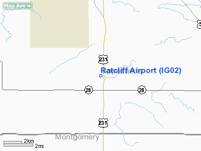
Location
& QuickFacts
|
FAA
Information Effective: |
2008-06-05 |
|
Airport
Identifier: |
IG02 |
|
Airport
Status: |
Operational |
|
Longitude/Latitude: |
086-54-27.0000W/40-16-23.0000N
-86.907500/40.273056 (Estimated) |
|
Elevation: |
730 ft / 222.50 m (Estimated) |
|
Land: |
0 acres |
|
From nearest
city: |
8 nautical miles S of Lafayette, IN |
|
Location: |
Tippecanoe County, IN |
|
Magnetic
Variation: |
02W (1995) |
Owner
& Manager
|
Ownership: |
Privately
owned |
|
Owner: |
Gary Ratcliff |
|
Address: |
9950 U.s. 231 South
Lafayette, IN 47905 |
|
Phone
number: |
317-538-3170 |
|
Manager: |
Gary Ratcliff |
|
Address: |
9950 U.s. 231 South
Lafayette, IN 47905 |
|
Phone
number: |
317-538-3170 |
Airport Operations
and Facilities
|
Airport
Use: |
Private |
|
Segmented
Circle: |
No |
|
Control
Tower: |
No |
|
Sectional
chart: |
Chicago |
|
Region: |
AGL - Great Lakes |
|
Boundary
ARTCC: |
ZAU - Chicago |
|
Tie-in
FSS: |
HUF - Terre Haute |
|
FSS on
Airport: |
No |
|
FSS Toll
Free: |
1-800-WX-BRIEF |
|
Runway Information
Runway 09/27
|
Dimension: |
1800 x 75 ft
/ 548.6 x 22.9 m |
|
Surface: |
TURF, Good Condition |
|
|
Runway 09 |
Runway 27 |
|
Traffic
Pattern: |
Left |
Left |
|
Radio Navigation
Aids
|
ID |
Type |
Name |
Ch |
Freq |
Var |
Dist |
|
FKR |
NDB |
Frankfort |
|
278.00 |
02W |
15.8 nm |
|
CFJ |
NDB |
Crawfordsville |
|
388.00 |
02W |
17.6 nm |
|
MCX |
NDB |
White County |
|
377.00 |
03W |
27.1 nm |
|
TVX |
NDB |
Greencastle |
|
521.00 |
03W |
33.9 nm |
|
GGP |
NDB |
Logansport |
|
263.00 |
01W |
35.8 nm |
|
HZP |
NDB |
Zionsville |
|
248.00 |
03W |
36.3 nm |
|
RZL |
NDB |
Rensselaer |
|
362.00 |
02W |
42.4 nm |
|
UMP |
NDB |
Metropolitan |
|
338.00 |
03W |
44.3 nm |
|
PRG |
NDB |
Paris |
|
341.00 |
01E |
49.4 nm |
|
BVT |
VORTAC |
Boiler |
098X |
115.10 |
01E |
18.6 nm |
|
DNV |
VORTAC |
Danville |
047X |
111.00 |
02E |
29.8 nm |
|
VHP |
VORTAC |
Brickyard |
110X |
116.30 |
01E |
37.1 nm |
|
GUS |
VORTAC |
Grissom |
21Y |
108.45 |
02W |
41.2 nm |
|
OKK |
VORTAC |
Kokomo |
082X |
113.50 |
00E |
41.8 nm |
|
TTH |
VORTAC |
Terre Haute |
100X |
115.30 |
02E |
49.7 nm |
|
IND |
VOT |
Indianapolis Intl |
|
109.60 |
|
43.7 nm |
Remarks
- PRVDD
AREA 125 FT EITHER SIDE OF RY & 200 FT OFF RY ENDS IS CLEAR OF OBSTNS;
OBSTNS REMOVED/LOWERED TO PROVIDE 20:1 APCH CLNC.
Ratcliff Airport
Address:
Tippecanoe County, IN
Tel:
317-538-3170
Images
and information placed above are from
http://www.airport-data.com/airport/IG02/
We
thank them for the data!
| General
Info |
| Country |
United
States |
| State |
INDIANA
|
| FAA ID |
IG02 |
| Latitude |
40-16-23.000N
|
| Longitude |
086-54-27.000W
|
| Elevation |
730 feet
|
| Near City |
LAFAYETTE
|
We don't guarantee the information is fresh and accurate. The data may
be wrong or outdated.
For more up-to-date information please refer to other sources.
|
|


