 |
|
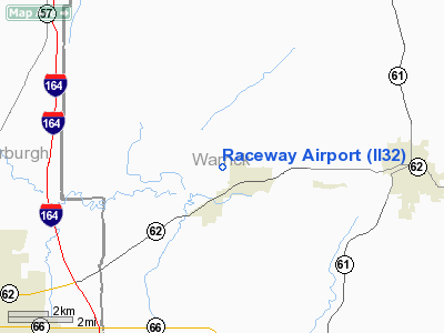
Location
& QuickFacts
|
FAA
Information Effective: |
2008-06-05 |
|
Airport
Identifier: |
II32 |
|
Airport
Status: |
Operational |
|
Longitude/Latitude: |
087-22-53.0350W/38-02-57.1600N
-87.381399/38.049211 (Estimated) |
|
Elevation: |
400 ft / 121.92 m (Estimated) |
|
Land: |
0 acres |
|
From nearest
city: |
1 nautical miles W of Chandler, IN |
|
Location: |
Warrick County, IN |
|
Magnetic
Variation: |
00W (1985) |
Owner & Manager
|
Ownership: |
Privately
owned |
|
Owner: |
Harold S. Baker |
|
Address: |
Rr 3,box 93
Chandler, IN 47610 |
|
Phone
number: |
812-925-7634 |
|
Address: |
|
Airport
Operations and Facilities
|
Airport
Use: |
Private |
|
Segmented
Circle: |
No |
|
Control
Tower: |
No |
|
Landing
fee charge: |
No |
|
Sectional
chart: |
St Louis |
|
Region: |
AGL - Great Lakes |
|
Boundary
ARTCC: |
ZID - Indianapolis |
|
Tie-in
FSS: |
HUF - Terre Haute |
|
FSS Toll
Free: |
1-800-WX-BRIEF |
|
Runway Information
Runway 04/22
|
Dimension: |
3600 x 60 ft
/ 1097.3 x 18.3 m |
|
Surface: |
ASPH, |
|
|
Runway 04 |
Runway 22 |
|
Traffic
Pattern: |
Left |
Left |
|
Radio Navigation
Aids
|
ID |
Type |
Name |
Ch |
Freq |
Var |
Dist |
|
PDW |
NDB |
Evansville |
|
284.00 |
00E |
7.1 nm |
|
GVA |
NDB |
Geneva |
|
224.00 |
01W |
23.7 nm |
|
FNZ |
NDB |
Ferdinand |
|
239.00 |
00E |
28.4 nm |
|
TEL |
NDB |
Tell City |
|
206.00 |
02W |
32.8 nm |
|
CUL |
NDB |
Carmi |
|
332.00 |
01W |
35.0 nm |
|
AJG |
NDB |
Mount Carmel |
|
524.00 |
02W |
37.5 nm |
|
OEA |
NDB |
Vincennes |
|
251.00 |
00E |
39.5 nm |
|
DCY |
NDB |
Washington |
|
212.00 |
03W |
40.6 nm |
|
TWT |
NDB |
Tradewater |
|
276.00 |
00E |
44.1 nm |
|
RRJ |
NDB |
Oranj |
|
368.00 |
02W |
49.5 nm |
|
OWB |
VOR/DME |
Owensboro |
023X |
108.60 |
01E |
21.0 nm |
|
HNB |
VOR/DME |
Huntingburg |
029X |
109.20 |
00E |
23.4 nm |
|
SAM |
VOR/DME |
Samsville |
113X |
116.60 |
03E |
42.3 nm |
|
LWV |
VOR/DME |
Lawrenceville |
025X |
108.80 |
01W |
44.6 nm |
|
PXV |
VORTAC |
Pocket City |
080X |
113.30 |
03E |
19.5 nm |
|
CCT |
VORTAC |
Central City |
035X |
109.80 |
01W |
40.5 nm |
Remarks
- OWNER
DESIRES ARPT NOT TO BE CHARTED.
- SAFE
OPRNS CANNOT BE CONDUCTED DUE TO PLINE CROSSING CENTER OF RWY.
Based Aircraft
|
Aircraft
based on field: |
2 |
|
Multi Engine Airplanes: |
2 |
Raceway Airport
Address:
Warrick County, IN
Tel:
812-925-7634
Images
and information placed above are from
http://www.airport-data.com/airport/II32/
We
thank them for the data!
| General
Info |
| Country |
United
States |
| State |
INDIANA
|
| FAA ID |
II32 |
| Latitude |
38-02-57.160N
|
| Longitude |
087-22-53.035W
|
| Elevation |
400 feet
|
| Near City |
CHANDLER
|
We don't guarantee the information is fresh and accurate. The data may
be wrong or outdated.
For more up-to-date information please refer to other sources.
|
|


