|
 |
|
||||
|
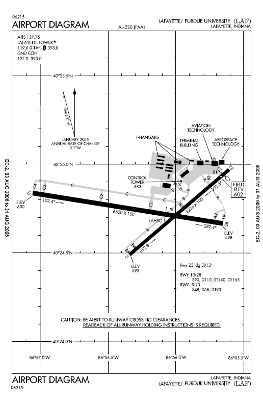
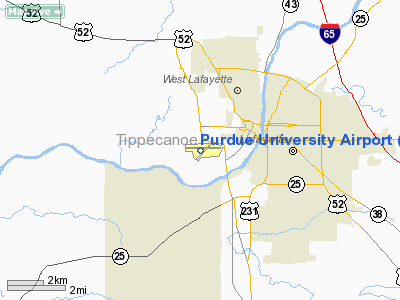
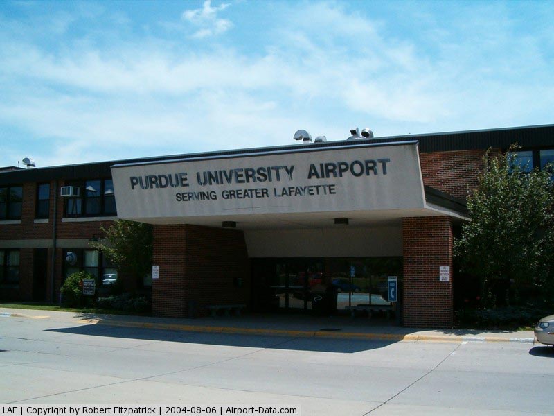
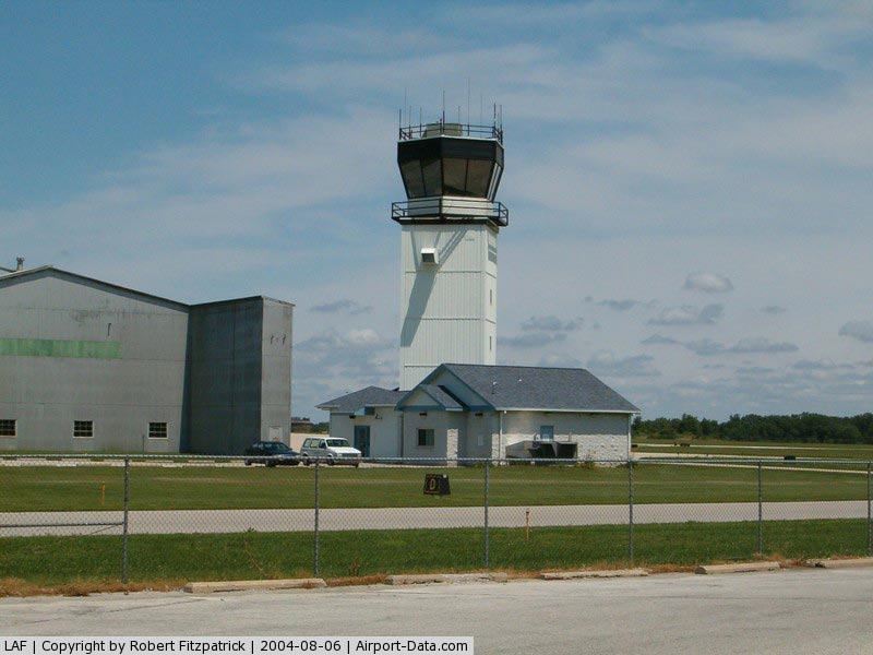
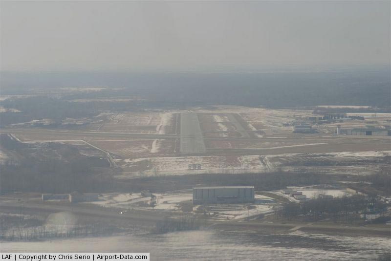
Purdue University Airport (IATA: LAF, ICAO: KLAF, FAA LID: LAF) is a public airport in West Lafayette, Indiana. It is two miles (3 km) southwest of the central business district of Lafayette, a city in Tippecanoe County, Indiana, United States. Owned by Purdue University, the facility no longer offers a commercial airline service. However, the airport is working to regain scheduled airline service. Because of the heavy traffic generated by Purdue University and its flight programs, Purdue University Airport is one of the busiest airports in Indiana, second only to Indianapolis International Airport. HistoryPurdue University Airport was the first university owned airport in the United States. Amelia Earhart prepared her airplane for her around-the-world flight attempt in Hangar 1 at the airport. The original hangar, now referred to as the Niswonger Hall Of Aviation Technology, still stands to this day and is used by Purdue University's department of Aviation Technology for offices, classrooms, and laboratories. The bay that held Amelia's plane still contains aircraft; they are used by the Aeronautical Engineering Technology program for maintenance and inspection training. A large addition to the building was completed in the summer of 2009. A plaque on the building near the side entrance commemorates the airport's history. FacilitiesPurdue University Airport has a [2] FAA staffed Air Traffic Control Tower and is the 2nd busiest airport in Indiana.. Hangar 1 (Niswonger Hall of Aviation Technology) is described above in history. Hangar 2, known as the terminal building, houses the airport administration, classrooms, and offices for Purdue's Department of Aviation Technology. It has two hangar bays: one for storing private aircraft and one used by Purdue as an aviation engine laboratory. With the loss of commercial airline service to the airport, the lobby and gate areas are now used primarily for meetings and as a study lounge for aviation students. Rent-A-Car service is still available and is provided by Budget. The terminal also still sees the occasional airliner when collegiate sports teams arrive on charter flights. The airport administration has stated that only minor security enhancements would be required to update the terminal to current standards and enable it to once again host commercial airline service. Hangar 3 is small and is composed of several individual hangar bays. It houses private aircraft. Hangar 4 is next to the Air Traffic Control Tower and houses private aircraft and the airport's snow removal equipment. Hangar 5 houses Purdue's corporate flight department and is also where the briefing rooms are located for Purdue flight operations. Hangar 6 is the nerve center of Purdue's Professional Flight Technology program. It houses the offices of the flight instructors, dispatch, and maintenance operations for the university. Hangar 6W is primarily an aircraft storage hangar and aircraft maintenance area for Purdue University. Hangar 7 houses the airport's Fixed Base Operator, Lafayette Aviation. The company provides flight training and aircraft rental to the public, as well as fuel to all aircraft at the airport. Hangar 8 houses private offices, private aircraft, and an air ambulance helicopter. A simulator center next to Hangar 6W houses Purdue's flight simulators and offices. Two large Boeing 727 simulators are inside along with numerous smaller simulators A CRJ700 FTD was recently added to the simulator center. Additional facilities at the airport include T-Hangars, two large ramp areas for parking aircraft, an aerospace materials laboratory, fuel farm for storage of aviation gasoline and jet fuel, and a fire station. LayoutPurdue University Airport covers an area of 527 acres (213 ha) which contains two runways:
Runway 10 has a Category 1 ILS approach. Runways 10 and 28 are both served by WAAS GPS approaches. Additionally, a VOR-A approach is available. Runway 10 is occasionally used in a shortened configuration: aircraft land at the beginning of the runway but do not use its full length to stop. Instead, they hold short of the intersecting runway 5/23. Known as a land and hold short operation (LAHSO), this procedure is relatively common in the United States and allows both runways to be used at the same time. Pilots have the ability to reject the LAHSO clearance if they need the full runway to ensure a safe landing. Runway 23 has a displaced threshold, which shortens the runway to 3,913 ft for landing operations. This is due to the runway's proximity to a railroad, fence, power lines, and the campus of Purdue University. Aircraft landing on runway 23 fly over the central campus of the university at low altitude as they proceed on final approach to the airport. This affords an excellent view of campus to passengers in the aircraft and provides a means of entertainment for students walking to class, who sometimes look up to watch the airplanes pass. Noise pollution is fairly low because the aircraft are descending toward the runway at near idle engine power and the runway is closed at night. Because of prevailing wind conditions, runway 23 is the most commonly used runway at the airport. At night, operations usually switch to runway 28. AviationToday, Purdue University's Aviation Flight Technology Program is one of the best nationwide. [7] Annually, only 60 students are admitted into this exclusive and selective program. On top of training in basic single and multi engine aircraft, all flight students will fly in a King Air 200 and some will also have the opportunity to fly on the Raytheon BeechJet 400A carrying VIPs across the nation. No other University has a corporate flight department built into the University to provide private aircraft for faculty and staff. Purdue is also one out of approximately 30 secondary-level education institutions in the United States that participates in the Federal Aviation Administration's CTI (Collegiate Training Initiative) program. Graduates of Purdue's CTI program are recommended to join the Federal Aviation Administration's air traffic controller workforce. The above content comes from Wikipedia and is published under free licenses – click here to read more.
Runway InformationRunway 05/23
Runway 10/28
Radio Navigation Aids
Remarks
Based Aircraft
Operational StatisticsTime Period: 2006-01-01 - 2006-12-31
Purdue University Airport Address: Tippecanoe County, IN Tel: 765-743-3442 Images
and information placed above are from We thank them for the data!
We don't guarantee the information is fresh and accurate. The data may
be wrong or outdated.
|
|||||||||||||||||||||||||||||||||||||||||||||||||||||||||||||||||||||||||||||||||||||||||||||||||||||||||||||||||||||||||||||||||||||||||||||||||||||||||||||||||||||||||||||||||||||||||||||||||||||||||||||||||||||||||||||||||||||||||||||||||||||||||||||||||||||||||||||||||||||||||||||||||||||||||||||||||||||||||||||||||||||||||||||||||||||||||||||||||||||||||||||||||||||||||||||||||||||||||||||||||||||||||||||||||||||||||||||||||||||||||||

 |
|
Copyright 2004-2026 © by Airports-Worldwide.com, Vyshenskoho st. 36, Lviv 79010, Ukraine Legal Disclaimer |