 |
|
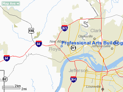
Professional Arts Building Heliport |
|
|
Location
& QuickFacts
|
FAA
Information Effective: |
2008-06-05 |
|
Airport
Identifier: |
41IN |
|
Airport
Status: |
Operational |
|
Longitude/Latitude: |
085-50-09.0000W/38-18-01.0000N
-85.835833/38.300278 (Estimated) |
|
Elevation: |
512 ft / 156.06 m (Estimated) |
|
Land: |
0 acres |
|
From nearest
city: |
0 nautical miles N of New Albany, IN |
|
Location: |
Floyd County, IN |
|
Magnetic
Variation: |
03W (1995) |
Owner
& Manager
|
Ownership: |
Privately
owned |
|
Owner: |
Floyd Physicians Corporation |
|
Address: |
1919 State Street
New
Albany, IN 47150 |
|
Phone
number: |
812-945-4200 |
|
Manager: |
Joann Mattingly |
|
Address: |
1919 State Street
New
Albany, IN 47150 |
|
Phone
number: |
812-945-4200 |
Airport Operations
and Facilities
|
Airport
Use: |
Private
MEDICAL USE. |
|
Wind indicator: |
Yes |
|
Segmented
Circle: |
No |
|
Control
Tower: |
No |
|
Lighting
Schedule: |
PHONE REQ
FOR PERIMETER LGTS CALL 812-945-4200. |
|
Sectional
chart: |
St Louis |
|
Region: |
AGL - Great Lakes |
|
Boundary
ARTCC: |
ZID - Indianapolis |
|
Tie-in
FSS: |
HUF - Terre Haute |
|
FSS on
Airport: |
No |
|
FSS Toll
Free: |
1-800-WX-BRIEF |
|
Runway Information
Helipad H1
|
Dimension: |
51 x 54 ft /
15.5 x 16.5 m |
|
Surface: |
CONC, Good Condition |
|
|
Runway H1 |
Runway |
|
Traffic
Pattern: |
Left |
Left |
|
Radio Navigation
Aids
|
ID |
Type |
Name |
Ch |
Freq |
Var |
Dist |
|
GOI |
NDB |
Godman |
|
396.00 |
02W |
21.6 nm |
|
BRY |
NDB |
Bardstown/dcmsnd |
|
248.00 |
02W |
31.9 nm |
|
IMS |
NDB |
Madison |
|
404.00 |
03W |
32.8 nm |
|
EQZ |
NDB |
Captain |
|
308.00 |
02W |
34.7 nm |
|
RRJ |
NDB |
Oranj |
|
368.00 |
02W |
35.3 nm |
|
BFR |
NDB |
Bedford |
|
344.00 |
02W |
43.0 nm |
|
TEL |
NDB |
Tell City |
|
206.00 |
02W |
43.9 nm |
|
OVO |
NDB |
North Vernon |
|
374.00 |
02W |
46.4 nm |
|
FNZ |
NDB |
Ferdinand |
|
239.00 |
00E |
47.4 nm |
|
FEU |
NDB |
Arnold |
|
521.00 |
03W |
48.2 nm |
|
IKY |
NDB |
Springfield |
|
429.00 |
03W |
49.1 nm |
|
MYS |
VOR |
Mystic |
|
108.20 |
01W |
31.1 nm |
|
FFT |
VOR |
Frankfort |
|
109.40 |
03W |
44.3 nm |
|
BQM |
VOR/DME |
Bowman |
059X |
112.20 |
01W |
9.1 nm |
|
FTK |
VOR/DME |
Fort Knox |
033X |
109.60 |
01W |
24.5 nm |
|
EWO |
VOR/DME |
New Hope |
045X |
110.80 |
01E |
40.9 nm |
|
IIU |
VORTAC |
Louisville |
095X |
114.80 |
01E |
17.0 nm |
|
ABB |
VORTAC |
Nabb |
071X |
112.40 |
01E |
19.7 nm |
|
SDF |
VOT |
Louisville Standifd |
|
111.00 |
|
8.7 nm |
Remarks
- PRVDD
APCH/DEP OPNS ARE CONDUCTED FROM 000 DEGS CLKWS 360 DEGS USING TOUCHDOWN
PAD AS CENTER OF COMPASS ROSE; COMPLIANCE WITH 91.126(B)(2); TKOF/LNDG
AREA IS MKD; WIND INDICATOR IS MAINTAINED.
Professional Arts Building Heliport
Address:
Floyd County, IN
Tel:
812-945-4200
Images
and information placed above are from
http://www.airport-data.com/airport/41IN/
We
thank them for the data!
| General
Info |
| Country |
United
States |
| State |
INDIANA
|
| FAA ID |
41IN |
| Latitude |
38-18-01.000N
|
| Longitude |
085-50-09.000W
|
| Elevation |
512 feet
|
| Near City |
NEW ALBANY
|
We don't guarantee the information is fresh and accurate. The data may
be wrong or outdated.
For more up-to-date information please refer to other sources.
|
|


