|
|
|
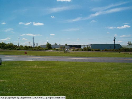 |
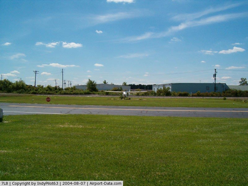
(Click on the photo to enlarge) |
|
 |
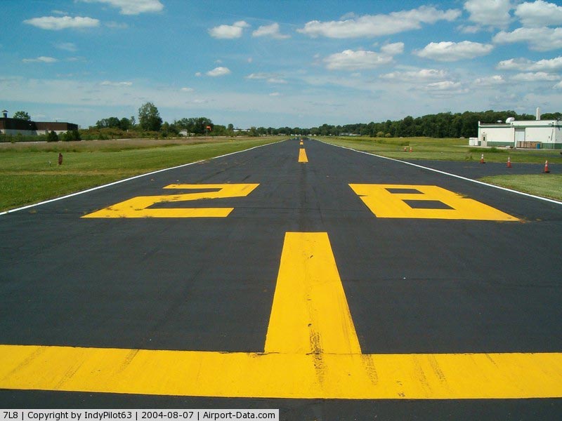
(Click on the photo to enlarge) |
Location
& QuickFacts
|
FAA Information Effective: |
2008-06-05 |
|
Airport
Identifier: |
7L8 |
|
Airport
Status: |
Operational |
|
Longitude/Latitude: |
086-00-49.9360W/39-45-00.1540N
-86.013871/39.750043 (Estimated) |
|
Elevation: |
861 ft / 262.43 m (Surveyed) |
|
Land: |
20 acres |
|
From
nearest city: |
6 nautical miles E of Indianapolis, IN |
|
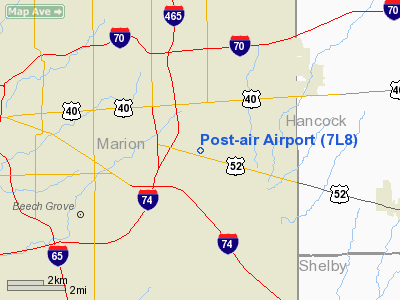
Location: |
Marion County, IN |
|
Magnetic
Variation: |
02W (1985) |
Owner
& Manager
|
Ownership: |
Privately owned |
|
Owner: |
Gladys K. Fall |
|
Address: |
1410 S. Post Road
Indianapolis,
IN 46239 |
|
Phone
number: |
317-897-7000 |
|
Manager: |
Rick Reeves |
|
Address: |
P.o. Box 39100
Indianapolis,
IN 46239 |
|
Phone
number: |
317-897-7000 |
Airport Operations
and Facilities
|
Airport Use: |
Open to public |
|
Wind
indicator: |
Yes |
|
Segmented
Circle: |
Yes |
|
Control
Tower: |
No |
|
Sectional
chart: |
St Louis |
|
Region: |
AGL - Great Lakes |
|
Boundary
ARTCC: |
ZID - Indianapolis |
|
Tie-in
FSS: |
HUF - Terre Haute |
|
FSS
on Airport: |
No |
|
FSS
Toll Free: |
1-800-WX-BRIEF |
|
NOTAMs
Facility: |
HUF (NOTAM-d service avaliable) |
Airport Communications
|
Runway Information
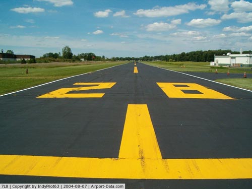
Runway 10/28
|
Dimension: |
3750 x 47 ft / 1143.0 x 14.3 m |
|
Surface: |
ASPH, Good Condition |
|
Edge
Lights: |
Low |
|
|
Runway 10 |
Runway 28 |
|
Longitude: |
086-01-19.2100W |
086-00-31.9300W |
|
Latitude: |
39-45-04.5700N |
39-44-58.1500N |
|
Elevation: |
861.00 ft |
861.00 ft |
|
Traffic
Pattern: |
Right |
Left |
|
Markings: |
Basic, Good Condition |
, |
|
Displaced
threshold: |
0.00 ft |
1269.00 ft |
|
Obstruction: |
15 ft trees, 720.0 ft from runway, 34:1 slope
to clear |
30 ft trees, 205.0 ft from runway, 125 ft right
of centerline
APCH RATIO 49:1 AT DSPLCD THLD.
HAS +25 FT PLINE; +15 FT ROAD; +20 FT HOUSE; 15-25 FT TREES
10-200 FT EAST OF RY CNTRLN. |
|
Radio Navigation
Aids
|
ID |
Type |
Name |
Ch |
Freq |
Var |
Dist |
|
HFY |
NDB |
Greenwood |
|
398.00 |
02W |
7.9 nm |
|
UMP |
NDB |
Metropolitan |
|
338.00 |
03W |
11.4 nm |
|
HZP |
NDB |
Zionsville |
|
248.00 |
03W |
15.8 nm |
|
BA |
NDB |
Clifs |
|
410.00 |
03W |
27.3 nm |
|
AI |
NDB |
Video |
|
371.00 |
03W |
30.1 nm |
|
UWL |
NDB |
New Castle |
|
385.00 |
02W |
33.0 nm |
|
TVX |
NDB |
Greencastle |
|
521.00 |
03W |
36.7 nm |
|
FKR |
NDB |
Frankfort |
|
278.00 |
02W |
40.2 nm |
|
HLB |
NDB |
Batesville |
|
254.00 |
02W |
42.5 nm |
|
CFJ |
NDB |
Crawfordsville |
|
388.00 |
02W |
43.9 nm |
|
OVO |
NDB |
North Vernon |
|
374.00 |
02W |
46.3 nm |
|
BM |
NDB |
Claye |
|
382.00 |
02W |
49.8 nm |
|
MIE |
VOR/DME |
Muncie |
091X |
114.40 |
03W |
40.9 nm |
|
MZZ |
VOR/DME |
Marion |
023X |
108.60 |
03W |
47.3 nm |
|
SHB |
VORTAC |
Shelbyville |
057X |
112.00 |
01E |
11.3 nm |
|
VHP |
VORTAC |
Brickyard |
110X |
116.30 |
01E |
16.8 nm |
|
OOM |
VORTAC |
Hoosier |
039X |
110.20 |
02W |
45.8 nm |
|
OKK |
VORTAC |
Kokomo |
082X |
113.50 |
00E |
46.8 nm |
|
IND |
VOT |
Indianapolis Intl |
|
109.60 |
|
12.5 nm |
Remarks
- 180
FT GRVL STOPWAY RY 28.
- LGTD
TV-TWR 2640'N OF APCH END RWY 28.
- RWY
28: 20 FT HOUSE 110 FT S.
- PRVDD
RWY OBSTACLE FREE ZONE & 20:1 APP SFCS ARE MAINTD CLEAR.
Based Aircraft
|
Aircraft
based on field: |
5 |
|
Single
Engine Airplanes: |
5 |
Operational Statistics
Time Period: 2005-01-01 - 2005-12-31
|
Aircraft
Operations: |
41/Week |
|
General
Aviation Local: |
90.0% |
|
General
Aviation Itinerant: |
10.0% |
Post-air Airport
Address:
Marion County, IN
Tel:
317-897-7000
Images
and information placed above are from
http://www.airport-data.com/airport/7L8/
We
thank them for the data!
| General
Info |
| Country |
United
States |
| State |
INDIANA
|
| FAA ID |
7L8 |
| Latitude |
39-45-00.154N
|
| Longitude |
086-00-49.936W
|
| Elevation |
861 feet
|
| Near City |
INDIANAPOLIS
|
We don't guarantee the information is fresh and accurate. The data may
be wrong or outdated.
For more up-to-date information please refer to other sources.
|
|