 |
|
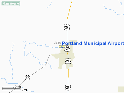
Portland Municipal Airport |
|
|
Location
& QuickFacts
|
FAA
Information Effective: |
2008-06-05 |
|
Airport
Identifier: |
PLD |
|
Airport
Status: |
Operational |
|
Longitude/Latitude: |
084-59-24.2850W/40-27-02.7420N
-84.990079/40.450762 (Estimated) |
|
Elevation: |
926 ft / 282.24 m (Surveyed) |
|
Land: |
45 acres |
|
From nearest
city: |
1 nautical miles NW of Portland, IN |
|
Location: |
Jay County, IN |
|
Magnetic
Variation: |
03W (1985) |
Owner
& Manager
|
Ownership: |
Publicly
owned |
|
Owner: |
City Of Portland |
|
Address: |
Avn Comm Board,city Hall
Portland, IN 47371 |
|
Phone
number: |
260-726-7226 |
|
Manager: |
David B. Miller |
|
Address: |
661 W 100 N
Portland, IN 47371 |
|
Phone
number: |
260-726-4901 |
Airport
Operations and Facilities
|
Airport
Use: |
Open
to public |
|
Wind indicator: |
Yes |
|
Segmented
Circle: |
Yes |
|
Control
Tower: |
No |
|
Lighting
Schedule: |
DUSK-DAWN
MIRL RY 09/27 PRESET LOW INTST; INCR INTST & ACTVT REIL
RY 09 & 27 - CTAF.
PAPI RYS 09 & 27 OPER 24 HRS. |
|
Beacon
Color: |
Clear-Green (lighted land airport) |
|
Landing
fee charge: |
No |
|
Sectional
chart: |
Detroit |
|
Region: |
AGL - Great Lakes |
|
Boundary
ARTCC: |
ZID - Indianapolis |
|
Responsible
ARTCC: |
ZAU - Chicago |
|
Tie-in
FSS: |
HUF - Terre Haute |
|
FSS on
Airport: |
No |
|
FSS Toll
Free: |
1-800-WX-BRIEF |
|
NOTAMs
Facility: |
HUF (NOTAM-d service avaliable) |
|
Federal
Agreements: |
NGY |
Airport Communications
|
CTAF: |
122.800 |
|
Unicom: |
122.800
|
Airport
Services
|
Fuel
available: |
100LLA |
|
Airframe
Repair: |
MINOR |
|
Power
Plant Repair: |
MINOR |
|
Bottled
Oxygen: |
NONE |
|
Bulk Oxygen: |
NONE |
|
Runway Information
Runway 09/27
|
Dimension: |
4002 x 75 ft
/ 1219.8 x 22.9 m |
|
Surface: |
ASPH, Good Condition |
|
Weight Limit: |
Single wheel: 12500 lbs. |
|
Edge Lights: |
Medium |
|
|
Runway 09 |
Runway 27 |
|
Longitude: |
084-59-46.3640W |
084-58-54.6080W |
|
Latitude: |
40-27-05.1720N |
40-27-06.1300N |
|
Elevation: |
913.00 ft |
925.00 ft |
|
Alignment: |
89 |
127 |
|
Traffic
Pattern: |
Left |
Left |
|
Markings: |
Non-precision instrument, Fair Condition |
Non-precision instrument, Fair Condition |
|
Crossing
Height: |
24.00 ft |
24.00 ft |
|
VASI: |
2-light PAPI on left side |
2-light PAPI on left side |
|
Visual Glide
Angle: |
3.00° |
3.00° |
|
Runway End
Identifier: |
Yes |
Yes |
|
Centerline
Lights: |
No |
No |
|
Touchdown
Lights: |
No |
No |
|
Obstruction: |
8 ft trees, 300.0 ft from runway, 20 ft right
of centerline, 12:1 slope to clear |
47 ft ant, 1800.0 ft from runway, 133 ft left
of centerline, 34:1 slope to clear
31` FT TREE 90 FT FM RY END 190 FT L OF CNTRLN. |
|
Runway 18/36
|
Dimension: |
1775 x 150 ft
/ 541.0 x 45.7 m |
|
Surface: |
TURF, Fair Condition |
|
|
Runway 18 |
Runway 36 |
|
Longitude: |
084-59-32.8850W |
084-59-32.8850W |
|
Latitude: |
40-27-05.1620N |
40-26-47.1620N |
|
Elevation: |
915.00 ft |
905.00 ft |
|
Traffic
Pattern: |
Left |
Left |
|
Displaced
threshold: |
100.00 ft |
300.00 ft |
|
Runway End
Identifier: |
No |
No |
|
Centerline
Lights: |
No |
No |
|
Touchdown
Lights: |
No |
No |
|
Obstruction: |
41 ft ant, 800.0 ft from runway, 130 ft right
of centerline, 19:1 slope to clear
RY 18 APCH RATIO 21:1 AT DSPLCD THLD. |
15 ft road, 0.0 ft from runway
APCH RATIO 20:1 AT DSPLCD THR. |
|
Radio Navigation
Aids
|
ID |
Type |
Name |
Ch |
Freq |
Var |
Dist |
|
PLD |
NDB |
Portland |
|
257.00 |
03W |
0.3 nm |
|
CQA |
NDB |
Lakefield |
|
205.00 |
04W |
19.6 nm |
|
VES |
NDB |
Versailles |
|
356.00 |
04W |
26.0 nm |
|
VFU |
NDB |
Stanley |
|
411.00 |
05W |
30.1 nm |
|
HHG |
NDB |
Huntington |
|
417.00 |
03W |
32.6 nm |
|
AI |
NDB |
Video |
|
371.00 |
03W |
33.1 nm |
|
UWL |
NDB |
New Castle |
|
385.00 |
02W |
37.5 nm |
|
IWH |
NDB |
Wabash |
|
329.00 |
03W |
41.4 nm |
|
LYL |
NDB |
Lima |
|
362.00 |
04W |
46.7 nm |
|
AOH |
VOR |
Allen County |
|
108.40 |
04W |
49.1 nm |
|
MIE |
VOR/DME |
Muncie |
091X |
114.40 |
03W |
22.5 nm |
|
MZZ |
VOR/DME |
Marion |
023X |
108.60 |
03W |
31.6 nm |
|
DQN |
VOR/DME |
Dayton |
092X |
114.50 |
01W |
37.7 nm |
|
FWA |
VORTAC |
Fort Wayne |
125X |
117.80 |
00E |
33.0 nm |
|
RID |
VORTAC |
Richmond |
043X |
110.60 |
03W |
42.4 nm |
|
ROD |
VORTAC |
Rosewood |
122X |
117.50 |
05W |
44.5 nm |
|
OKK |
VORTAC |
Kokomo |
082X |
113.50 |
00E |
49.0 nm |
|
FWA |
VOT |
Fort Wayne Baer |
|
111.00 |
|
33.0 nm |
|
DAY |
VOT |
Dayton J M Cox-day |
|
111.00 |
|
48.4 nm |
Remarks
- 150'
AGL WATER TOWER 1300' SE M&L; 120' AGL GRAIN ELEV 1300' ESE.
- RY
18/36 75 FT CROPS W OF CNTRLN COMPLETE LENGTH OF RY.
Based Aircraft
|
Aircraft
based on field: |
24 |
|
Single Engine
Airplanes: |
12 |
|
Multi Engine Airplanes: |
12 |
Operational Statistics
Time
Period: 2006-01-01 - 2006-12-31
|
Aircraft
Operations: |
237/Week |
|
Air Taxi: |
1.0% |
|
General Aviation
Local: |
50.0% |
|
General Aviation
Itinerant: |
30.0% |
|
Military: |
18.9% |
Portland Municipal Airport
Address:
Jay County, IN
Tel:
260-726-7226,
260-726-4901
Images
and information placed above are from
http://www.airport-data.com/airport/PLD/
We
thank them for the data!
| General
Info |
| Country |
United
States |
| State |
INDIANA
|
| FAA ID |
PLD |
| Latitude |
40-27-02.742N
|
| Longitude |
084-59-24.285W
|
| Elevation |
926 feet
|
| Near City |
PORTLAND
|
We don't guarantee the information is fresh and accurate. The data may
be wrong or outdated.
For more up-to-date information please refer to other sources.
|
|


