 |
|
Coordinates: 39°47′25″N 085°44′10″W / 39.79028°N 85.73611°W / 39.79028; -85.73611
| Pope Field |
| IATA: GFD – ICAO: KGFD – FAA LID: GFD |
| Summary |
| Airport type |
Public |
| Owner |
Pope Airport Inc. |
| Serves |
Greenfield, Indiana |
| Elevation AMSL |
895 ft / 273 m |
| Runways |
| Direction |
Length |
Surface |
| ft |
m |
| 18/36 |
2,165 |
660 |
Turf |
| Statistics (2005) |
| Aircraft operations |
4,111 |
| Source: Federal Aviation Administration |
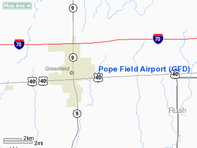
Pope Field (IATA: GFD, ICAO: KGFD, FAA LID: GFD) is a public-use airport located two miles (3 km) northeast of the central business district of Greenfield, a city in Hancock County, Indiana, United States. It is privately-owned by Pope Airport Inc.
Facilities and aircraft
Pope Field covers an area of 40 acres (16 ha) and contains one runway designated 18/36 with a turf surface measuring 2,165 x 150 ft (660 x 46 m). For the 12-month period ending August 8, 2005, the airport had 4,111 aircraft operations: 99% general aviation and 1% military.
The above content comes from Wikipedia and is published under free licenses – click here to read more.
Location
& QuickFacts
|
FAA
Information Effective: |
2008-06-05 |
|
Airport
Identifier: |
GFD |
|
Airport
Status: |
Operational |
|
Longitude/Latitude: |
085-44-09.9190W/39-47-25.1550N
-85.736089/39.790321 (Estimated) |
|
Elevation: |
895 ft / 272.80 m (Estimated) |
|
Land: |
40 acres |
|
From nearest
city: |
2 nautical miles NE of Greenfield, IN |
|
Location: |
Hancock County, IN |
|
Magnetic
Variation: |
02W (1985) |
Owner & Manager
|
Ownership: |
Privately
owned |
|
Owner: |
Pope Arpt Inc. |
|
Address: |
Po Box 333
Greenfield,
IN 46140 |
|
Phone
number: |
317-467-9740 |
|
Manager: |
Lisa Neill |
|
Address: |
Po Box 333
Greenfield,
IN 46140 |
|
Phone
number: |
317-467-9740 |
Airport
Operations and Facilities
|
Airport
Use: |
Open
to public |
|
Wind indicator: |
Yes |
|
Segmented
Circle: |
No |
|
Control
Tower: |
No |
|
Lighting
Schedule: |
DUSK-DAWN |
|
Landing
fee charge: |
No |
|
Sectional
chart: |
St Louis |
|
Region: |
AGL - Great Lakes |
|
Boundary
ARTCC: |
ZID - Indianapolis |
|
Tie-in
FSS: |
HUF - Terre Haute |
|
FSS on
Airport: |
No |
|
FSS Toll
Free: |
1-800-WX-BRIEF |
|
NOTAMs
Facility: |
HUF (NOTAM-d service avaliable) |
Airport Communications
Airport Services
|
Bottled
Oxygen: |
NONE |
|
Bulk Oxygen: |
NONE |
|
Runway Information
Runway 18/36
|
Dimension: |
2165 x 150 ft
/ 659.9 x 45.7 m |
|
Surface: |
TURF, Fair Condition |
|
Edge Lights: |
Non-standard lighting system
NSTD LIRL. NSTD SPACING OF LGTS ON PVC PIPES & GLASS JAR LENSES. |
|
|
Runway 18 |
Runway 36 |
|
Longitude: |
085-44-06.9100W |
085-44-06.9100W |
|
Latitude: |
39-47-39.9200N |
39-47-20.1500N |
|
Elevation: |
896.00 ft |
897.00 ft |
|
Traffic
Pattern: |
Left |
Left |
|
Displaced
threshold: |
165.00 ft |
0.00 ft |
|
Runway End
Identifier: |
No |
No |
|
Centerline
Lights: |
No |
No |
|
Touchdown
Lights: |
No |
No |
|
Obstruction: |
10 ft crops, 55.0 ft from runway, 5:1 slope
to clear
RY 18 APCH SLOPE TO DSPLCD THLD 22:1. ALSO,
+50 FT TREES, 195 FT NW OF APCH END. |
47 ft trees, 1224.0 ft from runway, 26:1 slope
to clear |
|
Radio Navigation
Aids
|
ID |
Type |
Name |
Ch |
Freq |
Var |
Dist |
|
UMP |
NDB |
Metropolitan |
|
338.00 |
03W |
17.0 nm |
|
HFY |
NDB |
Greenwood |
|
398.00 |
02W |
18.9 nm |
|
AI |
NDB |
Video |
|
371.00 |
03W |
19.7 nm |
|
UWL |
NDB |
New Castle |
|
385.00 |
02W |
20.0 nm |
|
HZP |
NDB |
Zionsville |
|
248.00 |
03W |
25.3 nm |
|
BA |
NDB |
Clifs |
|
410.00 |
03W |
28.4 nm |
|
HLB |
NDB |
Batesville |
|
254.00 |
02W |
34.5 nm |
|
OVO |
NDB |
North Vernon |
|
374.00 |
02W |
45.0 nm |
|
OXD |
NDB |
Oxford |
|
282.00 |
04W |
47.4 nm |
|
FKR |
NDB |
Frankfort |
|
278.00 |
02W |
47.8 nm |
|
TVX |
NDB |
Greencastle |
|
521.00 |
03W |
49.7 nm |
|
MIE |
VOR/DME |
Muncie |
091X |
114.40 |
03W |
31.1 nm |
|
MZZ |
VOR/DME |
Marion |
023X |
108.60 |
03W |
42.3 nm |
|
SHB |
VORTAC |
Shelbyville |
057X |
112.00 |
01E |
10.3 nm |
|
VHP |
VORTAC |
Brickyard |
110X |
116.30 |
01E |
29.2 nm |
|
RID |
VORTAC |
Richmond |
043X |
110.60 |
03W |
41.5 nm |
|
OKK |
VORTAC |
Kokomo |
082X |
113.50 |
00E |
46.7 nm |
|
IND |
VOT |
Indianapolis Intl |
|
109.60 |
|
25.6 nm |
Remarks
- RY
18/36 SEASONAL CROPS 85 FT E & W OF RY.
Based Aircraft
|
Aircraft
based on field: |
15 |
|
Single Engine
Airplanes: |
7 |
|
Multi Engine Airplanes: |
1 |
|
Ultralights: |
7 |
Operational Statistics
Time
Period: 2004-08-09 - 2005-08-08
|
Aircraft
Operations: |
80/Week |
|
General Aviation
Local: |
54.6% |
|
General Aviation
Itinerant: |
44.1% |
|
Military: |
1.2% |
Pope Field Airport
Address:
Hancock County, IN
Tel:
317-467-9740
Images
and information placed above are from
http://www.airport-data.com/airport/GFD/
We
thank them for the data!
| General
Info |
| Country |
United
States |
| State |
INDIANA
|
| FAA ID |
GFD |
| Latitude |
39-47-25.155N
|
| Longitude |
085-44-09.919W
|
| Elevation |
895 feet
|
| Near City |
GREENFIELD
|
We don't guarantee the information is fresh and accurate. The data may
be wrong or outdated.
For more up-to-date information please refer to other sources.
|
|


