 |
|
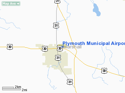
Plymouth Municipal Airport |
|
|
Location
& QuickFacts
|
FAA
Information Effective: |
2008-06-05 |
|
Airport
Identifier: |
C65 |
|
Airport
Status: |
Operational |
|
Longitude/Latitude: |
086-18-01.8150W/41-21-54.4800N
-86.300504/41.365133 (Estimated) |
|
Elevation: |
800 ft / 243.84 m (Surveyed) |
|
Land: |
192 acres |
|
From nearest
city: |
2 nautical miles N of Plymouth, IN |
|
Location: |
Marshall County, IN |
|
Magnetic
Variation: |
00E (1975) |
Owner
& Manager
|
Ownership: |
Publicly
owned |
|
Owner: |
Plymouth Boac
DR. HOLM - PRESIDENT. |
|
Address: |
301 Airport Drive
Plymouth,
IN 46563 |
|
Phone
number: |
574-935-5152 |
|
Manager: |
Ron Ritter |
|
Address: |
301 Airport Drive
Plymouth,
IN 46563 |
|
Phone
number: |
574-935-5152 |
Airport
Operations and Facilities
|
Airport
Use: |
Open
to public |
|
Wind indicator: |
Yes |
|
Segmented
Circle: |
Yes |
|
Control
Tower: |
No |
|
Lighting
Schedule: |
DUSK-DAWN
MIRL RY 10/28 PRESET ON LOW INTST; TO INCR INTST & ACTVT
REIL & VASI RYS 10 & 28 - CTAF. |
|
Beacon
Color: |
Clear-Green (lighted land airport) |
|
Landing
fee charge: |
No |
|
Sectional
chart: |
Chicago |
|
Region: |
AGL - Great Lakes |
|
Boundary
ARTCC: |
ZAU - Chicago |
|
Tie-in
FSS: |
HUF - Terre Haute |
|
FSS on
Airport: |
No |
|
FSS Toll
Free: |
1-800-WX-BRIEF |
|
NOTAMs
Facility: |
HUF (NOTAM-d service avaliable) |
|
Federal
Agreements: |
NGY |
Airport Communications
|
CTAF: |
122.800 |
|
Unicom: |
122.800
|
Airport
Services
|
Runway Information
Runway 10/28
|
Dimension: |
4400 x 60 ft
/ 1341.1 x 18.3 m |
|
Surface: |
ASPH, Good Condition |
|
Weight Limit: |
Single wheel: 25000 lbs.
Dual wheel: 40000 lbs. |
|
Edge Lights: |
Medium |
|
|
Runway 10 |
Runway 28 |
|
Longitude: |
086-18-29.6300W |
086-17-32.2200W |
|
Latitude: |
41-21-56.6600N |
41-21-52.3100N |
|
Elevation: |
796.00 ft |
800.00 ft |
|
Alignment: |
96 |
127 |
|
Traffic
Pattern: |
Left |
Left |
|
Markings: |
Basic, Good Condition |
Basic, Good Condition |
|
Crossing
Height: |
37.00 ft |
30.00 ft |
|
Displaced
threshold: |
0.00 ft |
300.00 ft |
|
VASI: |
2-box on left side |
4-box on left side |
|
Visual Glide
Angle: |
3.00° |
3.30° |
|
Runway End
Identifier: |
Yes |
Yes |
|
Centerline
Lights: |
No |
No |
|
Touchdown
Lights: |
No |
No |
|
Obstruction: |
52 ft tree, 1397.0 ft from runway, 183 ft right
of centerline, 23:1 slope to clear |
22 ft road, 450.0 ft from runway, 300 ft right
of centerline, 11:1 slope to clear
APCH RATIO 34:1 AT DSPLCD THLD. |
|
Radio Navigation
Aids
|
ID |
Type |
Name |
Ch |
Freq |
Var |
Dist |
|
CPB |
NDB |
Culver |
|
391.00 |
01W |
9.7 nm |
|
RCR |
NDB |
Rochester |
|
216.00 |
03W |
18.7 nm |
|
RWN |
NDB |
Winamac/dcmsnd |
|
335.00 |
00W |
21.3 nm |
|
IUL |
NDB |
La Porte |
|
356.00 |
03W |
22.7 nm |
|
VP |
NDB |
Sedly |
|
212.00 |
02W |
26.5 nm |
|
MGC |
NDB |
Michigan City |
|
203.00 |
01W |
31.0 nm |
|
GGP |
NDB |
Logansport |
|
263.00 |
01W |
39.6 nm |
|
IWH |
NDB |
Wabash |
|
329.00 |
03W |
42.7 nm |
|
MCX |
NDB |
White County |
|
377.00 |
03W |
44.6 nm |
|
RZL |
NDB |
Rensselaer |
|
362.00 |
02W |
47.2 nm |
|
IRS |
NDB |
Sturgis |
|
382.00 |
04W |
47.4 nm |
|
HAI |
NDB |
Three Rivers |
|
407.00 |
02W |
47.8 nm |
|
HHG |
NDB |
Huntington |
|
417.00 |
03W |
48.7 nm |
|
OLK |
VOR |
Wolf Lake |
|
110.40 |
03W |
37.0 nm |
|
OXI |
VOR/DME |
Knox |
103X |
115.60 |
00E |
16.0 nm |
|
ELX |
VOR/DME |
Keeler |
113X |
116.60 |
00E |
47.5 nm |
|
GSH |
VORTAC |
Goshen |
084X |
113.70 |
00E |
15.6 nm |
|
GIJ |
VORTAC |
Gipper |
101X |
115.40 |
00E |
24.3 nm |
|
GUS |
VORTAC |
Grissom |
21Y |
108.45 |
02W |
43.8 nm |
Remarks
- BIRDS
ON & INVOF ARPT.
- OUTSIDE
PHONE AVBL.
- SNOW
REMOVAL OPS DURING WINTER MONTHS; EQUIP OPERATORS WILL MONITOR CTAF
WHEN TWR IS CLSD.
Based Aircraft
|
Aircraft
based on field: |
24 |
|
Single Engine
Airplanes: |
24 |
Operational Statistics
Time
Period: 2006-01-01 - 2006-12-31
|
Aircraft
Operations: |
209/Week |
|
Air Taxi: |
20.0% |
|
General Aviation
Local: |
55.0% |
|
General Aviation
Itinerant: |
25.0% |
Plymouth Municipal Airport
Address:
Marshall County, IN
Tel:
574-935-5152
Images
and information placed above are from
http://www.airport-data.com/airport/C65/
We
thank them for the data!
| General
Info |
| Country |
United
States |
| State |
INDIANA
|
| FAA ID |
C65 |
| Latitude |
41-21-54.480N
|
| Longitude |
086-18-01.815W
|
| Elevation |
800 feet
|
| Near City |
PLYMOUTH
|
We don't guarantee the information is fresh and accurate. The data may
be wrong or outdated.
For more up-to-date information please refer to other sources.
|
|


