 |
|
|
|
|
|
Location
& QuickFacts
|
FAA
Information Effective: |
2008-06-05 |
|
Airport
Identifier: |
IN71 |
|
Airport
Status: |
Operational |
|
Longitude/Latitude: |
085-31-17.9300W/41-11-08.1660N
-85.521647/41.185602 (Estimated) |
|
Elevation: |
910 ft / 277.37 m (Estimated) |
|
Land: |
0 acres |
|
From nearest
city: |
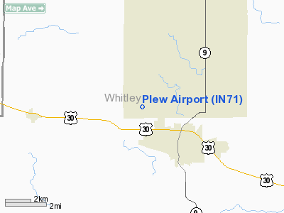
2 nautical miles NW of Columbia City, IN |
|
Location: |
Whitley County, IN |
|
Magnetic
Variation: |
03W (1985) |
Owner
& Manager
|
Ownership: |
Privately
owned |
|
Owner: |
Randy Plew |
|
Address: |
1150 W 150n
Columbia City, IN 46725 |
|
Phone
number: |
219-244-5621 |
|
Address: |
|
|
Phone
number: |
219-244-5621 |
Airport
Operations and Facilities
|
Airport
Use: |
Private |
|
Wind indicator: |
Yes |
|
Segmented
Circle: |
No |
|
Control
Tower: |
No |
|
Lighting
Schedule: |
PHONE REQ
FOR LIRL RY 17/35 CALL 219-244-5621. |
|
Landing
fee charge: |
No |
|
Sectional
chart: |
Chicago |
|
Region: |
AGL - Great Lakes |
|
Boundary
ARTCC: |
ZAU - Chicago |
|
Tie-in
FSS: |
HUF - Terre Haute |
|
FSS on
Airport: |
No |
|
FSS Toll
Free: |
1-800-WX-BRIEF |
Airport
Communications
Airport
Services
|
Fuel
available: |
100LL |
|
Airframe
Repair: |
NONE |
|
Power
Plant Repair: |
NONE |
|
Runway Information
Runway 17/35
|
Dimension: |
2100 x 100 ft
/ 640.1 x 30.5 m |
|
Surface: |
TURF, |
|
Edge Lights: |
Low |
|
|
Runway 17 |
Runway 35 |
|
Traffic
Pattern: |
Left |
Left |
|
Radio Navigation
Aids
|
ID |
Type |
Name |
Ch |
Freq |
Var |
Dist |
|
HHG |
NDB |
Huntington |
|
417.00 |
03W |
20.0 nm |
|
IWH |
NDB |
Wabash |
|
329.00 |
03W |
28.3 nm |
|
RCR |
NDB |
Rochester |
|
216.00 |
03W |
31.1 nm |
|
ANQ |
NDB |
Angola |
|
347.00 |
05W |
33.6 nm |
|
IRS |
NDB |
Sturgis |
|
382.00 |
04W |
37.9 nm |
|
CPB |
NDB |
Culver |
|
391.00 |
01W |
39.1 nm |
|
VFU |
NDB |
Stanley |
|
411.00 |
05W |
45.5 nm |
|
HAI |
NDB |
Three Rivers |
|
407.00 |
02W |
46.6 nm |
|
GGP |
NDB |
Logansport |
|
263.00 |
01W |
48.1 nm |
|
RWN |
NDB |
Winamac/dcmsnd |
|
335.00 |
00W |
49.3 nm |
|
OLK |
VOR |
Wolf Lake |
|
110.40 |
03W |
3.8 nm |
|
MZZ |
VOR/DME |
Marion |
023X |
108.60 |
03W |
42.2 nm |
|
FWA |
VORTAC |
Fort Wayne |
125X |
117.80 |
00E |
19.6 nm |
|
GSH |
VORTAC |
Goshen |
084X |
113.70 |
00E |
30.6 nm |
|
GUS |
VORTAC |
Grissom |
21Y |
108.45 |
02W |
43.3 nm |
|
OKK |
VORTAC |
Kokomo |
082X |
113.50 |
00E |
46.5 nm |
|
FWA |
VOT |
Fort Wayne Baer |
|
111.00 |
|
19.5 nm |
Based Aircraft
|
Aircraft
based on field: |
3 |
|
Single Engine
Airplanes: |
3 |
Plew Airport
Address:
Whitley County, IN
Tel:
219-244-5621
Images
and information placed above are from
http://www.airport-data.com/airport/IN71/
We
thank them for the data!
| General
Info |
| Country |
United
States |
| State |
INDIANA
|
| FAA ID |
IN71 |
| Latitude |
41-11-08.166N
|
| Longitude |
085-31-17.930W
|
| Elevation |
910 feet
|
| Near City |
COLUMBIA
CITY |
We don't guarantee the information is fresh and accurate. The data may
be wrong or outdated.
For more up-to-date information please refer to other sources.
|
|


