 |
|
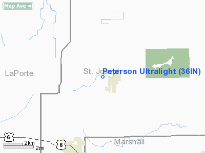
Location
& QuickFacts
|
FAA
Information Effective: |
2008-06-05 |
|
Airport
Identifier: |
36IN |
|
Airport
Status: |
Operational |
|
Longitude/Latitude: |
086-26-38.0440W/41-32-10.1640N
-86.443901/41.536157 (Estimated) |
|
Elevation: |
730 ft / 222.50 m (Estimated) |
|
Land: |
0 acres |
|
From nearest
city: |
1 nautical miles W of North Liberty, IN |
|
Location: |
St Joseph County, IN |
|
Magnetic
Variation: |
02W (1985) |
Owner
& Manager
|
Ownership: |
Privately
owned |
|
Owner: |
Gary C. Peterson |
|
Address: |
P.o. Box 309
North
Liberty, IN 46554 |
|
Phone
number: |
219-287-1869
OR 219-656-8763 |
|
Address: |
|
|
Phone
number: |
219-656-8763 |
Airport
Operations and Facilities
|
Airport
Use: |
Private
PERSONAL USE. |
|
Segmented
Circle: |
No |
|
Control
Tower: |
No |
|
Sectional
chart: |
Chicago |
|
Region: |
AGL - Great Lakes |
|
Boundary
ARTCC: |
ZAU - Chicago |
|
Tie-in
FSS: |
HUF - Terre Haute |
|
FSS Toll
Free: |
1-800-WX-BRIEF |
|
Runway Information
Runway NE/SW
|
Dimension: |
1200 x 100 ft
/ 365.8 x 30.5 m |
|
Surface: |
TURF, |
|
|
Runway NE |
Runway SW |
|
Traffic
Pattern: |
Left |
Left |
|
Obstruction: |
15 ft road |
|
|
Radio Navigation
Aids
|
ID |
Type |
Name |
Ch |
Freq |
Var |
Dist |
|
IUL |
NDB |
La Porte |
|
356.00 |
03W |
14.9 nm |
|
CPB |
NDB |
Culver |
|
391.00 |
01W |
19.4 nm |
|
MGC |
NDB |
Michigan City |
|
203.00 |
01W |
19.6 nm |
|
VP |
NDB |
Sedly |
|
212.00 |
02W |
20.2 nm |
|
RWN |
NDB |
Winamac/dcmsnd |
|
335.00 |
00W |
27.6 nm |
|
RCR |
NDB |
Rochester |
|
216.00 |
03W |
30.5 nm |
|
HAI |
NDB |
Three Rivers |
|
407.00 |
02W |
45.9 nm |
|
IRS |
NDB |
Sturgis |
|
382.00 |
04W |
48.3 nm |
|
RZL |
NDB |
Rensselaer |
|
362.00 |
02W |
48.7 nm |
|
GGP |
NDB |
Logansport |
|
263.00 |
01W |
49.8 nm |
|
OLK |
VOR |
Wolf Lake |
|
110.40 |
03W |
46.1 nm |
|
OXI |
VOR/DME |
Knox |
103X |
115.60 |
00E |
15.9 nm |
|
ELX |
VOR/DME |
Keeler |
113X |
116.60 |
00E |
39.3 nm |
|
GIJ |
VORTAC |
Gipper |
101X |
115.40 |
00E |
15.1 nm |
|
GSH |
VORTAC |
Goshen |
084X |
113.70 |
00E |
18.7 nm |
Based Aircraft
|
Aircraft
based on field: |
1 |
|
Single Engine
Airplanes: |
1 |
Peterson Ultralight
Address:
St Joseph County, IN
Tel:
219-656-8763
Images
and information placed above are from
http://www.airport-data.com/airport/36IN/
We
thank them for the data!
| General
Info |
| Country |
United
States |
| State |
INDIANA
|
| FAA ID |
36IN |
| Latitude |
41-32-10.164N
|
| Longitude |
086-26-38.044W
|
| Elevation |
730 feet
|
| Near City |
NORTH
LIBERTY |
We don't guarantee the information is fresh and accurate. The data may
be wrong or outdated.
For more up-to-date information please refer to other sources.
|
|


