 |
|
|
|
|
|
Location
& QuickFacts
|
FAA
Information Effective: |
2008-06-05 |
|
Airport
Identifier: |
I76 |
|
Airport
Status: |
Operational |
|
Longitude/Latitude: |
086-08-47.1600W/40-47-08.7800N
-86.146433/40.785772 (Estimated) |
|
Elevation: |
779 ft / 237.44 m (Surveyed) |
|
Land: |
140 acres |
|
From nearest
city: |
4 nautical miles NW of Peru, IN |
|
Location: |
Miami County, IN |
|
Magnetic
Variation: |
04W (2005) |
Owner
& Manager
|
Ownership: |
Publicly
owned |
|
Owner: |
Peru Boac
RON KOENES CHAIRMAN OF THE BOARD. |
|
Address: |
1635 N. 400 W.
Peru, IN 46970 |
|
Phone
number: |
765-472-1990 |
|
Manager: |
Ron Jett |
|
Address: |
1635 N. 400 W.
Peru, IN 46970 |
|
Phone
number: |
765-472-1990 |
Airport
Operations and Facilities
|
Airport
Use: |
Open
to public |
|
Wind indicator: |
Yes |
|
Segmented
Circle: |
Yes |
|
Control
Tower: |
No |
|
Lighting
Schedule: |
DUSK-DAWN
ACTVT MIRL RY 01/19, PAPI RY 01 & 19, & REIL RY
01 & 19 - CTAF. |
|
Beacon
Color: |
Clear-Green (lighted land airport) |
|
Landing
fee charge: |
No |
|
Sectional
chart: |
Chicago |
|
Region: |
AGL - Great Lakes |
|
Boundary
ARTCC: |
ZAU - Chicago |
|
Tie-in
FSS: |
HUF - Terre Haute |
|
FSS on
Airport: |
No |
|
FSS Toll
Free: |
1-800-WX-BRIEF |
|
NOTAMs
Facility: |
HUF (NOTAM-d service avaliable) |
|
Federal
Agreements: |
NGY |
Airport Communications
|
CTAF: |
122.800 |
|
Unicom: |
122.800
|
Airport
Services
|
Fuel
available: |
100LLA |
|
Airframe
Repair: |
MINOR |
|
Power
Plant Repair: |
MINOR |
|
Bottled
Oxygen: |
NONE |
|
Bulk Oxygen: |
NONE |
|
Runway Information
Runway 01/19
|
Dimension: |
4400 x 75 ft
/ 1341.1 x 22.9 m |
|
Surface: |
ASPH, Good Condition |
|
Weight Limit: |
Single wheel: 10000 lbs. |
|
Edge Lights: |
Medium |
|
|
Runway 01 |
Runway 19 |
|
Longitude: |
086-08-49.4800W |
086-08-44.8500W |
|
Latitude: |
40-46-47.1200N |
40-47-30.4500N |
|
Elevation: |
768.00 ft |
779.00 ft |
|
Alignment: |
5 |
127 |
|
Traffic
Pattern: |
Left |
Left |
|
Markings: |
Non-precision instrument, Fair Condition |
Non-precision instrument, Fair Condition |
|
Crossing
Height: |
36.00 ft |
40.00 ft |
|
VASI: |
2-light PAPI on left side |
2-light PAPI on left side |
|
Visual Glide
Angle: |
3.00° |
3.00° |
|
Runway End
Identifier: |
Yes |
Yes |
|
Centerline
Lights: |
No |
No |
|
Touchdown
Lights: |
No |
No |
|
Obstruction: |
15 ft road, 451.0 ft from runway, 16:1 slope
to clear |
12 ft road, 450.0 ft from runway, 20:1 slope
to clear |
|
Radio Navigation
Aids
|
ID |
Type |
Name |
Ch |
Freq |
Var |
Dist |
|
GGP |
NDB |
Logansport |
|
263.00 |
01W |
11.3 nm |
|
IWH |
NDB |
Wabash |
|
329.00 |
03W |
15.9 nm |
|
RCR |
NDB |
Rochester |
|
216.00 |
03W |
16.9 nm |
|
RWN |
NDB |
Winamac/dcmsnd |
|
335.00 |
00W |
27.8 nm |
|
CPB |
NDB |
Culver |
|
391.00 |
01W |
28.1 nm |
|
MCX |
NDB |
White County |
|
377.00 |
03W |
28.4 nm |
|
HHG |
NDB |
Huntington |
|
417.00 |
03W |
31.3 nm |
|
FKR |
NDB |
Frankfort |
|
278.00 |
02W |
36.3 nm |
|
RZL |
NDB |
Rensselaer |
|
362.00 |
02W |
48.1 nm |
|
OLK |
VOR |
Wolf Lake |
|
110.40 |
03W |
40.4 nm |
|
MZZ |
VOR/DME |
Marion |
023X |
108.60 |
03W |
27.6 nm |
|
OXI |
VOR/DME |
Knox |
103X |
115.60 |
00E |
39.5 nm |
|
MIE |
VOR/DME |
Muncie |
091X |
114.40 |
03W |
47.6 nm |
|
GUS |
VORTAC |
Grissom |
21Y |
108.45 |
02W |
8.5 nm |
|
OKK |
VORTAC |
Kokomo |
082X |
113.50 |
00E |
16.0 nm |
|
BVT |
VORTAC |
Boiler |
098X |
115.10 |
01E |
44.3 nm |
|
GSH |
VORTAC |
Goshen |
084X |
113.70 |
00E |
44.8 nm |
|
FWA |
VORTAC |
Fort Wayne |
125X |
117.80 |
00E |
45.1 nm |
|
FWA |
VOT |
Fort Wayne Baer |
|
111.00 |
|
44.9 nm |
Based Aircraft
|
Aircraft
based on field: |
24 |
|
Single Engine
Airplanes: |
21 |
|
Multi Engine Airplanes: |
2 |
|
Helicopters: |
1 |
Operational Statistics
Time
Period: 2006-01-01 - 2006-12-31
|
Aircraft
Operations: |
89/Week |
|
General Aviation
Local: |
74.8% |
|
General Aviation
Itinerant: |
25.2% |
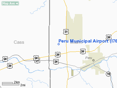
Peru Municipal Airport
Address:
Miami County, IN
Tel:
765-472-1990
Images
and information placed above are from
http://www.airport-data.com/airport/I76/
We
thank them for the data!
| General
Info |
| Country |
United
States |
| State |
INDIANA
|
| FAA ID |
I76 |
| Latitude |
40-47-10.748N
|
| Longitude |
086-08-46.979W
|
| Elevation |
779 feet
|
| Near City |
PERU |
We don't guarantee the information is fresh and accurate. The data may
be wrong or outdated.
For more up-to-date information please refer to other sources.
|
|


