 |
|
Perry County Municipal Airport |
| Perry County Municipal Airport |
| IATA: none â ICAO: KTEL â FAA LID: TEL |
| Summary |
| Airport type |
Public |
| Owner |
Perry County Airport Authority |
| Serves |
Tell City, Indiana |
| Elevation AMSL |
659 ft / 201 m |
| Coordinates |
38°01â²04â³N 086°41â²27â³W / 38.01778°N 86.69083°W / 38.01778; -86.69083 |
| Runways |
| Direction |
Length |
Surface |
| ft |
m |
| 13/31 |
4,400 |
1,341 |
Asphalt |
| Statistics (2006) |
| Aircraft operations |
3,048 |
| Source: Federal Aviation Administration |
Perry County Municipal Airport (ICAO: KTEL, FAA LID: TEL) is a public use airport located six nautical miles (11 km) northeast of the central business district of Tell City, in Perry County, Indiana, United States. It is owned by the Perry County Airport Authority.
Although most U.S. airports use the same three-letter location identifier for the FAA and IATA, this airport is assigned TEL by the FAA but has no designation from the IATA.
Facilities and aircraft
Perry County Municipal Airport covers an area of 76 acres (31 ha) at an elevation of 659 feet (201 m) above mean sea level. It has one runway designated 13/31 with a 4,400 x 75 ft (1,341 x 23 m) asphalt surface. For the 12-month period ending December 31, 2006, the airport had 3,048 aircraft operations, an average of 254 per month: 92% general aviation, 7% military and 1% air taxi.
The above content comes from Wikipedia and is published under free licenses – click here to read more.
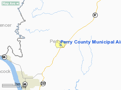
Location
& QuickFacts
|
FAA
Information Effective: |
2008-06-05 |
|
Airport
Identifier: |
TEL |
|
Airport
Status: |
Operational |
|
Longitude/Latitude: |
086-41-27.3480W/38-01-03.7090N
-86.690930/38.017697 (Estimated) |
|
Elevation: |
659 ft / 200.86 m (Surveyed) |
|
Land: |
76 acres |
|
From nearest
city: |
6 nautical miles NE of Tell City, IN |
|
Location: |
Perry County, IN |
|
Magnetic
Variation: |
02W (1995) |
Owner
& Manager
|
Ownership: |
Publicly
owned |
|
Owner: |
Perry County Arpt Auth |
|
Address: |
11965 Old State Rd 37
Tell City, IN 47586 |
|
Phone
number: |
812-547-2366 |
|
Manager: |
Gary Gebhard |
|
Address: |
11965 Old State Rd 37
Tell City, IN 47586 |
|
Phone
number: |
812-547-4101 |
Airport Operations
and Facilities
|
Airport
Use: |
Open
to public |
|
Wind indicator: |
Yes |
|
Segmented
Circle: |
No |
|
Control
Tower: |
No |
|
Lighting
Schedule: |
DUSK-DAWN
ACTVT MIRL RY 13/31 & REIL RYS 13 & 31 - CTAF. |
|
Beacon
Color: |
Clear-Green (lighted land airport) |
|
Landing
fee charge: |
No |
|
Sectional
chart: |
St Louis |
|
Region: |
AGL - Great Lakes |
|
Boundary
ARTCC: |
ZID - Indianapolis |
|
Tie-in
FSS: |
HUF - Terre Haute |
|
FSS on
Airport: |
No |
|
FSS Toll
Free: |
1-800-WX-BRIEF |
|
NOTAMs
Facility: |
HUF (NOTAM-d service avaliable) |
|
Federal
Agreements: |
NGY |
Airport Communications
|
CTAF: |
122.700 |
|
Unicom: |
122.700
|
Airport
Services
|
Fuel
available: |
100LLA |
|
Bottled
Oxygen: |
LOW |
|
Bulk Oxygen: |
NONE |
|
Runway Information
Runway 13/31
|
Dimension: |
4400 x 75 ft
/ 1341.1 x 22.9 m |
|
Surface: |
ASPH, Good Condition |
|
Weight Limit: |
Single wheel: 12000 lbs. |
|
Edge Lights: |
Medium |
|
|
Runway 13 |
Runway 31 |
|
Longitude: |
086-41-52.5800W |
086-41-12.9100W |
|
Latitude: |
38-01-22.8600N |
38-00-52.7400N |
|
Elevation: |
608.00 ft |
660.00 ft |
|
Alignment: |
127 |
127 |
|
Traffic
Pattern: |
Left |
Left |
|
Markings: |
Basic, Good Condition |
Basic, Good Condition |
|
Crossing
Height: |
29.00 ft |
28.00 ft |
|
VASI: |
4-light PAPI on right side
RY 13/31 PAPI ON CONTLY. |
4-light PAPI on right side |
|
Visual Glide
Angle: |
3.00° |
3.25° |
|
Runway End
Identifier: |
Yes |
Yes |
|
Centerline
Lights: |
No |
No |
|
Touchdown
Lights: |
No |
No |
|
Obstruction: |
76 ft trees, 900.0 ft from runway, 85 ft left
of centerline, 35:1 slope to clear |
64 ft trees, 1290.0 ft from runway, 17:1 slope
to clear |
|
Radio Navigation
Aids
|
ID |
Type |
Name |
Ch |
Freq |
Var |
Dist |
|
TEL |
NDB |
Tell City |
|
206.00 |
02W |
0.2 nm |
|
FNZ |
NDB |
Ferdinand |
|
239.00 |
00E |
15.5 nm |
|
RRJ |
NDB |
Oranj |
|
368.00 |
02W |
31.6 nm |
|
GOI |
NDB |
Godman |
|
396.00 |
02W |
34.0 nm |
|
PDW |
NDB |
Evansville |
|
284.00 |
00E |
39.8 nm |
|
DCY |
NDB |
Washington |
|
212.00 |
03W |
45.8 nm |
|
MYS |
VOR |
Mystic |
|
108.20 |
01W |
22.4 nm |
|
HNB |
VOR/DME |
Huntingburg |
029X |
109.20 |
00E |
18.8 nm |
|
OWB |
VOR/DME |
Owensboro |
023X |
108.60 |
01E |
27.9 nm |
|
FTK |
VOR/DME |
Fort Knox |
033X |
109.60 |
01W |
34.7 nm |
|
CCT |
VORTAC |
Central City |
035X |
109.80 |
01W |
46.9 nm |
|
SDF |
VOT |
Louisville Standifd |
|
111.00 |
|
46.2 nm |
Based
Aircraft
|
Aircraft
based on field: |
13 |
|
Single Engine
Airplanes: |
12 |
|
Multi Engine Airplanes: |
1 |
Operational Statistics
Time
Period: 2006-01-01 - 2006-12-31
|
Aircraft
Operations: |
59/Week |
|
Air Taxi: |
1.2% |
|
General Aviation
Local: |
65.0% |
|
General Aviation
Itinerant: |
26.9% |
|
Military: |
6.9% |
Perry County Municipal Airport
Address:
Perry County, IN
Tel:
812-547-2366,
812-547-4101
Images
and information placed above are from
http://www.airport-data.com/airport/TEL/
We
thank them for the data!
| General
Info |
| Country |
United
States |
| State |
INDIANA
|
| FAA ID |
TEL |
| Latitude |
38-01-03.709N
|
| Longitude |
086-41-27.348W
|
| Elevation |
659 feet
|
| Near City |
TELL CITY
|
We don't guarantee the information is fresh and accurate. The data may
be wrong or outdated.
For more up-to-date information please refer to other sources.
|
|


