 |
|
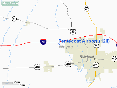
Location
& QuickFacts
|
FAA
Information Effective: |
2008-06-05 |
|
Airport
Identifier: |
12II |
|
Airport
Status: |
Operational |
|
Longitude/Latitude: |
084-58-19.8640W/39-51-22.1690N
-84.972184/39.856158 (Estimated) |
|
Elevation: |
1020 ft / 310.90 m (Estimated) |
|
Land: |
0 acres |
|
From nearest
city: |
4 nautical miles NE of Centerville, IN |
|
Location: |
Wayne County, IN |
|
Magnetic
Variation: |
03W (1980) |
Owner & Manager
|
Ownership: |
Privately
owned |
|
Owner: |
Robert D. Pentecost |
|
Address: |
Rr 2
Centerville, IN 47330 |
|
Phone
number: |
317-855-3989 |
|
Address: |
|
Airport
Operations and Facilities
|
Airport
Use: |
Private |
|
Segmented
Circle: |
No |
|
Control
Tower: |
No |
|
Sectional
chart: |
Cincinnati |
|
Region: |
AGL - Great Lakes |
|
Boundary
ARTCC: |
ZID - Indianapolis |
|
Tie-in
FSS: |
HUF - Terre Haute |
|
FSS Toll
Free: |
1-800-WX-BRIEF |
|
Runway Information
Runway E/W
|
Dimension: |
2500 x 75 ft
/ 762.0 x 22.9 m |
|
Surface: |
TURF, |
|
|
Runway E |
Runway W |
|
Traffic
Pattern: |
Left |
Left |
|
Radio Navigation
Aids
|
ID |
Type |
Name |
Ch |
Freq |
Var |
Dist |
|
UWL |
NDB |
New Castle |
|
385.00 |
02W |
16.1 nm |
|
OXD |
NDB |
Oxford |
|
282.00 |
04W |
22.8 nm |
|
AI |
NDB |
Video |
|
371.00 |
03W |
27.9 nm |
|
VES |
NDB |
Versailles |
|
356.00 |
04W |
29.5 nm |
|
HKF |
NDB |
Hook Field |
|
239.00 |
04W |
32.4 nm |
|
HLB |
NDB |
Batesville |
|
254.00 |
02W |
33.2 nm |
|
HAO |
NDB |
Hamilton |
|
260.00 |
04W |
34.5 nm |
|
PLD |
NDB |
Portland |
|
257.00 |
03W |
35.9 nm |
|
CQA |
NDB |
Lakefield |
|
205.00 |
04W |
42.0 nm |
|
ISZ |
NDB |
Cincinnati-blue Ash |
|
388.00 |
04W |
45.4 nm |
|
MDE |
NDB |
Madeira |
|
379.00 |
04W |
47.6 nm |
|
XEN |
NDB |
Xenia |
|
395.00 |
03W |
48.9 nm |
|
UR |
NDB |
Burln |
|
321.00 |
04W |
49.6 nm |
|
UMP |
NDB |
Metropolitan |
|
338.00 |
03W |
50.0 nm |
|
FFO |
TACAN |
Patterson |
099X |
|
04W |
42.4 nm |
|
DQN |
VOR/DME |
Dayton |
092X |
114.50 |
01W |
28.2 nm |
|
MIE |
VOR/DME |
Muncie |
091X |
114.40 |
03W |
30.0 nm |
|
RID |
VORTAC |
Richmond |
043X |
110.60 |
03W |
8.7 nm |
|
SHB |
VORTAC |
Shelbyville |
057X |
112.00 |
01E |
41.6 nm |
|
ROD |
VORTAC |
Rosewood |
122X |
117.50 |
05W |
50.0 nm |
|
DAY |
VOT |
Dayton J M Cox-day |
|
111.00 |
|
34.8 nm |
Remarks
- OWNER
DESIRES ARPT NOT BE CHARTED.
- FILED
FOR RECORD PURPOSES ONLY.
Based Aircraft
|
Aircraft
based on field: |
1 |
|
Single Engine
Airplanes: |
1 |
Pentecost Airport
Address:
Wayne County, IN
Tel:
317-855-3989
Images
and information placed above are from
http://www.airport-data.com/airport/12II/
We
thank them for the data!
| General
Info |
| Country |
United
States |
| State |
INDIANA
|
| FAA ID |
12II |
| Latitude |
39-51-22.169N
|
| Longitude |
084-58-19.864W
|
| Elevation |
1020 feet
|
| Near City |
CENTERVILLE
|
We don't guarantee the information is fresh and accurate. The data may
be wrong or outdated.
For more up-to-date information please refer to other sources.
|
|


