 |
|
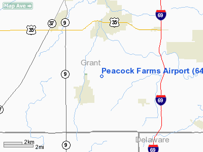
Location
& QuickFacts
|
FAA
Information Effective: |
2008-06-05 |
|
Airport
Identifier: |
64IN |
|
Airport
Status: |
Operational |
|
Longitude/Latitude: |
085-37-31.9120W/40-26-05.1450N
-85.625531/40.434762 (Estimated) |
|
Elevation: |
875 ft / 266.70 m (Estimated) |
|
Land: |
0 acres |
|
From nearest
city: |
2 nautical miles NE of Fairmount, IN |
|
Location: |
Grant County, IN |
|
Magnetic
Variation: |
02W (1985) |
Owner & Manager
|
Ownership: |
Privately
owned |
|
Owner: |
Charles Robert Peacock |
|
Address: |
2280 E 800 S
Fairmount, IN 46928 |
|
Phone
number: |
317-948-5165 |
|
Address: |
|
Airport
Operations and Facilities
|
Airport
Use: |
Private |
|
Wind indicator: |
Yes |
|
Segmented
Circle: |
No |
|
Control
Tower: |
No |
|
Sectional
chart: |
Cincinnati |
|
Region: |
AGL - Great Lakes |
|
Boundary
ARTCC: |
ZID - Indianapolis |
|
Tie-in
FSS: |
HUF - Terre Haute |
|
FSS Toll
Free: |
1-800-WX-BRIEF |
|
Runway Information
Runway 18/36
|
Dimension: |
2600 x 70 ft
/ 792.5 x 21.3 m |
|
Surface: |
TURF, |
|
|
Runway 18 |
Runway 36 |
|
Traffic
Pattern: |
Left |
Left |
|
Obstruction: |
25 ft pline, 6.0 ft from runway |
|
|
Radio Navigation
Aids
|
ID |
Type |
Name |
Ch |
Freq |
Var |
Dist |
|
IWH |
NDB |
Wabash |
|
329.00 |
03W |
21.3 nm |
|
AI |
NDB |
Video |
|
371.00 |
03W |
22.6 nm |
|
HHG |
NDB |
Huntington |
|
417.00 |
03W |
26.3 nm |
|
PLD |
NDB |
Portland |
|
257.00 |
03W |
29.4 nm |
|
UMP |
NDB |
Metropolitan |
|
338.00 |
03W |
35.7 nm |
|
UWL |
NDB |
New Castle |
|
385.00 |
02W |
36.2 nm |
|
GGP |
NDB |
Logansport |
|
263.00 |
01W |
37.9 nm |
|
HZP |
NDB |
Zionsville |
|
248.00 |
03W |
41.3 nm |
|
FKR |
NDB |
Frankfort |
|
278.00 |
02W |
44.1 nm |
|
RCR |
NDB |
Rochester |
|
216.00 |
03W |
45.8 nm |
|
CQA |
NDB |
Lakefield |
|
205.00 |
04W |
48.6 nm |
|
OLK |
VOR |
Wolf Lake |
|
110.40 |
03W |
49.2 nm |
|
MZZ |
VOR/DME |
Marion |
023X |
108.60 |
03W |
4.3 nm |
|
MIE |
VOR/DME |
Muncie |
091X |
114.40 |
03W |
15.9 nm |
|
OKK |
VORTAC |
Kokomo |
082X |
113.50 |
00E |
20.5 nm |
|
GUS |
VORTAC |
Grissom |
21Y |
108.45 |
02W |
27.2 nm |
|
FWA |
VORTAC |
Fort Wayne |
125X |
117.80 |
00E |
38.3 nm |
|
SHB |
VORTAC |
Shelbyville |
057X |
112.00 |
01E |
49.1 nm |
|
FWA |
VOT |
Fort Wayne Baer |
|
111.00 |
|
38.2 nm |
Remarks
- PRVDD
OBSTRUCTIONS IN APCH SURFACE BE REMOVED/LOWERED OR THRS DSPLD TO PRVD
20:1 APCH.
Based Aircraft
|
Aircraft
based on field: |
1 |
|
Single Engine
Airplanes: |
1 |
Peacock Farms Airport
Address:
Grant County, IN
Tel:
317-948-5165
Images
and information placed above are from
http://www.airport-data.com/airport/64IN/
We
thank them for the data!
| General
Info |
| Country |
United
States |
| State |
INDIANA
|
| FAA ID |
64IN |
| Latitude |
40-26-05.145N
|
| Longitude |
085-37-31.912W
|
| Elevation |
875 feet
|
| Near City |
FAIRMOUNT
|
We don't guarantee the information is fresh and accurate. The data may
be wrong or outdated.
For more up-to-date information please refer to other sources.
|
|


