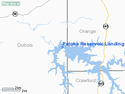
Patoka Reservoir Landing Area Seaplane Base |
 |
|
Location
& QuickFacts
|
FAA
Information Effective: |
2008-06-05 |
|
Airport
Identifier: |
06I |
|
Airport
Status: |
Operational |
|
Longitude/Latitude: |
086-41-27.9680W/38-26-00.1990N
-86.691102/38.433389 (Estimated) |
|
Elevation: |
536 ft / 163.37 m (Estimated) |
|
Land: |
8800 acres |
|
From nearest
city: |
8 nautical miles NW of French Lick, IN |
|
Location: |
Orange County, IN |
|
Magnetic
Variation: |
01W (1985) |
Owner
& Manager
|
Ownership: |
Publicly
owned |
|
Owner: |
Dept Of Natural Resources |
|
Address: |
3084 N. Dillard Rd.
Birdseye,
IN 47513 |
|
Phone
number: |
812-685-2464 |
|
Manager: |
Tony Hazelwood |
|
Address: |
3084 N. Dillard Rd.
Birdseye,
IN 47513 |
|
Phone
number: |
812-685-2464 |
Airport Operations
and Facilities
|
Airport
Use: |
Open
to public |
|
Segmented
Circle: |
No |
|
Control
Tower: |
No |
|
Sectional
chart: |
St Louis |
|
Region: |
AGL - Great Lakes |
|
Boundary
ARTCC: |
ZID - Indianapolis |
|
Tie-in
FSS: |
HUF - Terre Haute |
|
FSS on
Airport: |
No |
|
FSS Toll
Free: |
1-800-WX-BRIEF |
|
NOTAMs
Facility: |
HUF (NOTAM-d service avaliable) |
Airport
Communications
|
Runway Information
Runway E/W
|
Dimension: |
16000 x 3500
ft / 4876.8 x 1066.8 m |
|
Surface: |
WATER, |
|
|
Runway E |
Runway W |
|
Traffic
Pattern: |
Left |
Left |
|
Radio Navigation
Aids
|
ID |
Type |
Name |
Ch |
Freq |
Var |
Dist |
|
RRJ |
NDB |
Oranj |
|
368.00 |
02W |
9.6 nm |
|
FNZ |
NDB |
Ferdinand |
|
239.00 |
00E |
13.1 nm |
|
TEL |
NDB |
Tell City |
|
206.00 |
02W |
25.2 nm |
|
DCY |
NDB |
Washington |
|
212.00 |
03W |
26.1 nm |
|
BFR |
NDB |
Bedford |
|
344.00 |
02W |
27.2 nm |
|
BM |
NDB |
Claye |
|
382.00 |
02W |
37.7 nm |
|
EQZ |
NDB |
Captain |
|
308.00 |
02W |
42.6 nm |
|
OEA |
NDB |
Vincennes |
|
251.00 |
00E |
43.5 nm |
|
GOI |
NDB |
Godman |
|
396.00 |
02W |
44.2 nm |
|
PDW |
NDB |
Evansville |
|
284.00 |
00E |
46.2 nm |
|
AJG |
NDB |
Mount Carmel |
|
524.00 |
02W |
49.8 nm |
|
MYS |
VOR |
Mystic |
|
108.20 |
01W |
38.7 nm |
|
HNB |
VOR/DME |
Huntingburg |
029X |
109.20 |
00E |
16.7 nm |
|
FTK |
VOR/DME |
Fort Knox |
033X |
109.60 |
01W |
46.4 nm |
|
OWB |
VOR/DME |
Owensboro |
023X |
108.60 |
01E |
47.2 nm |
|
LWV |
VOR/DME |
Lawrenceville |
025X |
108.80 |
01W |
47.4 nm |
|
BQM |
VOR/DME |
Bowman |
059X |
112.20 |
01W |
49.9 nm |
|
OOM |
VORTAC |
Hoosier |
039X |
110.20 |
02W |
42.9 nm |
|
SDF |
VOT |
Louisville Standifd |
|
111.00 |
|
47.6 nm |
Remarks
- LOW
ALT-HIGH SPEED MIL TRNG RTE ACTVTY.
CTC FSS FOR INFO.
- SEAPLANE
OPNS PROHIBITED SS-SR.
Operational Statistics
Time
Period: 2004-01-02 - 2004-12-31
|
Aircraft
Operations: |
1/Month |
|
General Aviation
Itinerant: |
100.0% |
Patoka Reservoir Landing Area Seaplane
Base
Address:
Orange County, IN
Tel:
812-685-2464
Images
and information placed above are from
http://www.airport-data.com/airport/06I/
We
thank them for the data!
| General
Info |
| Country |
United
States |
| State |
INDIANA
|
| FAA ID |
06I |
| Latitude |
38-26-00.199N
|
| Longitude |
086-41-27.968W
|
| Elevation |
536 feet
|
| Near City |
FRENCH
LICK |
We don't guarantee the information is fresh and accurate. The data may
be wrong or outdated.
For more up-to-date information please refer to other sources.
|


