 |
|
|
|
|
|
Location
& QuickFacts
|
FAA
Information Effective: |
2008-06-05 |
|
Airport
Identifier: |
7I4 |
|
Airport
Status: |
Operational |
|
Longitude/Latitude: |
086-26-34.9590W/38-39-30.1930N
-86.443044/38.658387 (Estimated) |
|
Elevation: |
655 ft / 199.64 m (Estimated) |
|
Land: |
52 acres |
|
From nearest
city: |
1 nautical miles E of Orleans, IN |
|
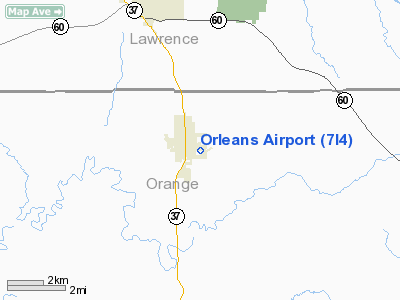
Location: |
Orange County, IN |
|
Magnetic
Variation: |
01W (1985) |
Owner
& Manager
|
Ownership: |
Publicly
owned |
|
Owner: |
Orleans Boac |
|
Address: |
550 E South St
Orleans,
IN 47452 |
|
Phone
number: |
812-865-2020 |
|
Manager: |
Aaron Carr |
|
Address: |
550 E South St
Orleans,
IN 47452 |
|
Phone
number: |
812-865-3265 |
Airport Operations
and Facilities
|
Airport
Use: |
Open
to public |
|
Wind indicator: |
Yes |
|
Segmented
Circle: |
No |
|
Control
Tower: |
No |
|
Lighting
Schedule: |
RDO-CTL
ACTVT LIRL RY 06/24 - CTAF. |
|
Landing
fee charge: |
No |
|
Sectional
chart: |
St Louis |
|
Region: |
AGL - Great Lakes |
|
Boundary
ARTCC: |
ZID - Indianapolis |
|
Tie-in
FSS: |
HUF - Terre Haute |
|
FSS on
Airport: |
No |
|
FSS Toll
Free: |
1-800-WX-BRIEF |
|
NOTAMs
Facility: |
HUF (NOTAM-d service avaliable) |
Airport Communications
|
CTAF: |
122.800 |
|
Unicom: |
122.800
|
Airport Services
|
Airframe
Repair: |
NONE |
|
Power
Plant Repair: |
NONE |
|
Runway Information
Runway 06/24
|
Dimension: |
3456 x 30 ft
/ 1053.4 x 9.1 m |
|
Surface: |
ASPH, Poor Condition
RWY SHOULDER SPALLING. |
|
Edge Lights: |
Non-standard lighting system
RY 06/24 NSTD LIRL; ONLY 2 THLD LGTS EACH SIDE OF RY.
NO LGTS BTWN RY
END & DSPLCD THLD BOTH ENDS. |
|
|
Runway 06 |
Runway 24 |
|
Longitude: |
086-26-47.9500W |
086-26-11.0000W |
|
Latitude: |
38-39-17.1900N |
38-39-35.2900N |
|
Elevation: |
655.00 ft |
650.00 ft |
|
Traffic
Pattern: |
Left |
Left |
|
Markings: |
Nonstandard, Good Condition
06/24 NUMBERS ARE SMALLER THAN STD. |
Nonstandard, Good Condition |
|
Displaced
threshold: |
291.00 ft |
200.00 ft |
|
Runway End
Identifier: |
No |
No |
|
Centerline
Lights: |
No |
No |
|
Touchdown
Lights: |
No |
|
|
Obstruction: |
10 ft crops, 201.0 ft from runway
APCH RATIO 49:1 TO DSPLCD THLD.
RY 06 FENCE; BRUSH WI 125 FT OF RY CNTRLN; CROPS 10 FT FROM
RY END. |
15 ft crops, 201.0 ft from runway
RWY 24 APCH RATIO 26:1 TO DSPLCD THLD.
15 FT ROAD 130 FT FM END. |
|
Radio Navigation
Aids
|
ID |
Type |
Name |
Ch |
Freq |
Var |
Dist |
|
RRJ |
NDB |
Oranj |
|
368.00 |
02W |
8.8 nm |
|
BFR |
NDB |
Bedford |
|
344.00 |
02W |
10.9 nm |
|
BM |
NDB |
Claye |
|
382.00 |
02W |
25.0 nm |
|
EQZ |
NDB |
Captain |
|
308.00 |
02W |
25.4 nm |
|
FNZ |
NDB |
Ferdinand |
|
239.00 |
00E |
30.9 nm |
|
DCY |
NDB |
Washington |
|
212.00 |
03W |
32.4 nm |
|
TEL |
NDB |
Tell City |
|
206.00 |
02W |
40.4 nm |
|
OVO |
NDB |
North Vernon |
|
374.00 |
02W |
45.9 nm |
|
IMS |
NDB |
Madison |
|
404.00 |
03W |
46.5 nm |
|
GOI |
NDB |
Godman |
|
396.00 |
02W |
47.5 nm |
|
BA |
NDB |
Clifs |
|
410.00 |
03W |
49.4 nm |
|
MYS |
VOR |
Mystic |
|
108.20 |
01W |
46.9 nm |
|
HNB |
VOR/DME |
Huntingburg |
029X |
109.20 |
00E |
34.4 nm |
|
BQM |
VOR/DME |
Bowman |
059X |
112.20 |
01W |
44.8 nm |
|
OOM |
VORTAC |
Hoosier |
039X |
110.20 |
02W |
30.2 nm |
|
ABB |
VORTAC |
Nabb |
071X |
112.40 |
01E |
38.1 nm |
|
SDF |
VOT |
Louisville Standifd |
|
111.00 |
|
44.1 nm |
Based Aircraft
|
Aircraft
based on field: |
9 |
|
Single Engine
Airplanes: |
8 |
|
Ultralights: |
1 |
Operational Statistics
Time
Period: 2006-01-01 - 2006-12-31
|
Aircraft
Operations: |
51/Week |
|
General Aviation
Local: |
73.0% |
|
General Aviation
Itinerant: |
27.0% |
Orleans Airport
Address:
Orange County, IN
Tel:
812-865-2020,
812-865-3265
Images
and information placed above are from
http://www.airport-data.com/airport/7I4/
We
thank them for the data!
| General
Info |
| Country |
United
States |
| State |
INDIANA
|
| FAA ID |
7I4 |
| Latitude |
38-39-30.193N
|
| Longitude |
086-26-34.959W
|
| Elevation |
655 feet
|
| Near City |
ORLEANS
|
We don't guarantee the information is fresh and accurate. The data may
be wrong or outdated.
For more up-to-date information please refer to other sources.
|
|


