 |
|
| O'Neal Airport |
| IATA: OEA – ICAO: KOEA – FAA LID: OEA |
| Summary |
| Airport type |
Public (Closed) |
| Owner |
Vincennes University |
| Serves |
Vincennes, Indiana |
| Elevation AMSL |
414 ft / 126 m |
| Coordinates |
38°41′29″N 087°33′08″W / 38.69139°N 87.55222°W / 38.69139; -87.55222 |
| Runways |
| Direction |
Length |
Surface |
| ft |
m |
| 9/27 |
3,450 |
1,052 |
Turf |
| 14/32 |
2,625 |
800 |
Turf |
| 3/21 |
2,350 |
716 |
Turf |
| Statistics (2004) |
| Aircraft operations |
8,000 |
| Based aircraft |
18 |
| Source: Federal Aviation Administration |
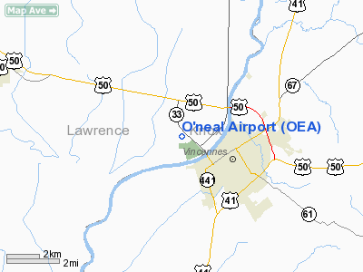
O'Neal Airport (IATA: OEA, ICAO: KOEA, FAA LID: OEA) was a public use airport owned by Vincennes University and located in Lawrence County, Indiana, United States. The airport was one nautical mile (1.85 km) west of the central business district of Vincennes, a city in Knox County. The airport is now closed.
Facilities and aircraft
O'Neal Airport covered an area of 250 acres (101 ha) at an elevation of 414 feet (126 m) above mean sea level. It had three runways with turf surfaces: 9/27 is 3,450 by 150 feet (1,052 x 46 m); 14/32 is 2,625 by 135 feet (800 x 41 m); 3/21 is 2,350 by 120 feet (716 x 37 m).
For the 12-month period ending August 31, 2004, the airport had 8,000 general aviation aircraft operations, an average of 21 per day. At that time there were 18 aircraft based at this airport: 67% single-engine, 22% multi-engine, 6% helicopter and 6% ultralight.
The above content comes from Wikipedia and is published under free licenses – click here to read more.
Location
& QuickFacts
|
FAA
Information Effective: |
2008-06-05 |
|
Airport
Identifier: |
OEA |
|
Airport
Status: |
Operational |
|
Longitude/Latitude: |
087-33-08.0790W/38-41-29.1680N
-87.552244/38.691436 (Estimated) |
|
Elevation: |
414 ft / 126.19 m (Estimated) |
|
Land: |
250 acres |
|
From nearest
city: |
1 nautical miles W of Vincennes, IN |
|
Location: |
Lawrence County, IL |
|
Magnetic
Variation: |
00W (1985) |
Owner
& Manager
|
Ownership: |
Privately
owned |
|
Owner: |
Vincennes Univ |
|
Address: |
1002 N. First St
Vincennes, IN 47591 |
|
Phone
number: |
812-885-4104 |
|
Manager: |
Rick Weidig |
|
Address: |
O'neal Airport Vincennes Univ
Vincennes, IN 45791 |
|
Phone
number: |
618-884-9049 |
Airport Operations
and Facilities
|
Airport
Use: |
Open
to public |
|
Wind indicator: |
Yes |
|
Segmented
Circle: |
Yes |
|
Control
Tower: |
No |
|
Landing
fee charge: |
No |
|
Sectional
chart: |
St Louis |
|
Region: |
AGL - Great Lakes |
|
Boundary
ARTCC: |
ZID - Indianapolis |
|
Tie-in
FSS: |
STL - Saint Louis |
|
FSS on
Airport: |
No |
|
FSS Toll
Free: |
1-800-WX-BRIEF |
|
NOTAMs
Facility: |
STL (NOTAM-d service avaliable) |
Airport Communications
Airport Services
|
Fuel
available: |
100LLA
FUEL OTS INDEFLY. |
|
Airframe
Repair: |
MAJOR |
|
Power
Plant Repair: |
MAJOR |
|
Bottled
Oxygen: |
NONE |
|
Bulk Oxygen: |
NONE |
|
Runway Information
Runway 03/21
|
Dimension: |
2350 x 120 ft
/ 716.3 x 36.6 m |
|
Surface: |
TURF, Good Condition |
|
|
Runway 03 |
Runway 21 |
|
Traffic
Pattern: |
Left |
Left |
|
Markings: |
None, |
None, |
|
Displaced
threshold: |
340.00 ft
03/21 DSPLCD THLDS MARKED BY CRUSHED ROCKS. |
300.00 ft |
|
Runway End
Identifier: |
No |
No |
|
Centerline
Lights: |
No |
No |
|
Touchdown
Lights: |
No |
No |
|
Obstruction: |
15 ft road, 50.0 ft from runway, 3:1 slope
to clear
APCH SLOPE IS 26:1 TO DSPLCD THLD. |
15 ft road, 50.0 ft from runway, 3:1 slope
to clear
APCH SLOPE IS 23:1 TO DSPLCD THLD. |
|
Runway 09/27
|
Dimension: |
3450 x 150 ft
/ 1051.6 x 45.7 m |
|
Surface: |
TURF, Good Condition |
|
|
Runway 09 |
Runway 27 |
|
Traffic
Pattern: |
Left |
Left |
|
Markings: |
None, |
None, |
|
Displaced
threshold: |
0.00 ft
09/27 DSPLCD THLDS MARKED BY CRUSHED ROCKS. |
120.00 ft |
|
Runway End
Identifier: |
No |
No |
|
Centerline
Lights: |
No |
No |
|
Touchdown
Lights: |
No |
No |
|
Obstruction: |
60 ft trees, 1200.0 ft from runway, 20:1 slope
to clear |
15 ft road, 200.0 ft from runway, 13:1 slope
to clear
APCH SLOPE IS 21:1 TO DSPLCD THLD. |
|
Runway 14/32
|
Dimension: |
2625 x 135 ft
/ 800.1 x 41.1 m |
|
Surface: |
TURF, Good Condition |
|
|
Runway 14 |
Runway 32 |
|
Traffic
Pattern: |
Left |
Left |
|
Markings: |
None, |
None, |
|
Displaced
threshold: |
375.00 ft
14/32 DSPLCD THLDS MARKED BY CRUSHED ROCKS. |
260.00 ft |
|
Runway End
Identifier: |
No |
No |
|
Centerline
Lights: |
No |
No |
|
Touchdown
Lights: |
No |
No |
|
Obstruction: |
45 ft trees, 600.0 ft from runway, 60 ft right
of centerline, 13:1 slope to clear
APCH SLOPE IS 21:1 TO DSPLCD THLD. |
15 ft road, 100.0 ft from runway, 6:1 slope
to clear
APCH SLOPE IS 24:1 TO DSPLCD THLD. |
|
Radio Navigation
Aids
|
ID |
Type |
Name |
Ch |
Freq |
Var |
Dist |
|
OEA |
NDB |
Vincennes |
|
251.00 |
00E |
0.1 nm |
|
AJG |
NDB |
Mount Carmel |
|
524.00 |
02W |
9.5 nm |
|
DCY |
NDB |
Washington |
|
212.00 |
03W |
19.7 nm |
|
PLX |
NDB |
Palestine |
|
391.00 |
00W |
19.8 nm |
|
SIV |
NDB |
Sullivan |
|
326.00 |
02W |
25.8 nm |
|
OLY |
NDB |
Olney |
|
272.00 |
00W |
29.2 nm |
|
PDW |
NDB |
Evansville |
|
284.00 |
00E |
39.2 nm |
|
FOA |
NDB |
Elm River |
|
353.00 |
00E |
42.3 nm |
|
CZB |
NDB |
Casey |
|
359.00 |
00E |
42.5 nm |
|
HU |
NDB |
Yinno |
|
245.00 |
02W |
42.5 nm |
|
FNZ |
NDB |
Ferdinand |
|
239.00 |
00E |
42.9 nm |
|
FWC |
NDB |
Wayne County |
|
257.00 |
01E |
44.5 nm |
|
CUL |
NDB |
Carmi |
|
332.00 |
01W |
44.8 nm |
|
RRJ |
NDB |
Oranj |
|
368.00 |
02W |
49.1 nm |
|
BM |
NDB |
Claye |
|
382.00 |
02W |
49.7 nm |
|
LWV |
VOR/DME |
Lawrenceville |
025X |
108.80 |
01W |
5.3 nm |
|
RSV |
VOR/DME |
Robinson |
021X |
108.40 |
02E |
20.1 nm |
|
SAM |
VOR/DME |
Samsville |
113X |
116.60 |
03E |
28.0 nm |
|
HNB |
VOR/DME |
Huntingburg |
029X |
109.20 |
00E |
38.6 nm |
|
BIB |
VORTAC |
Bible Grove |
027X |
109.00 |
03E |
45.7 nm |
|
PXV |
VORTAC |
Pocket City |
080X |
113.30 |
03E |
46.9 nm |
|
TTH |
VORTAC |
Terre Haute |
100X |
115.30 |
02E |
50.0 nm |
Remarks
Based Aircraft
|
Aircraft
based on field: |
18 |
|
Single Engine
Airplanes: |
12 |
|
Multi Engine Airplanes: |
4 |
|
Helicopters: |
1 |
|
Ultralights: |
1 |
Operational Statistics
Time
Period: 2003-09-02 - 2004-08-31
|
Aircraft
Operations: |
154/Week |
|
General Aviation
Local: |
25.0% |
|
General Aviation
Itinerant: |
75.0% |
O'neal Airport
Address:
Lawrence County, IL
Tel:
812-885-4104,
618-884-9049
Images
and information placed above are from
http://www.airport-data.com/airport/OEA/
We
thank them for the data!
| General
Info |
| Country |
United
States |
| State |
INDIANA
|
| FAA ID |
OEA |
| Latitude |
38-41-29.168N
|
| Longitude |
087-33-08.079W
|
| Elevation |
414 feet
|
| Near City |
VINCENNES
|
We don't guarantee the information is fresh and accurate. The data may
be wrong or outdated.
For more up-to-date information please refer to other sources.
|
|


