 |
|
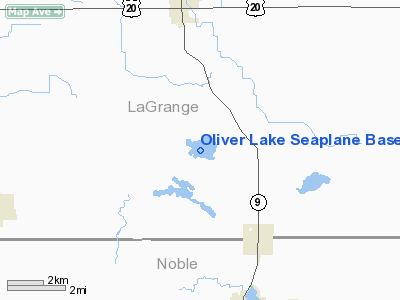
Oliver Lake Seaplane Base |
Location
& QuickFacts
|
FAA
Information Effective: |
2008-06-05 |
|
Airport
Identifier: |
4IN2 |
|
Airport
Status: |
Operational |
|
Longitude/Latitude: |
085-24-19.0000W/41-34-12.7000N
-85.405278/41.570194 (Estimated) |
|
Elevation: |
900 ft / 274.32 m (Estimated) |
|
Land: |
0 acres |
|
From nearest
city: |
5 nautical miles S of La Grange, IN |
|
Location: |
Lagrange County, IN |
|
Magnetic
Variation: |
04W (1995) |
Owner
& Manager
|
Ownership: |
Privately
owned |
|
Owner: |
Indiana Dept Of Natueal Resources |
|
Address: |
402 W Washington Blvd
Indianapolis,
IN 46204 |
|
Phone
number: |
317-232-4010 |
|
Manager: |
Randy Strebig |
|
Address: |
520 W. Jefferson Blvd
Fort
Wayne, IN 46802 |
|
Phone
number: |
260-424-5371 |
Airport Operations
and Facilities
|
Airport
Use: |
Private |
|
Segmented
Circle: |
No |
|
Control
Tower: |
No |
|
Sectional
chart: |
Chicago |
|
Region: |
AGL - Great Lakes |
|
Boundary
ARTCC: |
ZAU - Chicago |
|
Tie-in
FSS: |
HUF - Terre Haute |
|
FSS Toll
Free: |
1-800-WX-BRIEF |
|
Runway Information
Runway 13W/31W
|
Dimension: |
2500 x 1000
ft / 762.0 x 304.8 m |
|
Surface: |
WATER, |
|
|
Runway 13W |
Runway 31W |
|
Traffic
Pattern: |
Left |
Left |
|
Radio Navigation
Aids
|
ID |
Type |
Name |
Ch |
Freq |
Var |
Dist |
|
IRS |
NDB |
Sturgis |
|
382.00 |
04W |
14.7 nm |
|
ANQ |
NDB |
Angola |
|
347.00 |
05W |
14.9 nm |
|
HAI |
NDB |
Three Rivers |
|
407.00 |
02W |
24.8 nm |
|
BYN |
NDB |
Bryan |
|
260.00 |
04W |
42.6 nm |
|
HHG |
NDB |
Huntington |
|
417.00 |
03W |
43.0 nm |
|
DFI |
NDB |
Defiance |
|
246.00 |
05W |
46.3 nm |
|
RCR |
NDB |
Rochester |
|
216.00 |
03W |
46.7 nm |
|
BT |
NDB |
Batol |
|
272.00 |
04W |
48.6 nm |
|
CPB |
NDB |
Culver |
|
391.00 |
01W |
49.0 nm |
|
OLK |
VOR |
Wolf Lake |
|
110.40 |
03W |
19.9 nm |
|
AZO |
VOR/DME |
Kalamazoo |
027X |
109.00 |
01W |
40.6 nm |
|
LFD |
VOR/DME |
Litchfield |
049X |
111.20 |
05W |
41.2 nm |
|
ELX |
VOR/DME |
Keeler |
113X |
116.60 |
00E |
47.1 nm |
|
GSH |
VORTAC |
Goshen |
084X |
113.70 |
00E |
28.1 nm |
|
FWA |
VORTAC |
Fort Wayne |
125X |
117.80 |
00E |
36.9 nm |
|
GIJ |
VORTAC |
Gipper |
101X |
115.40 |
00E |
42.7 nm |
|
BTL |
VORTAC |
Battle Creek |
031X |
109.40 |
02W |
45.0 nm |
|
FWA |
VOT |
Fort Wayne Baer |
|
111.00 |
|
36.9 nm |
Remarks
- PRVDD
INGRESS & EGRESS PATHS ARE KEPT ALIGNED WITH ADJ LAKE OLIN (MAGVAR
ALIGNMENTS;L 130/310 DEGS).
Oliver Lake Seaplane Base
Address:
Lagrange County, IN
Tel:
317-232-4010,
260-424-5371
Images
and information placed above are from
http://www.airport-data.com/airport/4IN2/
We
thank them for the data!
| General
Info |
| Country |
United
States |
| State |
INDIANA
|
| FAA ID |
4IN2 |
| Latitude |
41-34-12.700N
|
| Longitude |
085-24-19.000W
|
| Elevation |
900 feet
|
| Near City |
LA GRANGE
|
We don't guarantee the information is fresh and accurate. The data may
be wrong or outdated.
For more up-to-date information please refer to other sources.
|
|


