 |
|
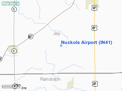
Location
& QuickFacts
|
FAA
Information Effective: |
2008-06-05 |
|
Airport
Identifier: |
IN41 |
|
Airport
Status: |
Operational |
|
Longitude/Latitude: |
085-02-56.8860W/40-21-17.1590N
-85.049135/40.354766 (Estimated) |
|
Elevation: |
1025 ft / 312.42 m (Estimated) |
|
Land: |
10 acres |
|
From nearest
city: |
5 nautical miles E of Redkey, IN |
|
Location: |
Jay County, IN |
|
Magnetic
Variation: |
03W (1985) |
Owner & Manager
|
Ownership: |
Privately
owned |
|
Owner: |
Larry Nuckols |
|
Address: |
Rr 5
Portland, IN 47571 |
|
Phone
number: |
219-726-4092 |
|
Manager: |
Larry Nuckols |
|
Address: |
Rr 5
Portland, IN 47571 |
|
Phone
number: |
219-726-4092 |
Airport
Operations and Facilities
|
Airport
Use: |
Private
PERSONAL USE |
|
Segmented
Circle: |
No |
|
Control
Tower: |
No |
|
Sectional
chart: |
Chicago |
|
Region: |
AGL - Great Lakes |
|
Boundary
ARTCC: |
ZID - Indianapolis |
|
Tie-in
FSS: |
HUF - Terre Haute |
|
FSS Toll
Free: |
1-800-WX-BRIEF |
|
Runway Information
Runway NE/SW
|
Dimension: |
1350 x 60 ft
/ 411.5 x 18.3 m |
|
Surface: |
TURF, |
|
|
Runway NE |
Runway SW |
|
Traffic
Pattern: |
Left |
Left |
|
Obstruction: |
40 ft trees |
25 ft pline |
|
Radio Navigation
Aids
|
ID |
Type |
Name |
Ch |
Freq |
Var |
Dist |
|
PLD |
NDB |
Portland |
|
257.00 |
03W |
6.7 nm |
|
CQA |
NDB |
Lakefield |
|
205.00 |
04W |
23.5 nm |
|
VES |
NDB |
Versailles |
|
356.00 |
04W |
25.7 nm |
|
AI |
NDB |
Video |
|
371.00 |
03W |
27.3 nm |
|
UWL |
NDB |
New Castle |
|
385.00 |
02W |
31.1 nm |
|
HHG |
NDB |
Huntington |
|
417.00 |
03W |
35.6 nm |
|
VFU |
NDB |
Stanley |
|
411.00 |
05W |
36.4 nm |
|
IWH |
NDB |
Wabash |
|
329.00 |
03W |
42.1 nm |
|
MIE |
VOR/DME |
Muncie |
091X |
114.40 |
03W |
17.3 nm |
|
MZZ |
VOR/DME |
Marion |
023X |
108.60 |
03W |
30.0 nm |
|
DQN |
VOR/DME |
Dayton |
092X |
114.50 |
01W |
36.2 nm |
|
RID |
VORTAC |
Richmond |
043X |
110.60 |
03W |
37.3 nm |
|
FWA |
VORTAC |
Fort Wayne |
125X |
117.80 |
00E |
38.1 nm |
|
ROD |
VORTAC |
Rosewood |
122X |
117.50 |
05W |
46.3 nm |
|
OKK |
VORTAC |
Kokomo |
082X |
113.50 |
00E |
47.3 nm |
|
FWA |
VOT |
Fort Wayne Baer |
|
111.00 |
|
38.0 nm |
|
DAY |
VOT |
Dayton J M Cox-day |
|
111.00 |
|
46.8 nm |
Remarks
- 1000'
SSW 30' LIGHT WIRES & POLE
- PROVIDED
ADEQUATE RY EXIST FOR THE OPS INTENDED RYS BE DISPLACED TO PROVIDE A
CLEAR 20:1 APPROACH
Nuckols Airport
Address:
Jay County, IN
Tel:
219-726-4092
Images
and information placed above are from
http://www.airport-data.com/airport/IN41/
We
thank them for the data!
| General
Info |
| Country |
United
States |
| State |
INDIANA
|
| FAA ID |
IN41 |
| Latitude |
40-21-17.159N
|
| Longitude |
085-02-56.886W
|
| Elevation |
1025 feet
|
| Near City |
REDKEY
|
We don't guarantee the information is fresh and accurate. The data may
be wrong or outdated.
For more up-to-date information please refer to other sources.
|
|


