 |
|
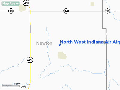
North West Indiana Air Airport |
Location
& QuickFacts
|
FAA
Information Effective: |
2008-06-05 |
|
Airport
Identifier: |
II04 |
|
Airport
Status: |
Operational |
|
Longitude/Latitude: |
087-22-09.0940W/40-53-02.1310N
-87.369193/40.883925 (Estimated) |
|
Elevation: |
660 ft / 201.17 m (Estimated) |
|
Land: |
0 acres |
|
From nearest
city: |
1 nautical miles N of Brook, IN |
|
Location: |
Newton County, IN |
|
Magnetic
Variation: |
01W (1985) |
Owner & Manager
|
Ownership: |
Privately
owned |
|
Owner: |
Robert E. Lyons |
|
Address: |
Rr 1
Brook, IN 47922 |
|
Phone
number: |
219-275-4775 |
|
Manager: |
Robert E. Lyons |
|
Address: |
Rr 1
Brook, IN 47922 |
|
Phone
number: |
219-275-4775 |
Airport
Operations and Facilities
|
Airport
Use: |
Private |
|
Wind indicator: |
Yes |
|
Segmented
Circle: |
No |
|
Control
Tower: |
No |
|
Landing
fee charge: |
No |
|
Sectional
chart: |
Chicago |
|
Region: |
AGL - Great Lakes |
|
Boundary
ARTCC: |
ZAU - Chicago |
|
Tie-in
FSS: |
HUF - Terre Haute |
|
FSS on
Airport: |
No |
|
FSS Toll
Free: |
1-800-WX-BRIEF |
|
Runway Information
Runway N/S
|
Dimension: |
2600 x 125 ft
/ 792.5 x 38.1 m |
|
Surface: |
TURF, |
|
|
Runway N |
Runway S |
|
Traffic
Pattern: |
Left |
Left |
|
Obstruction: |
|
3 ft fence |
|
Radio Navigation
Aids
|
ID |
Type |
Name |
Ch |
Freq |
Var |
Dist |
|
RZL |
NDB |
Rensselaer |
|
362.00 |
02W |
9.2 nm |
|
MCX |
NDB |
White County |
|
377.00 |
03W |
29.5 nm |
|
RWN |
NDB |
Winamac/dcmsnd |
|
335.00 |
00W |
36.9 nm |
|
VP |
NDB |
Sedly |
|
212.00 |
02W |
40.7 nm |
|
IUL |
NDB |
La Porte |
|
356.00 |
03W |
45.8 nm |
|
GGP |
NDB |
Logansport |
|
263.00 |
01W |
46.5 nm |
|
CPB |
NDB |
Culver |
|
391.00 |
01W |
48.9 nm |
|
IKK |
VOR/DME |
Kankakee |
053X |
111.60 |
00E |
24.6 nm |
|
RBS |
VOR/DME |
Roberts |
115X |
116.80 |
02E |
40.5 nm |
|
OXI |
VOR/DME |
Knox |
103X |
115.60 |
00E |
41.9 nm |
|
BVT |
VORTAC |
Boiler |
098X |
115.10 |
01E |
24.0 nm |
|
EON |
VORTAC |
Peotone |
079X |
113.20 |
02E |
30.0 nm |
|
DNV |
VORTAC |
Danville |
047X |
111.00 |
02E |
36.5 nm |
|
CGT |
VORTAC |
Chicago Heights |
089X |
114.20 |
02E |
38.7 nm |
Remarks
- OWNER
DOES NOT DESIRE CHARTING.
- FILED
FOR RECORD PURPOSES ONLY.
Based Aircraft
|
Aircraft
based on field: |
2 |
|
Single Engine
Airplanes: |
2 |
North West Indiana Air Airport
Address:
Newton County, IN
Tel:
219-275-4775
Images
and information placed above are from
http://www.airport-data.com/airport/II04/
We
thank them for the data!
| General
Info |
| Country |
United
States |
| State |
INDIANA
|
| FAA ID |
II04 |
| Latitude |
40-53-02.131N
|
| Longitude |
087-22-09.094W
|
| Elevation |
660 feet
|
| Near City |
BROOK
|
We don't guarantee the information is fresh and accurate. The data may
be wrong or outdated.
For more up-to-date information please refer to other sources.
|
|


