 |
|
|
|
|
|
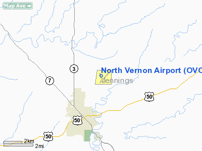
Location
& QuickFacts
|
FAA
Information Effective: |
2008-06-05 |
|
Airport
Identifier: |
OVO |
|
Airport
Status: |
Operational |
|
Longitude/Latitude: |
085-36-20.2000W/39-02-43.2000N
-85.605611/39.045333 (Estimated) |
|
Elevation: |
757 ft / 230.73 m (Surveyed) |
|
Land: |
803 acres |
|
From nearest
city: |
2 nautical miles NE of North Vernon, IN |
|
Location: |
Jennings County, IN |
|
Magnetic
Variation: |
02W (1985) |
Owner
& Manager
|
Ownership: |
Publicly
owned |
|
Owner: |
North Vernon Boac |
|
Address: |
645 E Co Rd 450n
North Vernon, IN 47265 |
|
Phone
number: |
812-346-5223 |
|
Manager: |
Ryan A. Curry |
|
Address: |
645 E Co Rd 450n
North Vernon, IN 47265 |
|
Phone
number: |
812-346-5223 |
Airport Operations
and Facilities
|
Airport
Use: |
Open
to public |
|
Wind indicator: |
Yes |
|
Segmented
Circle: |
No |
|
Control
Tower: |
No |
|
Lighting
Schedule: |
DUSK-DAWN
ACTVT MIRL RY 05/23 - CTAF |
|
Beacon
Color: |
Clear-Green (lighted land airport) |
|
Landing
fee charge: |
No |
|
Sectional
chart: |
St Louis |
|
Region: |
AGL - Great Lakes |
|
Boundary
ARTCC: |
ZID - Indianapolis |
|
Tie-in
FSS: |
HUF - Terre Haute |
|
FSS on
Airport: |
No |
|
FSS Toll
Free: |
1-800-WX-BRIEF |
|
NOTAMs
Facility: |
HUF (NOTAM-d service avaliable) |
|
Federal
Agreements: |
NGRY |
Airport Communications
|
CTAF: |
122.700 |
|
Unicom: |
122.700
|
Airport
Services
|
Fuel
available: |
100LLA
24 HR SELF SERVICE. |
|
Airframe
Repair: |
MAJOR |
|
Power
Plant Repair: |
MAJOR |
|
Bottled
Oxygen: |
NONE |
|
Bulk Oxygen: |
NONE |
|
Runway Information
Runway 05/23
|
Dimension: |
5002 x 75 ft
/ 1524.6 x 22.9 m |
|
Surface: |
ASPH, Good Condition |
|
Weight Limit: |
Single wheel: 4000 lbs. |
|
Edge Lights: |
Medium |
|
|
Runway 05 |
Runway 23 |
|
Longitude: |
085-36-37.8379W |
085-35-50.9098W |
|
Latitude: |
39-02-25.0367N |
39-02-58.3005N |
|
Elevation: |
757.00 ft |
755.00 ft |
|
Alignment: |
48 |
127 |
|
Traffic
Pattern: |
Left |
Left |
|
Markings: |
Non-precision instrument, Good Condition |
Non-precision instrument, Good Condition |
|
Crossing
Height: |
27.00 ft |
27.00 ft |
|
VASI: |
4-light PAPI on left side |
4-light PAPI on left side |
|
Visual Glide
Angle: |
3.00° |
3.00° |
|
Obstruction: |
10 ft crops, 201.0 ft from runway |
15 ft road, 800.0 ft from runway, 40:1 slope
to clear |
|
Runway 15/33
|
Dimension: |
2730 x 50 ft
/ 832.1 x 15.2 m |
|
Surface: |
ASPH, Fair Condition |
|
Weight Limit: |
Single wheel: 4000 lbs. |
|
|
Runway 15 |
Runway 33 |
|
Longitude: |
085-36-38.8546W |
085-36-23.0510W |
|
Latitude: |
39-02-57.9088N |
39-02-33.9116N |
|
Elevation: |
752.00 ft |
756.00 ft |
|
Alignment: |
127 |
127 |
|
Traffic
Pattern: |
Left |
Left |
|
Markings: |
Basic, Good Condition |
Basic, Fair Condition |
|
Obstruction: |
15 ft road, 300.0 ft from runway, 125 ft right
of centerline, 6:1 slope to clear
10' SEASONAL CROPS 0'-100' FM THR 65 'LR CNTRLN. |
88 ft trees, 2400.0 ft from runway, 25:1 slope
to clear |
|
Radio Navigation
Aids
|
ID |
Type |
Name |
Ch |
Freq |
Var |
Dist |
|
OVO |
NDB |
North Vernon |
|
374.00 |
02W |
0.3 nm |
|
IMS |
NDB |
Madison |
|
404.00 |
03W |
18.4 nm |
|
BA |
NDB |
Clifs |
|
410.00 |
03W |
19.4 nm |
|
EQZ |
NDB |
Captain |
|
308.00 |
02W |
20.2 nm |
|
HLB |
NDB |
Batesville |
|
254.00 |
02W |
24.4 nm |
|
UR |
NDB |
Burln |
|
321.00 |
04W |
38.9 nm |
|
BFR |
NDB |
Bedford |
|
344.00 |
02W |
40.8 nm |
|
HFY |
NDB |
Greenwood |
|
398.00 |
02W |
41.9 nm |
|
BM |
NDB |
Claye |
|
382.00 |
02W |
46.4 nm |
|
OXD |
NDB |
Oxford |
|
282.00 |
04W |
47.4 nm |
|
BQM |
VOR/DME |
Bowman |
059X |
112.20 |
01W |
49.1 nm |
|
ABB |
VORTAC |
Nabb |
071X |
112.40 |
01E |
27.5 nm |
|
SHB |
VORTAC |
Shelbyville |
057X |
112.00 |
01E |
36.7 nm |
|
CVG |
VORTAC |
Cincinnati |
120X |
117.30 |
04W |
42.2 nm |
|
OOM |
VORTAC |
Hoosier |
039X |
110.20 |
02W |
47.4 nm |
Remarks
- NGT
OPNS PROHIBTED ON RY 15/33.
- RWY
15/33 ONLY AVBL FOR USE NW OF INT.
Based Aircraft
|
Aircraft
based on field: |
30 |
|
Single Engine
Airplanes: |
27 |
|
Multi Engine Airplanes: |
1 |
|
Ultralights: |
2 |
Operational Statistics
Time
Period: 2006-01-01 - 2006-12-31
|
Aircraft
Operations: |
239/Week |
|
Air Taxi: |
3.0% |
|
General Aviation
Local: |
51.0% |
|
General Aviation
Itinerant: |
22.0% |
|
Military: |
24.0% |
North Vernon Airport
Address:
Jennings County, IN
Tel:
812-346-5223
Images
and information placed above are from
http://www.airport-data.com/airport/OVO/
We
thank them for the data!
| General
Info |
| Country |
United
States |
| State |
INDIANA
|
| FAA ID |
OVO |
| Latitude |
39-02-44.292N
|
| Longitude |
085-36-19.188W
|
| Elevation |
758 feet
|
| Near City |
NORTH
VERNON |
We don't guarantee the information is fresh and accurate. The data may
be wrong or outdated.
For more up-to-date information please refer to other sources.
|
|


