 |
|
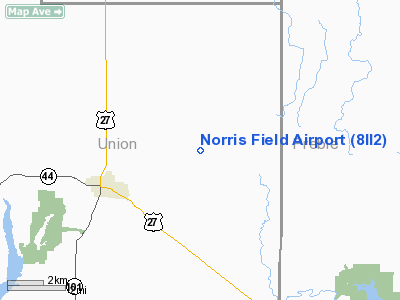
Location
& QuickFacts
|
FAA
Information Effective: |
2008-06-05 |
|
Airport
Identifier: |
8II2 |
|
Airport
Status: |
Operational |
|
Longitude/Latitude: |
084-51-58.0000W/39-39-11.0000N
-84.866111/39.653056 (Estimated) |
|
Elevation: |
1085 ft / 330.71 m (Estimated) |
|
Land: |
0 acres |
|
From nearest
city: |
3 nautical miles NE of Liberty, IN |
|
Location: |
Union County, IN |
|
Magnetic
Variation: |
03W (1990) |
Owner
& Manager
|
Ownership: |
Privately
owned |
|
Owner: |
Wayne C Norris |
|
Address: |
Rr1 Co Rd 350e Box 271
Liberty, IN 47353 |
|
Phone
number: |
317-458-6773 |
|
Manager: |
Wayne C Norris |
|
Address: |
Rr1 Co Rd 350e Box 271
Liberty, IN 47353 |
|
Phone
number: |
317-458-6773 |
Airport Operations
and Facilities
|
Airport
Use: |
Private |
|
Segmented
Circle: |
No |
|
Control
Tower: |
No |
|
Sectional
chart: |
Cincinnati |
|
Region: |
AGL - Great Lakes |
|
Boundary
ARTCC: |
ZID - Indianapolis |
|
Tie-in
FSS: |
HUF - Terre Haute |
|
FSS Toll
Free: |
1-800-WX-BRIEF |
|
Runway Information
Runway 09/27
|
Dimension: |
2020 x 100 ft
/ 615.7 x 30.5 m |
|
Surface: |
TURF, |
|
|
Runway 09 |
Runway 27 |
|
Traffic
Pattern: |
Left |
Left |
|
Displaced
threshold: |
0.00 ft |
300.00 ft |
|
Obstruction: |
|
12 ft pline, 585.0 ft from runway |
|
Radio Navigation
Aids
|
ID |
Type |
Name |
Ch |
Freq |
Var |
Dist |
|
OXD |
NDB |
Oxford |
|
282.00 |
04W |
9.6 nm |
|
HKF |
NDB |
Hook Field |
|
239.00 |
04W |
21.5 nm |
|
HAO |
NDB |
Hamilton |
|
260.00 |
04W |
21.7 nm |
|
UWL |
NDB |
New Castle |
|
385.00 |
02W |
25.0 nm |
|
HLB |
NDB |
Batesville |
|
254.00 |
02W |
25.7 nm |
|
ISZ |
NDB |
Cincinnati-blue Ash |
|
388.00 |
04W |
32.9 nm |
|
MDE |
NDB |
Madeira |
|
379.00 |
04W |
35.1 nm |
|
UR |
NDB |
Burln |
|
321.00 |
04W |
36.8 nm |
|
VES |
NDB |
Versailles |
|
356.00 |
04W |
36.8 nm |
|
LUK |
NDB |
Cincinnati |
|
335.00 |
04W |
38.4 nm |
|
AI |
NDB |
Video |
|
371.00 |
03W |
38.9 nm |
|
XEN |
NDB |
Xenia |
|
395.00 |
03W |
43.5 nm |
|
PWF |
NDB |
Sportys |
|
245.00 |
04W |
46.0 nm |
|
PLD |
NDB |
Portland |
|
257.00 |
03W |
48.4 nm |
|
BA |
NDB |
Clifs |
|
410.00 |
03W |
48.5 nm |
|
HW |
NDB |
Cubla |
|
299.00 |
04W |
49.3 nm |
|
OVO |
NDB |
North Vernon |
|
374.00 |
02W |
49.8 nm |
|
FFO |
TACAN |
Patterson |
099X |
|
04W |
38.8 nm |
|
XSF |
TACAN |
Springfield |
065X |
|
04W |
48.7 nm |
|
DQN |
VOR/DME |
Dayton |
092X |
114.50 |
01W |
30.8 nm |
|
MIE |
VOR/DME |
Muncie |
091X |
114.40 |
03W |
42.7 nm |
|
SGH |
VOR/DME |
Springfield |
079X |
113.20 |
04W |
48.5 nm |
|
RID |
VORTAC |
Richmond |
043X |
110.60 |
03W |
6.3 nm |
|
CVG |
VORTAC |
Cincinnati |
120X |
117.30 |
04W |
39.0 nm |
|
SHB |
VORTAC |
Shelbyville |
057X |
112.00 |
01E |
44.4 nm |
|
DAY |
VOT |
Dayton J M Cox-day |
|
111.00 |
|
33.4 nm |
|
LUK |
VOT |
Cincinnati Muni/lunken |
|
108.40 |
|
38.8 nm |
Remarks
- OBS
REMOVED/LOWERED OR THE DSPLCD THR TO PRVD 20:1 SLOPE; 125' EITHER SIDE
OF CNTRLN AND 200' EITHER END BE CLEAR.
Norris Field Airport
Address:
Union County, IN
Tel:
317-458-6773
Images
and information placed above are from
http://www.airport-data.com/airport/8II2/
We
thank them for the data!
| General
Info |
| Country |
United
States |
| State |
INDIANA
|
| FAA ID |
8II2 |
| Latitude |
39-39-11.000N
|
| Longitude |
084-51-58.000W
|
| Elevation |
1085 feet
|
| Near City |
LIBERTY
|
We don't guarantee the information is fresh and accurate. The data may
be wrong or outdated.
For more up-to-date information please refer to other sources.
|
|


