 |
|
Location
& QuickFacts
|
FAA
Information Effective: |
2008-06-05 |
|
Airport
Identifier: |
29II |
|
Airport
Status: |
Operational |
|
Longitude/Latitude: |
086-48-27.0940W/41-39-35.1480N
-86.807526/41.659763 (Estimated) |
|
Elevation: |
750 ft / 228.60 m (Estimated) |
|
Land: |
22 acres |
|
From nearest
city: |
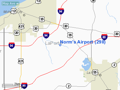
3 nautical miles S of Michigan City, IN |
|
Location: |
La Porte County, IN |
|
Magnetic
Variation: |
02W (1985) |
Owner
& Manager
|
Ownership: |
Privately
owned |
|
Owner: |
Norman Byron Simcox |
|
Address: |
5607 W Schultz Rd
La
Porte, IN 46350 |
|
Phone
number: |
219-326-8129 |
|
Address: |
|
Airport Operations
and Facilities
|
Airport
Use: |
Private
PERSONAL USE. |
|
Segmented
Circle: |
No |
|
Control
Tower: |
No |
|
Sectional
chart: |
Chicago |
|
Region: |
AGL - Great Lakes |
|
Boundary
ARTCC: |
ZAU - Chicago |
|
Tie-in
FSS: |
HUF - Terre Haute |
|
FSS Toll
Free: |
1-800-WX-BRIEF |
|
Runway Information
Runway 15/33
|
Dimension: |
1600 x 40 ft
/ 487.7 x 12.2 m |
|
Surface: |
TURF, |
|
|
Runway 15 |
Runway 33 |
|
Traffic
Pattern: |
Left |
Left |
|
Obstruction: |
21 ft pline, 50.0 ft from runway |
|
|
Radio Navigation
Aids
|
ID |
Type |
Name |
Ch |
Freq |
Var |
Dist |
|
MGC |
NDB |
Michigan City |
|
203.00 |
01W |
2.9 nm |
|
IUL |
NDB |
La Porte |
|
356.00 |
03W |
9.8 nm |
|
VP |
NDB |
Sedly |
|
212.00 |
02W |
12.9 nm |
|
CPB |
NDB |
Culver |
|
391.00 |
01W |
32.7 nm |
|
RWN |
NDB |
Winamac/dcmsnd |
|
335.00 |
00W |
35.2 nm |
|
MX |
NDB |
Kedzi |
|
248.00 |
01W |
39.9 nm |
|
RCR |
NDB |
Rochester |
|
216.00 |
03W |
45.3 nm |
|
RZL |
NDB |
Rensselaer |
|
362.00 |
02W |
46.1 nm |
|
HK |
NDB |
Ermin |
|
332.00 |
01W |
46.3 nm |
|
OXI |
VOR/DME |
Knox |
103X |
115.60 |
00E |
21.5 nm |
|
ELX |
VOR/DME |
Keeler |
113X |
116.60 |
00E |
42.3 nm |
|
GIJ |
VORTAC |
Gipper |
101X |
115.40 |
00E |
22.9 nm |
|
CGT |
VORTAC |
Chicago Heights |
089X |
114.20 |
02E |
35.5 nm |
|
GSH |
VORTAC |
Goshen |
084X |
113.70 |
00E |
36.0 nm |
|
MDW |
VOT |
Chicago Midway |
|
111.00 |
|
43.1 nm |
Remarks
- OWNER
DESIRES ARPT NOT BE CHARTED.
Norm's Airport
Address:
La Porte County, IN
Tel:
219-326-8129
Images
and information placed above are from
http://www.airport-data.com/airport/29II/
We
thank them for the data!
| General
Info |
| Country |
United
States |
| State |
INDIANA
|
| FAA ID |
29II |
| Latitude |
41-39-35.148N
|
| Longitude |
086-48-27.094W
|
| Elevation |
750 feet
|
| Near City |
MICHIGAN
CITY |
We don't guarantee the information is fresh and accurate. The data may
be wrong or outdated.
For more up-to-date information please refer to other sources.
|
|


