 |
|
|
|
|
|
Location
& QuickFacts
|
FAA
Information Effective: |
2008-06-05 |
|
Airport
Identifier: |
I80 |
|
Airport
Status: |
Operational |
|
Longitude/Latitude: |
085-57-52.3000W/40-00-12.6000N
-85.964528/40.003500 (Estimated) |
|
Elevation: |
821 ft / 250.24 m (Estimated) |
|
Land: |
20 acres |
|
From nearest
city: |
4 nautical miles SE of Noblesville, IN |
|
Location: |
Hamilton County, IN |
|
Magnetic
Variation: |
02W (1985) |
Owner & Manager
|
Ownership: |
Privately
owned |
|
Owner: |
Don Roberts/larry Jacobi |
|
Address: |
14782 Promise Road
Noblesville,
IN 46060 |
|
Phone
number: |
317-773-5298 |
|
Manager: |
Don Roberts/larry Jacobi |
|
Address: |
14782 Promise Road
Noblesville,
IN 46060 |
|
Phone
number: |
317-773-3112 |
Airport
Operations and Facilities
|
Airport
Use: |
Open
to public |
|
Wind indicator: |
Yes |
|
Segmented
Circle: |
Yes |
|
Control
Tower: |
No |
|
Lighting
Schedule: |
RDO-CTL
ACTVT LIRL RY 09/27 - 122.7 |
|
Sectional
chart: |
Chicago |
|
Region: |
AGL - Great Lakes |
|
Boundary
ARTCC: |
ZID - Indianapolis |
|
Tie-in
FSS: |
HUF - Terre Haute |
|
FSS Toll
Free: |
1-800-WX-BRIEF |
|
NOTAMs
Facility: |
HUF (NOTAM-d service avaliable) |
Airport Communications
|
Runway Information
Runway 09/27
|
Dimension: |
3580 x 100 ft
/ 1091.2 x 30.5 m |
|
Surface: |
TURF, Good Condition |
|
Edge Lights: |
Low
RY 09/27 NO LIGHTS BTN RY ENDS AND DSPLCD THLDS. |
|
|
Runway 09 |
Runway 27 |
|
Longitude: |
085-58-15.2800W |
085-57-29.2600W |
|
Latitude: |
40-00-12.7500N |
40-00-12.4900N |
|
Traffic
Pattern: |
Right |
Left |
|
Displaced
threshold: |
465.00 ft |
110.00 ft |
|
Obstruction: |
15 ft road
RY 09 APCH SLOPE 31:1 AT DSPLCD THLD. |
21 ft tree, 401.0 ft from runway, 19:1 slope
to clear
RY27 APCH SLOPE 24:1 AT DSPLCD THLD. |
|
Radio Navigation
Aids
|
ID |
Type |
Name |
Ch |
Freq |
Var |
Dist |
|
UMP |
NDB |
Metropolitan |
|
338.00 |
03W |
5.6 nm |
|
HZP |
NDB |
Zionsville |
|
248.00 |
03W |
13.7 nm |
|
AI |
NDB |
Video |
|
371.00 |
03W |
21.3 nm |
|
HFY |
NDB |
Greenwood |
|
398.00 |
02W |
23.0 nm |
|
UWL |
NDB |
New Castle |
|
385.00 |
02W |
30.7 nm |
|
FKR |
NDB |
Frankfort |
|
278.00 |
02W |
31.8 nm |
|
BA |
NDB |
Clifs |
|
410.00 |
03W |
41.5 nm |
|
TVX |
NDB |
Greencastle |
|
521.00 |
03W |
42.5 nm |
|
CFJ |
NDB |
Crawfordsville |
|
388.00 |
02W |
43.8 nm |
|
IWH |
NDB |
Wabash |
|
329.00 |
03W |
46.3 nm |
|
GGP |
NDB |
Logansport |
|
263.00 |
01W |
46.4 nm |
|
MIE |
VOR/DME |
Muncie |
091X |
114.40 |
03W |
29.8 nm |
|
MZZ |
VOR/DME |
Marion |
023X |
108.60 |
03W |
32.2 nm |
|
VHP |
VORTAC |
Brickyard |
110X |
116.30 |
01E |
21.8 nm |
|
SHB |
VORTAC |
Shelbyville |
057X |
112.00 |
01E |
23.2 nm |
|
OKK |
VORTAC |
Kokomo |
082X |
113.50 |
00E |
31.8 nm |
|
GUS |
VORTAC |
Grissom |
21Y |
108.45 |
02W |
39.5 nm |
|
IND |
VOT |
Indianapolis Intl |
|
109.60 |
|
22.3 nm |
Based Aircraft
|
Aircraft
based on field: |
24 |
|
Single Engine
Airplanes: |
24 |
Operational Statistics
Time
Period: 2006-01-01 - 2006-12-31
|
Aircraft
Operations: |
135/Week |
|
General Aviation
Local: |
71.4% |
|
General Aviation
Itinerant: |
28.6% |
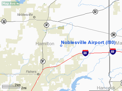
Noblesville Airport
Address:
Hamilton County, IN
Tel:
317-773-5298,
317-773-3112
Images
and information placed above are from
http://www.airport-data.com/airport/I80/
We
thank them for the data!
| General
Info |
| Country |
United
States |
| State |
INDIANA
|
| FAA ID |
I80 |
| Latitude |
40-00-13.131N
|
| Longitude |
085-57-52.938W
|
| Elevation |
821 feet
|
| Near City |
NOBLESVILLE
|
We don't guarantee the information is fresh and accurate. The data may
be wrong or outdated.
For more up-to-date information please refer to other sources.
|
|


