 |
|
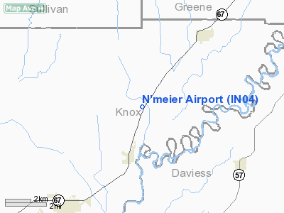
Location
& QuickFacts
|
FAA
Information Effective: |
2008-06-05 |
|
Airport
Identifier: |
IN04 |
|
Airport
Status: |
Operational |
|
Longitude/Latitude: |
087-14-25.0000W/38-50-47.0000N
-87.240278/38.846389 (Estimated) |
|
Elevation: |
495 ft / 150.88 m () |
|
Land: |
0 acres |
|
From nearest
city: |
2 nautical miles SW of Westphalia, IN |
|
Location: |
Knox County, IN |
|
Magnetic
Variation: |
02W (1995) |
Owner
& Manager
|
Ownership: |
Privately
owned |
|
Owner: |
George S. Ridgway |
|
Address: |
11680 N Spanger Rd, Box 137
Westphalia,
IN 47596 |
|
Phone
number: |
812-882-6555 |
|
Manager: |
George S. Ridgway |
|
Address: |
11680 N Spanger Rd, Box 137
Westphalia,
IN 47596 |
|
Phone
number: |
812-802-6555 |
Airport Operations
and Facilities
|
Airport
Use: |
Private |
|
Segmented
Circle: |
No |
|
Control
Tower: |
No |
|
Sectional
chart: |
St Louis |
|
Region: |
AGL - Great Lakes |
|
Boundary
ARTCC: |
ZID - Indianapolis |
|
Tie-in
FSS: |
HUF - Terre Haute |
|
FSS Toll
Free: |
1-800-WX-BRIEF |
|
Runway Information
Runway 18/36
|
Dimension: |
1708 x 75 ft
/ 520.6 x 22.9 m |
|
Surface: |
TURF, |
|
|
Runway 18 |
Runway 36 |
|
Traffic
Pattern: |
Left |
Left |
|
Displaced
threshold: |
130.00 ft
RY 18/36 DSPLCD THLDS MKD WITH TRANGULAR WOODEN FRAMES. |
270.00 ft |
|
Obstruction: |
18 ft road, 200.0 ft from runway |
40 ft pline, 330.0 ft from runway |
|
Radio Navigation
Aids
|
ID |
Type |
Name |
Ch |
Freq |
Var |
Dist |
|
DCY |
NDB |
Washington |
|
212.00 |
03W |
10.4 nm |
|
OEA |
NDB |
Vincennes |
|
251.00 |
00E |
17.5 nm |
|
SIV |
NDB |
Sullivan |
|
326.00 |
02W |
18.7 nm |
|
PLX |
NDB |
Palestine |
|
391.00 |
00W |
21.3 nm |
|
AJG |
NDB |
Mount Carmel |
|
524.00 |
02W |
26.8 nm |
|
BM |
NDB |
Claye |
|
382.00 |
02W |
32.5 nm |
|
HU |
NDB |
Yinno |
|
245.00 |
02W |
33.4 nm |
|
BFR |
NDB |
Bedford |
|
344.00 |
02W |
37.6 nm |
|
RRJ |
NDB |
Oranj |
|
368.00 |
02W |
38.5 nm |
|
FNZ |
NDB |
Ferdinand |
|
239.00 |
00E |
40.6 nm |
|
OLY |
NDB |
Olney |
|
272.00 |
00W |
44.4 nm |
|
CZB |
NDB |
Casey |
|
359.00 |
00E |
45.0 nm |
|
LWV |
VOR/DME |
Lawrenceville |
025X |
108.80 |
01W |
17.6 nm |
|
RSV |
VOR/DME |
Robinson |
021X |
108.40 |
02E |
21.7 nm |
|
HNB |
VOR/DME |
Huntingburg |
029X |
109.20 |
00E |
38.2 nm |
|
SAM |
VOR/DME |
Samsville |
113X |
116.60 |
03E |
45.2 nm |
|
OOM |
VORTAC |
Hoosier |
039X |
110.20 |
02W |
34.3 nm |
|
TTH |
VORTAC |
Terre Haute |
100X |
115.30 |
02E |
38.6 nm |
Remarks
- PRVDD
CLEAR 20:1 APCH, CLEAR OBSTACLE FREE ZONE AND CLEAR RY SAFETY AREA.
N'meier Airport
Address:
Knox County, IN
Tel:
812-882-6555,
812-802-6555
Images
and information placed above are from
http://www.airport-data.com/airport/IN04/
We
thank them for the data!
| General
Info |
| Country |
United
States |
| State |
INDIANA
|
| FAA ID |
IN04 |
| Latitude |
38-50-47.000N
|
| Longitude |
087-14-25.000W
|
| Elevation |
495 feet
|
| Near City |
WESTPHALIA
|
We don't guarantee the information is fresh and accurate. The data may
be wrong or outdated.
For more up-to-date information please refer to other sources.
|
|


