|
|
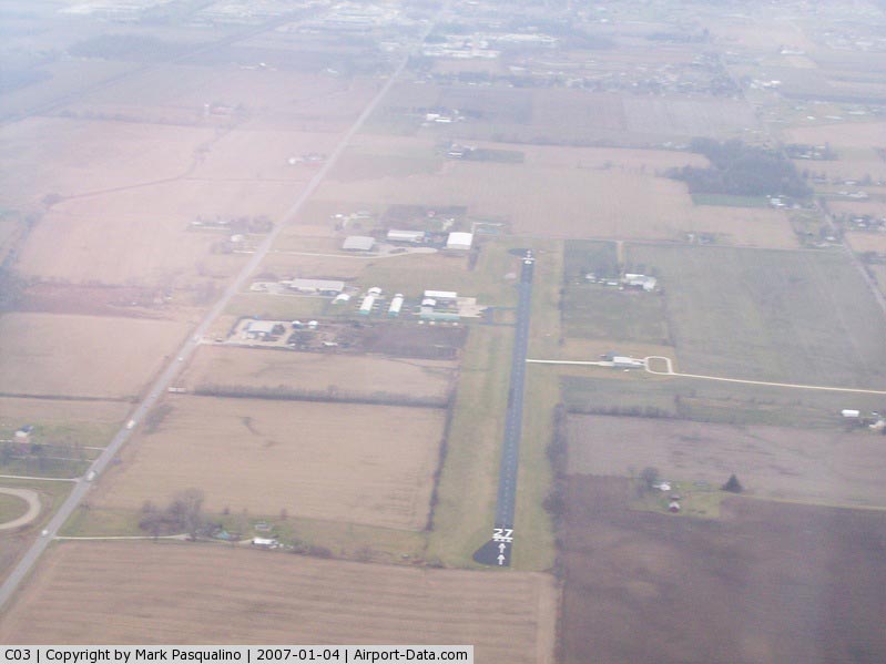
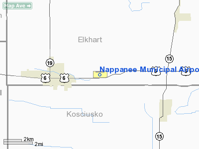
Nappanee Municipal Airport |
|
 |
(Click on the photo to enlarge) |
|
 |
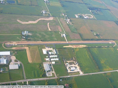
(Click on the photo to enlarge) |
|
 |
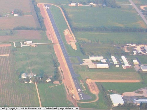
(Click on the photo to enlarge) |
Location
& QuickFacts
|
FAA
Information Effective: |
2008-06-05 |
|
Airport
Identifier: |
C03 |
|
Airport
Status: |
Operational |
|
Longitude/Latitude: |
085-56-05.3860W/41-26-46.1720N
-85.934829/41.446159 (Estimated) |
|
Elevation: |
860 ft / 262.13 m (Surveyed) |
|
Land: |
34 acres |
|
From nearest
city: |
3 nautical miles E of Nappanee, IN |
|
Location: |
Elkhart County, IN |
|
Magnetic
Variation: |
00E (1965) |
Owner & Manager
|
Ownership: |
Publicly
owned |
|
Owner: |
Nappanee Boac |
|
Address: |
24751 Us6e
Nappanee, IN 46550 |
|
Phone
number: |
574-773-4707 |
|
Manager: |
John Graber |
|
Address: |
24751 Us6e
Nappanee, IN 46550 |
|
Phone
number: |
574-773-2151 |
Airport
Operations and Facilities
|
Airport
Use: |
Open
to public |
|
Wind indicator: |
Yes |
|
Segmented
Circle: |
No |
|
Control
Tower: |
No |
|
Lighting
Schedule: |
DUSK-DAWN
ACTVT MIRL RY 09/27 - CTAF. |
|
Beacon
Color: |
Clear-Green (lighted land airport) |
|
Landing
fee charge: |
No |
|
Sectional
chart: |
Chicago |
|
Region: |
AGL - Great Lakes |
|
Boundary
ARTCC: |
ZAU - Chicago |
|
Tie-in
FSS: |
HUF - Terre Haute |
|
FSS on
Airport: |
No |
|
FSS Toll
Free: |
1-800-WX-BRIEF |
|
NOTAMs
Facility: |
HUF (NOTAM-d service avaliable) |
Airport Communications
|
CTAF: |
122.800 |
|
Unicom: |
122.800
|
Airport Services
|
Fuel
available: |
100LL |
|
Airframe
Repair: |
MAJOR |
|
Power
Plant Repair: |
MAJOR |
|
Runway Information
Runway 09/27
|
Dimension: |
3675 x 50 ft
/ 1120.1 x 15.2 m |
|
Surface: |
ASPH, Good Condition |
|
Weight Limit: |
Single wheel: 7000 lbs. |
|
Edge Lights: |
Medium
FIRST 670 FT RY 09 UNLGTD. |
|
|
Runway 09 |
Runway 27 |
|
Longitude: |
085-56-33.8900W |
085-55-45.6400W |
|
Latitude: |
41-26-45.9700N |
41-26-46.3600N |
|
Elevation: |
858.00 ft |
856.00 ft |
|
Alignment: |
89 |
127 |
|
Traffic
Pattern: |
Left |
Left |
|
Markings: |
Basic, Good Condition |
Basic, Good Condition |
|
Displaced
threshold: |
250.00 ft |
185.00 ft |
|
Centerline
Lights: |
No |
No |
|
Touchdown
Lights: |
No |
No |
|
Obstruction: |
15 ft road, 250.0 ft from runway, 3:1 slope
to clear
APCH RATIO 33:1 TO DSPLCD THLD. |
5 ft crops, 201.0 ft from runway
APCH RATIO 41:1 TO DSPLCD THR.
HAS 5 FT CROPS FROM 20 FT - 200 FT FROM RY END ON CNTRLN. |
|
Radio Navigation
Aids
|
ID |
Type |
Name |
Ch |
Freq |
Var |
Dist |
|
CPB |
NDB |
Culver |
|
391.00 |
01W |
24.5 nm |
|
RCR |
NDB |
Rochester |
|
216.00 |
03W |
25.7 nm |
|
IRS |
NDB |
Sturgis |
|
382.00 |
04W |
31.5 nm |
|
HAI |
NDB |
Three Rivers |
|
407.00 |
02W |
34.4 nm |
|
RWN |
NDB |
Winamac/dcmsnd |
|
335.00 |
00W |
36.9 nm |
|
IUL |
NDB |
La Porte |
|
356.00 |
03W |
37.8 nm |
|
ANQ |
NDB |
Angola |
|
347.00 |
05W |
39.9 nm |
|
HHG |
NDB |
Huntington |
|
417.00 |
03W |
41.4 nm |
|
IWH |
NDB |
Wabash |
|
329.00 |
03W |
41.5 nm |
|
VP |
NDB |
Sedly |
|
212.00 |
02W |
42.5 nm |
|
MGC |
NDB |
Michigan City |
|
203.00 |
01W |
42.6 nm |
|
GGP |
NDB |
Logansport |
|
263.00 |
01W |
48.6 nm |
|
OLK |
VOR |
Wolf Lake |
|
110.40 |
03W |
23.1 nm |
|
OXI |
VOR/DME |
Knox |
103X |
115.60 |
00E |
33.1 nm |
|
ELX |
VOR/DME |
Keeler |
113X |
116.60 |
00E |
42.8 nm |
|
GSH |
VORTAC |
Goshen |
084X |
113.70 |
00E |
6.3 nm |
|
GIJ |
VORTAC |
Gipper |
101X |
115.40 |
00E |
25.9 nm |
|
FWA |
VORTAC |
Fort Wayne |
125X |
117.80 |
00E |
43.9 nm |
|
GUS |
VORTAC |
Grissom |
21Y |
108.45 |
02W |
49.2 nm |
|
FWA |
VOT |
Fort Wayne Baer |
|
111.00 |
|
43.8 nm |
Based Aircraft
|
Aircraft
based on field: |
18 |
|
Single Engine
Airplanes: |
16 |
|
Multi Engine Airplanes: |
1 |
|
Ultralights: |
1 |
Operational Statistics
Time
Period: 2006-01-01 - 2006-12-31
|
Aircraft
Operations: |
82/Week |
|
Air Taxi: |
2.9% |
|
General Aviation
Local: |
75.6% |
|
General Aviation
Itinerant: |
21.5% |
Nappanee Municipal Airport
Address:
Elkhart County, IN
Tel:
574-773-4707,
574-773-2151
Images
and information placed above are from
http://www.airport-data.com/airport/C03/
We
thank them for the data!
| General
Info |
| Country |
United
States |
| State |
INDIANA
|
| FAA ID |
C03 |
| Latitude |
41-26-46.172N
|
| Longitude |
085-56-05.386W
|
| Elevation |
860 feet
|
| Near City |
NAPPANEE
|
We don't guarantee the information is fresh and accurate. The data may
be wrong or outdated.
For more up-to-date information please refer to other sources.
|
|