|
|
Coordinates: 39°50â²37â³N 085°53â²49â³W / 39.84361°N 85.89694°W / 39.84361; -85.89694
| Mount Comfort Airport |
| IATA: none â ICAO: KMQJ â FAA LID: MQJ |
| Summary |
| Airport type |
Public |
| Owner |
Indianapolis Airport Authority |
| Serves |
Indianapolis, Indiana |
| Location |
Greenfield / McCordsville |
| Elevation AMSL |
862 ft / 263 m |
| Runways |
| Direction |
Length |
Surface |
| ft |
m |
| 7/25 |
5,500 |
1,676 |
Concrete |
| 16/34 |
3,901 |
1,189 |
Concrete |
| Statistics (2006) |
| Aircraft operations |
44,026 |
| Based aircraft |
139 |
| Source: Federal Aviation Administration |
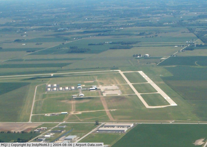
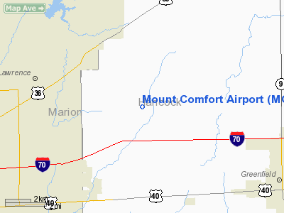
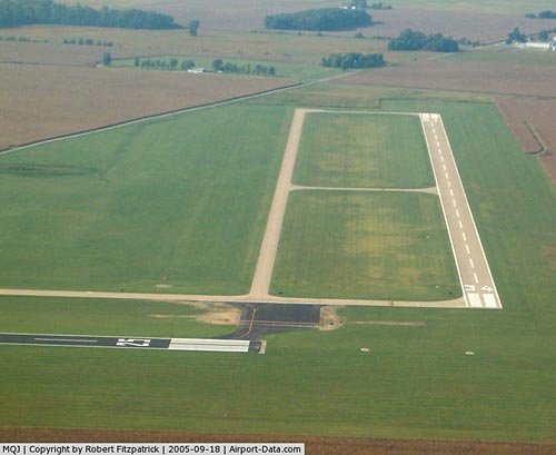
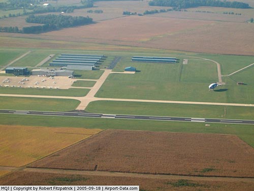
Mount Comfort Airport (ICAO: KMQJ, FAA LID: MQJ) is a public airport located 8 miles (13 km) northwest of Greenfield and 4 miles (6.4 km) southwest of McCordsville, in Hancock County, Indiana, United States. Also located 12 miles (19 km) east of the central business district of Indianapolis, it is owned by the Indianapolis Airport Authority and serves as a reliever airport for Indianapolis International Airport.
Although most U.S. airports use the same three-letter location identifier for the FAA and IATA, Mount Comfort Airport is assigned MQJ by the FAA but has no designation from the IATA.
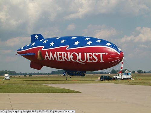
The airport is home to the Indianapolis Air Show.
Facilities and aircraft
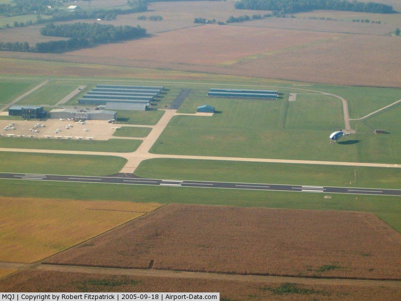
Mount Comfort Airport covers an area of 1,805 acres (730 ha) which contains two concrete paved runways: 7/25 at 5,500 x 100 ft (1,676 x 30 m) and 16/34 measuring 3,901 x 75 ft (1,189 x 23 m).
For the 12-month period ending July 25, 2006, the airport had 44,026 aircraft operations, an average of 120 per day: 84% general aviation, 16% air taxi and <1% military. There are 139 aircraft based at this airport: 79% single-engine, 18% multi-engine, 1% jet, 1% helicopter and 1% glider.
The above content comes from Wikipedia and is published under free licenses – click here to read more.
|
 |
(Click on the photo to enlarge) |
|
 |
(Click on the photo to enlarge) |
|
 |
(Click on the photo to enlarge) |
|
 |
(Click on the photo to enlarge) |
Location
& QuickFacts
|
FAA
Information Effective: |
2008-06-05 |
|
Airport
Identifier: |
MQJ |
|
Airport
Status: |
Operational |
|
Longitude/Latitude: |
085-53-49.4300W/39-50-36.5480N
-85.897064/39.843486 (Estimated) |
|
Elevation: |
862 ft / 262.74 m (Surveyed) |
|
Land: |
1805 acres |
|
From nearest
city: |
12 nautical miles E of Indianapolis, IN |
|
Location: |
Hancock County, IN |
|
Magnetic
Variation: |
04W (2005) |
Owner
& Manager
|
Ownership: |
Publicly
owned |
|
Owner: |
Indianapolis Arpt Authority |
|
Address: |
2500 S. High School Rd-bx 100
Indianapolis, IN 46241 |
|
Phone
number: |
317-487-9594 |
|
Manager: |
Patrick Dooley |
|
Address: |
2500 S. High School Rd-bx 100
Indianapolis, IN 46241 |
|
Phone
number: |
317-335-2130 |
Airport Operations
and Facilities
|
Airport
Use: |
Open
to public |
|
Wind indicator: |
Yes |
|
Segmented
Circle: |
Yes
LOCATED AROUND MID-FIELD WIND SOCK |
|
Control
Tower: |
No |
|
Lighting
Schedule: |
DUSK-DAWN
ACTVT HIRL RY 07/25 & MALSR RY 25 - CTAF. |
|
Beacon
Color: |
Clear-Green (lighted land airport) |
|
Sectional
chart: |
St Louis |
|
Region: |
AGL - Great Lakes |
|
Boundary
ARTCC: |
ZID - Indianapolis |
|
Tie-in
FSS: |
HUF - Terre Haute |
|
FSS on
Airport: |
No |
|
FSS Toll
Free: |
1-800-WX-BRIEF |
|
NOTAMs
Facility: |
HUF (NOTAM-d service avaliable) |
|
Federal
Agreements: |
NGY |
Airport Communications
|
CTAF: |
122.700 |
|
Unicom: |
122.700
|
Airport
Services
|
Fuel
available: |
100LLA |
|
Airframe
Repair: |
MAJOR |
|
Power
Plant Repair: |
MAJOR |
|
Runway Information
Runway 07/25
|
Dimension: |
5500 x 100 ft
/ 1676.4 x 30.5 m |
|
Surface: |
CONC, Fair Condition |
|
Weight Limit: |
Single wheel: 30000 lbs.
Dual wheel: 65000 lbs. |
|
Edge Lights: |
High |
|
|
Runway 07 |
Runway 25 |
|
Longitude: |
085-54-34.2150W |
085-53-27.9530W |
|
Latitude: |
39-50-13.3960N |
39-50-31.9760N |
|
Elevation: |
862.00 ft |
858.00 ft |
|
Alignment: |
70 |
127 |
|
ILS Type: |
|
ILS |
|
Traffic
Pattern: |
Left |
Left |
|
Markings: |
Non-precision instrument, Good Condition |
Precision instrument, Good Condition |
|
Crossing
Height: |
46.00 ft |
46.00 ft |
|
VASI: |
4-light PAPI on left side |
4-light PAPI on left side |
|
Visual Glide
Angle: |
3.00° |
3.00° |
|
Approach
lights: |
|
MALSR |
|
Runway End
Identifier: |
Yes |
|
|
Obstruction: |
, 50:1 slope to clear |
94 ft trees, 3932.0 ft from runway, 505 ft
left of centerline, 39:1 slope to clear |
|
Runway 16/34
|
Dimension: |
3901 x 75 ft
/ 1189.0 x 22.9 m |
|
Surface: |
CONC, Good Condition |
|
Weight Limit: |
Single wheel: 12500 lbs. |
|
Edge Lights: |
Medium |
|
|
Runway 16 |
Runway 34 |
|
Longitude: |
085-53-41.6110W |
085-53-24.5300W |
|
Latitude: |
39-51-14.1110N |
39-50-37.8770N |
|
Elevation: |
858.00 ft |
857.00 ft |
|
Alignment: |
127 |
127 |
|
Traffic
Pattern: |
Left |
Left |
|
Markings: |
Non-precision instrument, Good Condition |
Non-precision instrument, Good Condition |
|
Crossing
Height: |
31.00 ft |
30.00 ft |
|
VASI: |
2-box on left side |
2-box on left side |
|
Visual Glide
Angle: |
3.00° |
3.00° |
|
Runway End
Identifier: |
|
Yes |
|
Obstruction: |
75 ft trees, 1846.0 ft from runway, 336 ft
right of centerline, 21:1 slope to clear |
, 50:1 slope to clear |
|
Radio Navigation
Aids
|
ID |
Type |
Name |
Ch |
Freq |
Var |
Dist |
|
UMP |
NDB |
Metropolitan |
|
338.00 |
03W |
9.1 nm |
|
HFY |
NDB |
Greenwood |
|
398.00 |
02W |
15.5 nm |
|
HZP |
NDB |
Zionsville |
|
248.00 |
03W |
17.3 nm |
|
AI |
NDB |
Video |
|
371.00 |
03W |
22.4 nm |
|
UWL |
NDB |
New Castle |
|
385.00 |
02W |
26.8 nm |
|
BA |
NDB |
Clifs |
|
410.00 |
03W |
31.6 nm |
|
FKR |
NDB |
Frankfort |
|
278.00 |
02W |
40.0 nm |
|
HLB |
NDB |
Batesville |
|
254.00 |
02W |
41.9 nm |
|
TVX |
NDB |
Greencastle |
|
521.00 |
03W |
42.7 nm |
|
CFJ |
NDB |
Crawfordsville |
|
388.00 |
02W |
47.7 nm |
|
OVO |
NDB |
North Vernon |
|
374.00 |
02W |
49.6 nm |
|
MIE |
VOR/DME |
Muncie |
091X |
114.40 |
03W |
33.1 nm |
|
MZZ |
VOR/DME |
Marion |
023X |
108.60 |
03W |
40.3 nm |
|
SHB |
VORTAC |
Shelbyville |
057X |
112.00 |
01E |
13.1 nm |
|
VHP |
VORTAC |
Brickyard |
110X |
116.30 |
01E |
21.8 nm |
|
OKK |
VORTAC |
Kokomo |
082X |
113.50 |
00E |
41.8 nm |
|
RID |
VORTAC |
Richmond |
043X |
110.60 |
03W |
49.2 nm |
|
GUS |
VORTAC |
Grissom |
21Y |
108.45 |
02W |
49.6 nm |
|
IND |
VOT |
Indianapolis Intl |
|
109.60 |
|
19.2 nm |
Remarks
- RY
16/34 & TWY B NOT AVBL TO ACR ACFT WITH MORE THAN 30 PASSENGER SEATS.
Based Aircraft
|
Aircraft
based on field: |
139 |
|
Single Engine
Airplanes: |
110 |
|
Multi Engine Airplanes: |
26 |
|
Jet Engine Airplanes: |
1 |
|
Helicopters: |
1 |
|
Gliders: |
1 |
Operational Statistics
Time
Period: 2005-07-26 - 2006-07-25
|
Aircraft
Operations: |
121/Day |
|
Air Taxi: |
15.9% |
|
General Aviation
Local: |
34.1% |
|
General Aviation
Itinerant: |
50.0% |
|
Military: |
0.1% |
Mount Comfort Airport
Address:
Hancock County, IN
Tel:
317-487-9594,
317-335-2130
Images
and information placed above are from
http://www.airport-data.com/airport/MQJ/
We
thank them for the data!
| General
Info |
| Country |
United
States |
| State |
INDIANA
|
| FAA ID |
MQJ |
| Latitude |
39-50-36.548N
|
| Longitude |
085-53-49.430W
|
| Elevation |
862 feet
|
| Near City |
INDIANAPOLIS
|
We don't guarantee the information is fresh and accurate. The data may
be wrong or outdated.
For more up-to-date information please refer to other sources.
|
|