 |
|
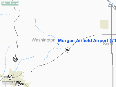
Location
& QuickFacts
|
FAA
Information Effective: |
2008-06-05 |
|
Airport
Identifier: |
71IN |
|
Airport
Status: |
Operational |
|
Longitude/Latitude: |
086-00-20.9120W/38-39-57.2050N
-86.005809/38.665890 (Estimated) |
|
Elevation: |
922 ft / 281.03 m (Estimated) |
|
Land: |
0 acres |
|
From nearest
city: |
7 nautical miles E of Salem, IN |
|
Location: |
Washington County, IN |
|
Magnetic
Variation: |
02W (1990) |
Owner
& Manager
|
Ownership: |
Privately
owned |
|
Owner: |
Donald G. Morgan |
|
Address: |
Rr C Box 408
Salem, IN 47167 |
|
Phone
number: |
812-883-4631 |
|
Manager: |
Donald G. Morgan |
|
Address: |
Rr C Box 408
Salem, IN 47167 |
|
Phone
number: |
812-883-4631 |
Airport Operations
and Facilities
|
Airport
Use: |
Private |
|
Wind indicator: |
Yes |
|
Segmented
Circle: |
No |
|
Control
Tower: |
No |
|
Sectional
chart: |
St Louis |
|
Region: |
AGL - Great Lakes |
|
Boundary
ARTCC: |
ZID - Indianapolis |
|
Tie-in
FSS: |
HUF - Terre Haute |
|
FSS Toll
Free: |
1-800-WX-BRIEF |
|
Runway Information
Runway 18/36
|
Dimension: |
1700 x 75 ft
/ 518.2 x 22.9 m |
|
Surface: |
TURF, |
|
|
Runway 18 |
Runway 36 |
|
Traffic
Pattern: |
Left |
Left |
|
Radio Navigation
Aids
|
ID |
Type |
Name |
Ch |
Freq |
Var |
Dist |
|
EQZ |
NDB |
Captain |
|
308.00 |
02W |
12.2 nm |
|
BFR |
NDB |
Bedford |
|
344.00 |
02W |
22.7 nm |
|
RRJ |
NDB |
Oranj |
|
368.00 |
02W |
25.9 nm |
|
IMS |
NDB |
Madison |
|
404.00 |
03W |
26.2 nm |
|
OVO |
NDB |
North Vernon |
|
374.00 |
02W |
29.9 nm |
|
BM |
NDB |
Claye |
|
382.00 |
02W |
36.4 nm |
|
BA |
NDB |
Clifs |
|
410.00 |
03W |
40.4 nm |
|
GOI |
NDB |
Godman |
|
396.00 |
02W |
42.5 nm |
|
FNZ |
NDB |
Ferdinand |
|
239.00 |
00E |
46.5 nm |
|
MYS |
VOR |
Mystic |
|
108.20 |
01W |
47.7 nm |
|
BQM |
VOR/DME |
Bowman |
059X |
112.20 |
01W |
30.7 nm |
|
FTK |
VOR/DME |
Fort Knox |
033X |
109.60 |
01W |
45.6 nm |
|
ABB |
VORTAC |
Nabb |
071X |
112.40 |
01E |
18.0 nm |
|
IIU |
VORTAC |
Louisville |
095X |
114.80 |
01E |
39.4 nm |
|
OOM |
VORTAC |
Hoosier |
039X |
110.20 |
02W |
40.4 nm |
|
SDF |
VOT |
Louisville Standifd |
|
111.00 |
|
32.0 nm |
Remarks
- PRVDD
OBSTNS ARE REMOVED/LOWERED OR THR DSPLCD TO PRVD 20:1 APCH SLOPE; 125
FT EITHER SIDE OF CENTERLINE REMAIN OBSTN FREE.
Based Aircraft
|
Aircraft
based on field: |
2 |
|
Single Engine
Airplanes: |
2 |
Morgan Airfield Airport
Address:
Washington County, IN
Tel:
812-883-4631
Images
and information placed above are from
http://www.airport-data.com/airport/71IN/
We
thank them for the data!
| General
Info |
| Country |
United
States |
| State |
INDIANA
|
| FAA ID |
71IN |
| Latitude |
38-39-57.205N
|
| Longitude |
086-00-20.912W
|
| Elevation |
922 feet
|
| Near City |
SALEM
|
We don't guarantee the information is fresh and accurate. The data may
be wrong or outdated.
For more up-to-date information please refer to other sources.
|
|


