 |
|
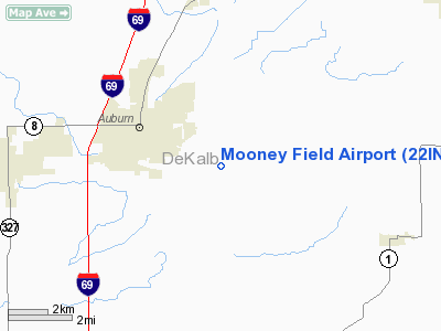
Location
& QuickFacts
|
FAA
Information Effective: |
2008-06-05 |
|
Airport
Identifier: |
22IN |
|
Airport
Status: |
Operational |
|
Longitude/Latitude: |
085-00-27.0000W/41-20-54.0000N
-85.007500/41.348333 (Estimated) |
|
Elevation: |
865 ft / 263.65 m (Estimated) |
|
Land: |
0 acres |
|
From nearest
city: |
4 nautical miles E of Auburn, IN |
|
Location: |
De Kalb County, IN |
|
Magnetic
Variation: |
04W (1995) |
Owner & Manager
|
Ownership: |
Privately
owned |
|
Owner: |
Michael E. Mooney |
|
Address: |
5103 County Road 37
Auburn, IN 46706 |
|
Phone
number: |
219-925-3681 |
|
Address: |
|
Airport
Operations and Facilities
|
Airport
Use: |
Private |
|
Segmented
Circle: |
No |
|
Control
Tower: |
No |
|
Sectional
chart: |
Chicago |
|
Region: |
AGL - Great Lakes |
|
Boundary
ARTCC: |
ZOB - Cleveland |
|
Tie-in
FSS: |
HUF - Terre Haute |
|
FSS Toll
Free: |
1-800-WX-BRIEF |
|
Runway Information
Runway 10/28
|
Dimension: |
1800 x 100 ft
/ 548.6 x 30.5 m |
|
Surface: |
TURF, |
|
|
Runway 10 |
Runway 28 |
|
Traffic
Pattern: |
Left |
Right |
|
Radio Navigation
Aids
|
ID |
Type |
Name |
Ch |
Freq |
Var |
Dist |
|
ANQ |
NDB |
Angola |
|
347.00 |
05W |
17.9 nm |
|
BYN |
NDB |
Bryan |
|
260.00 |
04W |
25.7 nm |
|
DFI |
NDB |
Defiance |
|
246.00 |
05W |
26.2 nm |
|
IRS |
NDB |
Sturgis |
|
382.00 |
04W |
33.9 nm |
|
VFU |
NDB |
Stanley |
|
411.00 |
05W |
34.2 nm |
|
HHG |
NDB |
Huntington |
|
417.00 |
03W |
36.1 nm |
|
USE |
NDB |
Fulton |
|
375.00 |
05W |
42.4 nm |
|
HAI |
NDB |
Three Rivers |
|
407.00 |
02W |
45.1 nm |
|
OLK |
VOR |
Wolf Lake |
|
110.40 |
03W |
22.9 nm |
|
LFD |
VOR/DME |
Litchfield |
049X |
111.20 |
05W |
44.3 nm |
|
FWA |
VORTAC |
Fort Wayne |
125X |
117.80 |
00E |
23.7 nm |
|
GSH |
VORTAC |
Goshen |
084X |
113.70 |
00E |
47.2 nm |
|
FWA |
VOT |
Fort Wayne Baer |
|
111.00 |
|
23.7 nm |
Remarks
- PRVDD
CLEAR 20:1 APCH, CLEAR RY SAFETY AREA, CLEAR OBSTACLE FREE ZONE, TFC
PATTERN LIMITED TO N SIDE OF ARPT AND MAXIMUM ALLOWABLE ELEVATION OF
614 FT AGL TTC PATTERN.
Mooney Field Airport
Address:
De Kalb County, IN
Tel:
219-925-3681
Images
and information placed above are from
http://www.airport-data.com/airport/22IN/
We
thank them for the data!
| General
Info |
| Country |
United
States |
| State |
INDIANA
|
| FAA ID |
22IN |
| Latitude |
41-20-54.000N
|
| Longitude |
085-00-27.000W
|
| Elevation |
865 feet
|
| Near City |
AUBURN
|
We don't guarantee the information is fresh and accurate. The data may
be wrong or outdated.
For more up-to-date information please refer to other sources.
|
|


