|
|
| Monroe County Airport |
 |
| IATA: BMG â ICAO: KBMG â FAA LID: BMG |
| Summary |
| Airport type |
Public |
| Owner |
Monroe County |
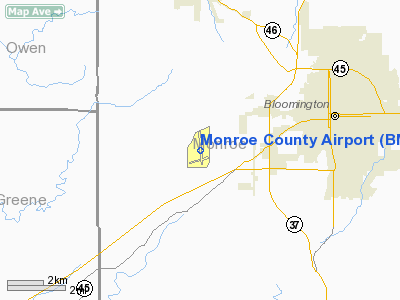
| Location |
Bloomington, Indiana |
| Elevation AMSL |
846 ft / 258 m |
| Coordinates |
39°08â²46â³N 086°37â²00â³W / 39.14611°N 86.6166667°W / 39.14611; -86.6166667 |
| Runways |
| Direction |
Length |
Surface |
| ft |
m |
| 17/35 |
6,500 |
1,981 |
Asphalt |
| 6/24 |
3,798 |
1,158 |
Asphalt |
| Statistics (2006) |
| Aircraft operations |
51,177 |
| Based aircraft |
101 |
| Source: Federal Aviation Administration |
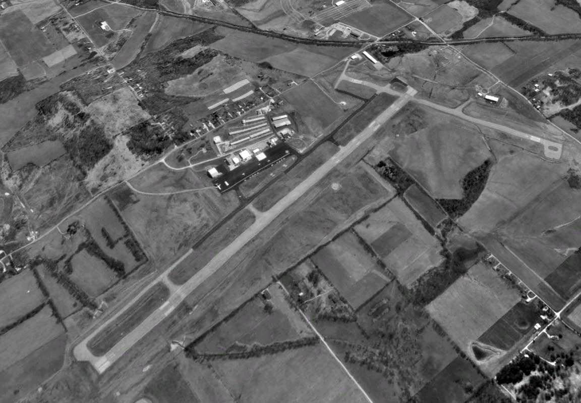
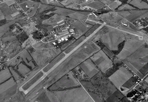
FAA diagram of Monroe County Airport (BMG) Monroe County Airport (IATA: BMG, ICAO: KBMG, FAA LID: BMG) is a county-owned public-use airport located four nautical miles (7 km) southwest of the central business district of Bloomington, a city in Monroe County, Indiana, United States. Scheduled service has been available at different points in the airport's history but as of 2009, no scheduled service is available. Facilities and aircraft
Monroe County Airport covers an area of 1,035 acres (419 ha) at an elevation of 845 feet (258 m) above mean sea level. It has two asphalt paved runways: 17/35 is 6,500 by 150 feet (1,981 x 46 m) and 6/24 is 3,798 by 100 feet (1,158 x 30 m).
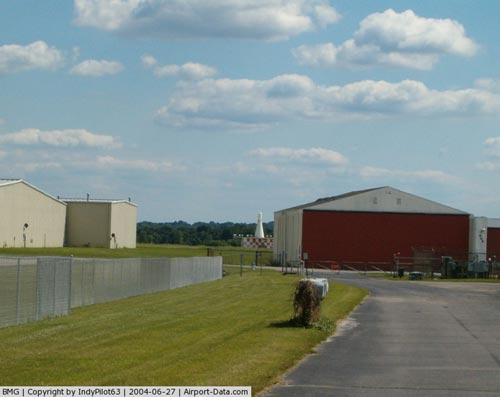
As constructed, the original runway was 5,200 feet (1,585 m) but was later lengthened to 6,500 feet (1,981 m) permitting the operation of Boeing 727 aircraft. In 1995, the aircraft parking ramp was completely replaced allowing for the handling of larger planes. 13 hangars were added at this time as well. Fixed Base Operator (FBO) services and car rentals are available. There are two FBOs at the airport: Cook Aviation (owned by Cook Group) and BMG Aviation.
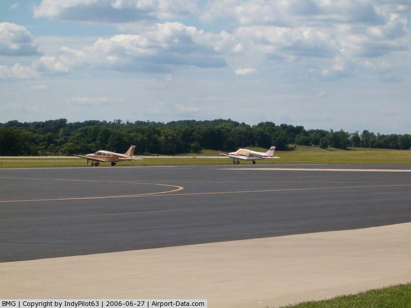
For the 12-month period ending December 31, 2006, the airport had 51,177 aircraft operations, an average of 140 per day: 95% general aviation, 4% air taxi, 1% military and <1% scheduled commercial. At that time there were 101 aircraft based at this airport: 77% single-engine, 14% multi-engine, 5% jet, 3% helicopter and 1% ultralight.
Accidents and incidents
- On 19 October 1985, Vickers Viscount N923RC of Ray Charles Enterprises was damaged beyond economic repair when it departed the runway on landing.
- On 21 April 2006, at about 23:45 a Cessna 206 N120HS was destroyed on impact while on an instrument approach to runway 35. The flight originated from the Purdue University Airport(LAF), near Lafayette, Indiana, about 2245. The pilot and four passengers all sustained fatal injures in the accident. All five people killed in the accident were Indiana University music students.
The above content comes from Wikipedia and is published under free licenses – click here to read more.
|
 |
(Click on the photo to enlarge) |
|
 |
(Click on the photo to enlarge) |
|
 |
(Click on the photo to enlarge) |
|
 |
(Click on the photo to enlarge) |
Location
& QuickFacts
|
FAA
Information Effective: |
2008-06-05 |
|
Airport
Identifier: |
BMG |
|
Airport
Status: |
Operational |
|
Longitude/Latitude: |
086-37-00.1000W/39-08-45.7000N
-86.616694/39.146028 (Estimated) |
|
Elevation: |
845 ft / 257.56 m (Surveyed) |
|
Land: |
1035 acres |
|
From nearest
city: |
4 nautical miles SW of Bloomington, IN |
|
Location: |
Monroe County, IN |
|
Magnetic
Variation: |
02W (1990) |
Owner
& Manager
|
Ownership: |
Publicly
owned |
|
Owner: |
Monroe County |
|
Address: |
972 South Kirby Road
Bloomington,
IN 47401 |
|
Phone
number: |
812-825-5406 |
|
Manager: |
Bruce Payton
ASST. MGR KEVIN SINIARD |
|
Address: |
972 S. Kirby Rd
Bloomington,
IN 47403 |
|
Phone
number: |
812-825-5406 |
Airport Operations
and Facilities
|
Airport
Use: |
Open
to public |
|
Wind indicator: |
Yes |
|
Segmented
Circle: |
Yes |
|
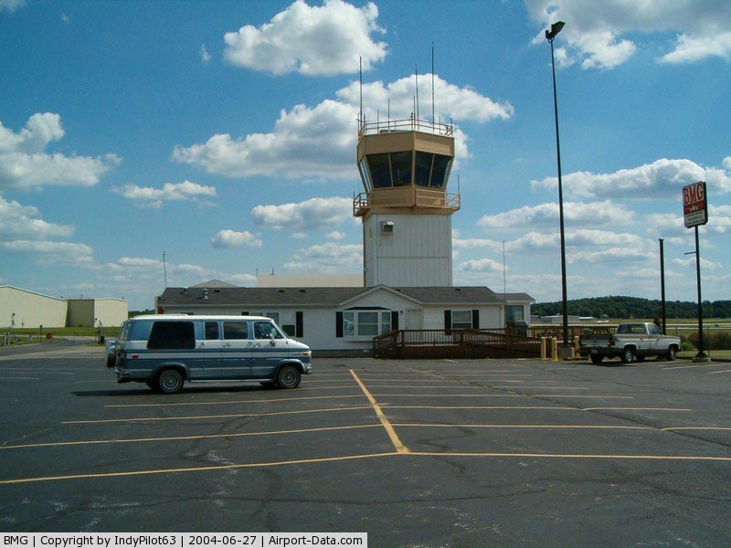
Control
Tower: |
Yes |
|
Lighting
Schedule: |
DUSK-DAWN
WHEN ATCT CLSD ACTVT HIRL RY 17/35 MALSR RY 35 & MIRL
RY 06/24 - CTAF. |
|
Beacon
Color: |
Clear-Green (lighted land airport) |
|
Landing
fee charge: |
No |
|
Sectional
chart: |
St Louis |
|
Region: |
AGL - Great Lakes |
|
Boundary
ARTCC: |
ZID - Indianapolis |
|
Tie-in
FSS: |
HUF - Terre Haute |
|
FSS on
Airport: |
No |
|
FSS Toll
Free: |
1-800-WX-BRIEF |
|
NOTAMs
Facility: |
BMG (NOTAM-d service avaliable) |
|
Certification
type/date: |
IV A U 10/197
PPR FOR ACR OPNS WITH MORE THAN 30 PSGR SEATS CALL AMGR
812-825-5406 0R 812-825-9600 ON WEEKENDS; HOLIDAYS &
NIGHTS. INDEX B ARFF CAPABILITY AVBL ON REQ. |
|
Federal
Agreements: |
NGY3 |
Airport Communications
|
CTAF: |
120.775 |
|
Unicom: |
122.950
|
Airport Services
|
Fuel
available: |
100LLA |
|
Airframe
Repair: |
MAJOR |
|
Power
Plant Repair: |
MAJOR |
|
Bottled
Oxygen: |
NONE |
|
Bulk Oxygen: |
NONE |
|
Runway Information
Runway 06/24
|
Dimension: |
3798 x 100 ft
/ 1157.6 x 30.5 m |
|
Surface: |
ASPH, Fair Condition |
|
Surface Treatment: |
Saw-cut or plastic Grooved |
|
Weight Limit: |
Single wheel: 35000 lbs.
Dual wheel: 50000 lbs. |
|
Edge Lights: |
Medium |
|
|
Runway 06 |
Runway 24 |
|
Longitude: |
086-37-22.5266W |
086-36-40.1263W |
|
Latitude: |
39-08-16.0989N |
39-08-33.9370N |
|
Elevation: |
832.00 ft |
841.00 ft |
|
Alignment: |
62 |
127 |
|
Traffic
Pattern: |
Left |
Left |
|
Markings: |
Non-precision instrument, Good Condition |
Non-precision instrument, Good Condition |
|
Crossing
Height: |
37.00 ft |
49.00 ft |
|
Displaced
threshold: |
304.00 ft |
222.00 ft |
|
VASI: |
4-box on left side |
4-box on left side |
|
Visual Glide
Angle: |
4.00° |
4.00° |
|
Runway End
Identifier: |
Yes
REIL OTS INDEFLY. |
Yes |
|
Centerline
Lights: |
No |
No |
|
Touchdown
Lights: |
No |
No |
|
Obstruction: |
22 ft road, 200.0 ft from runway, 204 ft right
of centerline
RY 06 NUMEROUS 64 FT TREES 950 FT FM RY 3ND 210 FT R, APCH
RATIO 19:1 TO DSPLCD THLD.
HAS
ROAD 100-200 FT RM THR 200-250 FT R. |
18 ft road, 200.0 ft from runway, 100 ft left
of centerline
HAS 19 FT ROAD 245 FT FM DSPLCD THLD 250 FT L; APCH RATIO
12:1.
7 FT FENCE 175 FT FM THR 113 FT L OF RY CL EXTDD. |
|
Runway 17/35
|
Dimension: |
6500 x 150 ft
/ 1981.2 x 45.7 m |
|
Surface: |
ASPH, Good Condition |
|
Surface Treatment: |
Saw-cut or plastic Grooved |
|
Weight Limit: |
Single wheel: 68000 lbs.
Dual wheel: 121000 lbs.
Dual tandem wheel: 169000 lbs. |
|
Edge Lights: |
High |
|
|
Runway 17 |
Runway 35 |
|
Longitude: |
086-37-05.2914W |
086-36-53.3207W |
|
Latitude: |
39-09-29.5244N |
39-08-25.9668N |
|
Elevation: |
845.00 ft |
837.00 ft |
|
Alignment: |
127 |
127 |
|
ILS Type: |
|
ILS |
|
Traffic
Pattern: |
Left |
Left |
|
Markings: |
Non-precision instrument, Good Condition |
Precision instrument, Good Condition |
|
Crossing
Height: |
40.00 ft |
0.00 ft |
|
VASI: |
4-box on left side |
|
|
Visual Glide
Angle: |
3.00° |
0.00° |
|
Approach
lights: |
|
MALSR |
|
Runway End
Identifier: |
Yes
REIL OTS INDEFLY. |
No |
|
Centerline
Lights: |
No |
No |
|
Touchdown
Lights: |
No |
No |
|
Obstruction: |
90 ft tree, 2600.0 ft from runway, 1100 ft
right of centerline, 26:1 slope to clear |
, 50:1 slope to clear |
|
Radio Navigation
Aids
|
ID |
Type |
Name |
Ch |
Freq |
Var |
Dist |
|
BM |
NDB |
Claye |
|
382.00 |
02W |
5.4 nm |
|
BFR |
NDB |
Bedford |
|
344.00 |
02W |
20.3 nm |
|
EQZ |
NDB |
Captain |
|
308.00 |
02W |
34.4 nm |
|
TVX |
NDB |
Greencastle |
|
521.00 |
03W |
35.3 nm |
|
DCY |
NDB |
Washington |
|
212.00 |
03W |
36.2 nm |
|
RRJ |
NDB |
Oranj |
|
368.00 |
02W |
37.4 nm |
|
HFY |
NDB |
Greenwood |
|
398.00 |
02W |
38.1 nm |
|
BA |
NDB |
Clifs |
|
410.00 |
03W |
38.6 nm |
|
SIV |
NDB |
Sullivan |
|
326.00 |
02W |
38.8 nm |
|
HU |
NDB |
Yinno |
|
245.00 |
02W |
39.1 nm |
|
OVO |
NDB |
North Vernon |
|
374.00 |
02W |
47.7 nm |
|
PLX |
NDB |
Palestine |
|
391.00 |
00W |
48.4 nm |
|
RSV |
VOR/DME |
Robinson |
021X |
108.40 |
02E |
48.8 nm |
|
OOM |
VORTAC |
Hoosier |
039X |
110.20 |
02W |
0.2 nm |
|
TTH |
VORTAC |
Terre Haute |
100X |
115.30 |
02E |
35.9 nm |
|
VHP |
VORTAC |
Brickyard |
110X |
116.30 |
01E |
41.8 nm |
|
SHB |
VORTAC |
Shelbyville |
057X |
112.00 |
01E |
47.0 nm |
|
IND |
VOT |
Indianapolis Intl |
|
109.60 |
|
38.1 nm |
Remarks
- RY
06/24 NOT AVBL FOR ACR OPNS WITH MORE THAN 30 PSGR SEATS.
Based Aircraft
|
Aircraft
based on field: |
103 |
|
Single Engine
Airplanes: |
66 |
|
Multi Engine Airplanes: |
26 |
|
Jet Engine Airplanes: |
8 |
|
Helicopters: |
2 |
|
Ultralights: |
1 |
Operational Statistics
Time
Period: 2006-01-01 - 2006-12-31
|
Aircraft
Operations: |
141/Day |
|
Commerical: |
0.4% |
|
Air Taxi: |
4.2% |
|
General Aviation
Local: |
26.5% |
|
General Aviation
Itinerant: |
68.2% |
|
Military: |
0.7% |
Monroe County Airport
Address:
Monroe County, IN
Tel:
812-825-5406
Images
and information placed above are from
http://www.airport-data.com/airport/BMG/
We
thank them for the data!
| General
Info |
| Country |
United
States |
| State |
INDIANA
|
| FAA ID |
BMG |
| Latitude |
39-08-45.677N
|
| Longitude |
086-37-00.058W
|
| Elevation |
846 feet
|
| Near City |
BLOOMINGTON
|
We don't guarantee the information is fresh and accurate. The data may
be wrong or outdated.
For more up-to-date information please refer to other sources.
|
|