 |
|
|
|
|
|
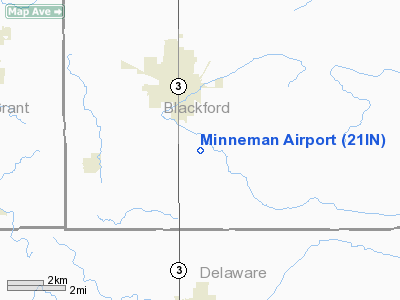
Location
& QuickFacts
|
FAA Information
Effective: |
2008-06-05 |
|
Airport
Identifier: |
21IN |
|
Airport
Status: |
Operational |
|
Longitude/Latitude: |
085-21-19.8980W/40-25-06.1540N
-85.355527/40.418376 (Estimated) |
|
Elevation: |
905 ft / 275.84 m (Estimated) |
|
Land: |
15 acres |
|
From nearest
city: |
3 nautical
miles SE of Hartford City, IN |
|
Location: |
Blackford
County, IN |
|
Magnetic
Variation: |
03W (1985) |
Owner
& Manager
|
Ownership: |
Privately
owned |
|
Owner: |
R. E. Minneman |
|
Address: |
2054s 100 E
Hartford City, IN 47348 |
|
Phone
number: |
317-348-2482 |
|
Manager: |
R. E. Minneman |
|
Address: |
2054s 100 E
Hartford City, IN 47248 |
|
Phone
number: |
317-348-2482 |
Airport Operations
and Facilities
|
Airport Use: |
Private |
|
Wind
indicator: |
Yes |
|
Segmented
Circle: |
No |
|
Control
Tower: |
No |
|
Landing
fee charge: |
No |
|
Sectional
chart: |
Chicago |
|
Region: |
AGL - Great Lakes |
|
Boundary
ARTCC: |
ZID - Indianapolis |
|
Responsible
ARTCC: |
ZAU - Chicago |
|
Tie-in
FSS: |
HUF - Terre Haute |
|
FSS on
Airport: |
No |
|
FSS Toll
Free: |
1-800-WX-BRIEF |
Airport Services
|
Airframe
Repair: |
MAJOR |
|
Power
Plant Repair: |
MAJOR |
|
Bottled
Oxygen: |
NONE |
|
Bulk Oxygen: |
NONE |
|
Runway Information
Runway 09/27
|
Dimension: |
2283 x 75 ft
/ 695.9 x 22.9 m |
|
Surface: |
TURF, |
|
|
Runway 09 |
Runway 27 |
|
Traffic
Pattern: |
Left |
Left |
|
Markings: |
None, |
None, |
|
Displaced
threshold: |
480.00 ft |
470.00 ft |
|
Runway End
Identifier: |
No |
No |
|
Centerline
Lights: |
No |
No |
|
Touchdown
Lights: |
No |
No |
|
Obstruction: |
24 ft pline/rr
APCH RATIO 20:1 AT DSPLCD THR. |
23 ft pline/road, 0.0 ft from runway
APCH RATIO 20:1 AT DSPLCD THR. |
|
Radio Navigation
Aids
|
ID |
Type |
Name |
Ch |
Freq |
Var |
Dist |
|
PLD |
NDB |
Portland |
|
257.00 |
03W |
17.1 nm |
|
AI |
NDB |
Video |
|
371.00 |
03W |
22.1 nm |
|
HHG |
NDB |
Huntington |
|
417.00 |
03W |
26.7 nm |
|
IWH |
NDB |
Wabash |
|
329.00 |
03W |
28.9 nm |
|
UWL |
NDB |
New Castle |
|
385.00 |
02W |
32.4 nm |
|
CQA |
NDB |
Lakefield |
|
205.00 |
04W |
36.4 nm |
|
VES |
NDB |
Versailles |
|
356.00 |
04W |
40.2 nm |
|
UMP |
NDB |
Metropolitan |
|
338.00 |
03W |
43.0 nm |
|
VFU |
NDB |
Stanley |
|
411.00 |
05W |
43.1 nm |
|
GGP |
NDB |
Logansport |
|
263.00 |
01W |
49.7 nm |
|
MIE |
VOR/DME |
Muncie |
091X |
114.40 |
03W |
11.0 nm |
|
MZZ |
VOR/DME |
Marion |
023X |
108.60 |
03W |
15.5 nm |
|
OKK |
VORTAC |
Kokomo |
082X |
113.50 |
00E |
32.8 nm |
|
FWA |
VORTAC |
Fort Wayne |
125X |
117.80 |
00E |
34.6 nm |
|
GUS |
VORTAC |
Grissom |
21Y |
108.45 |
02W |
38.8 nm |
|
RID |
VORTAC |
Richmond |
043X |
110.60 |
03W |
46.4 nm |
|
FWA |
VOT |
Fort Wayne Baer |
|
111.00 |
|
34.5 nm |
Remarks
- RWY
IN FAIR CONDITION, DIPS IN LNDG AREA.
- THRS
AND BDRY MARKED BY ORANGE HIGHWAY CONES ON RWY 09/27.
- CAUTION:
UNMARKED PLINES IN BOTH APPROACHES.
- SANITARY
LANDFILL 3/4 MILE NE.
- BASED
ON COMPATABLE TRAFFIC PATTERNS WITH INMAN AND HOOVERS ARPTS; BOTH LCTD
NEAR HARTFORD CITY-IN.
Based Aircraft
|
Aircraft
based on field: |
2 |
|
Single Engine
Airplanes: |
2 |
Operational Statistics
Time
Period: 1981-07-24 - 1982-07-23
|
Aircraft
Operations: |
44/Week |
|
General Aviation
Local: |
73.0% |
|
General Aviation
Itinerant: |
27.0% |
Minneman Airport
Address:
Blackford County, IN
Tel:
317-348-2482
Images
and information placed above are from
http://www.airport-data.com/airport/21IN/
We
thank them for the data!
| General
Info |
| Country |
United
States |
| State |
INDIANA
|
| FAA ID |
21IN |
| Latitude |
40-25-06.154N
|
| Longitude |
085-21-19.898W
|
| Elevation |
905 feet
|
| Near City |
HARTFORD
CITY |
We don't guarantee the information is fresh and accurate. The data may
be wrong or outdated.
For more up-to-date information please refer to other sources.
|
|


