 |
|
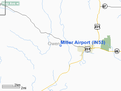
Location
& QuickFacts
|
FAA
Information Effective: |
2008-06-05 |
|
Airport
Identifier: |
IN53 |
|
Airport
Status: |
Operational |
|
Longitude/Latitude: |
086-49-25.0250W/39-17-30.1600N
-86.823618/39.291711 (Estimated) |
|
Elevation: |
710 ft / 216.41 m (Estimated) |
|
Land: |
0 acres |
|
From nearest
city: |
3 nautical miles W of Spencer, IN |
|
Location: |
Owen County, IN |
|
Magnetic
Variation: |
01W (1985) |
Owner & Manager
|
Ownership: |
Privately
owned |
|
Owner: |
Harry
Miller Farms Inc |
|
Address: |
Po Box
49
Spencer,
IN 47460 |
|
Phone
number: |
812-829-3166 |
|
Address: |
|
Airport
Operations and Facilities
|
Airport
Use: |
Private |
|
Segmented
Circle: |
No |
|
Control
Tower: |
No |
|
Sectional
chart: |
Chicago |
|
Region: |
AGL - Great Lakes |
|
Boundary
ARTCC: |
ZID - Indianapolis |
|
Tie-in
FSS: |
HUF - Terre Haute |
|
FSS on
Airport: |
No |
|
FSS Toll
Free: |
1-800-WX-BRIEF |
|
Runway Information
Runway WNW/ESE
|
Dimension: |
2600 x 50 ft
/ 792.5 x 15.2 m |
|
Surface: |
GRAVEL, |
|
|
Runway ESE |
Runway WNW |
|
Traffic
Pattern: |
Left |
Left |
|
Radio Navigation
Aids
|
ID |
Type |
Name |
Ch |
Freq |
Var |
Dist |
|
BM |
NDB |
Claye |
|
382.00 |
02W |
17.6 nm |
|
TVX |
NDB |
Greencastle |
|
521.00 |
03W |
25.4 nm |
|
HU |
NDB |
Yinno |
|
245.00 |
02W |
27.3 nm |
|
SIV |
NDB |
Sullivan |
|
326.00 |
02W |
30.9 nm |
|
BFR |
NDB |
Bedford |
|
344.00 |
02W |
32.6 nm |
|
DCY |
NDB |
Washington |
|
212.00 |
03W |
38.6 nm |
|
HFY |
NDB |
Greenwood |
|
398.00 |
02W |
39.7 nm |
|
PLX |
NDB |
Palestine |
|
391.00 |
00W |
41.6 nm |
|
CFJ |
NDB |
Crawfordsville |
|
388.00 |
02W |
41.6 nm |
|
PRG |
NDB |
Paris |
|
341.00 |
01E |
46.4 nm |
|
BA |
NDB |
Clifs |
|
410.00 |
03W |
46.8 nm |
|
HZP |
NDB |
Zionsville |
|
248.00 |
03W |
47.2 nm |
|
EQZ |
NDB |
Captain |
|
308.00 |
02W |
47.2 nm |
|
RRJ |
NDB |
Oranj |
|
368.00 |
02W |
48.0 nm |
|
OEA |
NDB |
Vincennes |
|
251.00 |
00E |
49.7 nm |
|
RSV |
VOR/DME |
Robinson |
021X |
108.40 |
02E |
41.8 nm |
|
LWV |
VOR/DME |
Lawrenceville |
025X |
108.80 |
01W |
48.1 nm |
|
OOM |
VORTAC |
Hoosier |
039X |
110.20 |
02W |
13.2 nm |
|
TTH |
VORTAC |
Terre Haute |
100X |
115.30 |
02E |
23.0 nm |
|
VHP |
VORTAC |
Brickyard |
110X |
116.30 |
01E |
37.9 nm |
|
IND |
VOT |
Indianapolis Intl |
|
109.60 |
|
36.1 nm |
Miller
Owen Airport
Address:
Owen County, IN
Tel:
812-829-3166
Images
and information placed above are from
http://www.airport-data.com/airport/IN53/
We
thank them for the data!
| General
Info |
| Country |
United
States |
| State |
INDIANA
|
| FAA ID |
IN53 |
| Latitude |
39-17-30.160N
|
| Longitude |
086-49-25.025W
|
| Elevation |
710 feet
|
| Near City |
SPENCER
|
We don't guarantee the information is fresh and accurate. The data may
be wrong or outdated.
For more up-to-date information please refer to other sources.
|
|


