 |
|
Location
& QuickFacts
|
FAA
Information Effective: |
2008-06-05 |
|
Airport
Identifier: |
39II |
|
Airport
Status: |
Operational |
|
Longitude/Latitude: |
085-33-07.9420W/41-30-53.1780N
-85.552206/41.514772 (Estimated) |
|
Elevation: |
957 ft / 291.69 m (Estimated) |
|
Land: |
0 acres |
|
From nearest
city: |
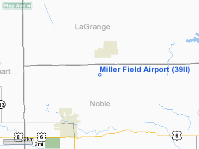
2 nautical miles SW of Topeka, IN |
|
Location: |
Noble County, IN |
|
Magnetic
Variation: |
03W (1985) |
Owner & Manager
|
Ownership: |
Privately
owned |
|
Owner: |
Robert L. Miller |
|
Address: |
6544 W-1100 N.
Ligonier, IN 46767 |
|
Phone
number: |
219-593-2219 |
|
Address: |
|
Airport
Operations and Facilities
|
Airport
Use: |
Private
PERSONAL USE. |
|
Wind indicator: |
Yes |
|
Segmented
Circle: |
No |
|
Control
Tower: |
No |
|
Sectional
chart: |
Chicago |
|
Region: |
AGL - Great Lakes |
|
Boundary
ARTCC: |
ZAU - Chicago |
|
Tie-in
FSS: |
HUF - Terre Haute |
|
FSS Toll
Free: |
1-800-WX-BRIEF |
|
Runway Information
Runway 18/36
|
Dimension: |
2500 x 100 ft
/ 762.0 x 30.5 m |
|
Surface: |
TURF, |
|
|
Runway 18 |
Runway 36 |
|
Traffic
Pattern: |
Left |
Left |
|
Radio Navigation
Aids
|
ID |
Type |
Name |
Ch |
Freq |
Var |
Dist |
|
IRS |
NDB |
Sturgis |
|
382.00 |
04W |
18.7 nm |
|
ANQ |
NDB |
Angola |
|
347.00 |
05W |
22.2 nm |
|
HAI |
NDB |
Three Rivers |
|
407.00 |
02W |
26.7 nm |
|
RCR |
NDB |
Rochester |
|
216.00 |
03W |
39.5 nm |
|
HHG |
NDB |
Huntington |
|
417.00 |
03W |
39.8 nm |
|
CPB |
NDB |
Culver |
|
391.00 |
01W |
41.6 nm |
|
IWH |
NDB |
Wabash |
|
329.00 |
03W |
46.5 nm |
|
BYN |
NDB |
Bryan |
|
260.00 |
04W |
48.9 nm |
|
OLK |
VOR |
Wolf Lake |
|
110.40 |
03W |
16.3 nm |
|
AZO |
VOR/DME |
Kalamazoo |
027X |
109.00 |
01W |
43.4 nm |
|
ELX |
VOR/DME |
Keeler |
113X |
116.60 |
00E |
45.7 nm |
|
LFD |
VOR/DME |
Litchfield |
049X |
111.20 |
05W |
48.3 nm |
|
GSH |
VORTAC |
Goshen |
084X |
113.70 |
00E |
21.4 nm |
|
FWA |
VORTAC |
Fort Wayne |
125X |
117.80 |
00E |
36.2 nm |
|
GIJ |
VORTAC |
Gipper |
101X |
115.40 |
00E |
37.7 nm |
|
BTL |
VORTAC |
Battle Creek |
031X |
109.40 |
02W |
49.6 nm |
|
FWA |
VOT |
Fort Wayne Baer |
|
111.00 |
|
36.1 nm |
Remarks
- PRVDD
ARPT IS FOR PERSONAL USE ONLY; OPER REMAIN E OF RY.
Based Aircraft
|
Aircraft
based on field: |
1 |
|
Single Engine
Airplanes: |
1 |
Miller Field Airport
Address:
Noble County, IN
Tel:
219-593-2219
Images
and information placed above are from
http://www.airport-data.com/airport/39II/
We
thank them for the data!
| General
Info |
| Country |
United
States |
| State |
INDIANA
|
| FAA ID |
39II |
| Latitude |
41-30-53.178N
|
| Longitude |
085-33-07.942W
|
| Elevation |
957 feet
|
| Near City |
TOPEKA
|
We don't guarantee the information is fresh and accurate. The data may
be wrong or outdated.
For more up-to-date information please refer to other sources.
|
|


