 |
|
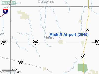
Location
& QuickFacts
|
FAA
Information Effective: |
2008-06-05 |
|
Airport
Identifier: |
2IN5 |
|
Airport
Status: |
Operational |
|
Longitude/Latitude: |
085-28-22.5050W/40-00-54.5650N
-85.472918/40.015157 (Estimated) |
|
Elevation: |
1038 ft / 316.38 m (Estimated) |
|
Land: |
120 acres |
|
From nearest
city: |
1 nautical miles NW of Sulphur Springs, IN |
|
Location: |
Henry County, IN |
|
Magnetic
Variation: |
03W (1990) |
Owner
& Manager
|
Ownership: |
Privately
owned |
|
Owner: |
Devon G Midkiff |
|
Address: |
4521 W Co Rd 600 N
Middletown, IN 47356 |
|
Phone
number: |
317-533-3497 |
|
Manager: |
Devon G Midkiff |
|
Address: |
4521 W Co Rd 600 N
Middletown, IN 47356 |
|
Phone
number: |
317-533-3497 |
Airport Operations
and Facilities
|
Airport
Use: |
Private |
|
Wind indicator: |
Yes |
|
Segmented
Circle: |
No |
|
Control
Tower: |
No |
|
Sectional
chart: |
Chicago |
|
Region: |
AGL - Great Lakes |
|
Boundary
ARTCC: |
ZID - Indianapolis |
|
Tie-in
FSS: |
HUF - Terre Haute |
|
FSS Toll
Free: |
1-800-WX-BRIEF |
|
Runway Information
Runway 18/36
|
Dimension: |
2650 x 60 ft
/ 807.7 x 18.3 m |
|
Surface: |
TURF, |
|
|
Runway 18 |
Runway 36 |
|
Traffic
Pattern: |
Left |
Left |
|
Displaced
threshold: |
1200.00 ft |
0.00 ft |
|
Obstruction: |
70 ft trees, 60.0 ft from runway |
|
|
Radio Navigation
Aids
|
ID |
Type |
Name |
Ch |
Freq |
Var |
Dist |
|
AI |
NDB |
Video |
|
371.00 |
03W |
3.7 nm |
|
UWL |
NDB |
New Castle |
|
385.00 |
02W |
10.8 nm |
|
UMP |
NDB |
Metropolitan |
|
338.00 |
03W |
27.0 nm |
|
PLD |
NDB |
Portland |
|
257.00 |
03W |
34.6 nm |
|
HZP |
NDB |
Zionsville |
|
248.00 |
03W |
36.1 nm |
|
HFY |
NDB |
Greenwood |
|
398.00 |
02W |
36.6 nm |
|
HLB |
NDB |
Batesville |
|
254.00 |
02W |
41.2 nm |
|
OXD |
NDB |
Oxford |
|
282.00 |
04W |
44.2 nm |
|
BA |
NDB |
Clifs |
|
410.00 |
03W |
44.6 nm |
|
VES |
NDB |
Versailles |
|
356.00 |
04W |
45.2 nm |
|
IWH |
NDB |
Wabash |
|
329.00 |
03W |
47.4 nm |
|
MIE |
VOR/DME |
Muncie |
091X |
114.40 |
03W |
13.8 nm |
|
MZZ |
VOR/DME |
Marion |
023X |
108.60 |
03W |
30.3 nm |
|
DQN |
VOR/DME |
Dayton |
092X |
114.50 |
01W |
49.5 nm |
|
SHB |
VORTAC |
Shelbyville |
057X |
112.00 |
01E |
28.1 nm |
|
RID |
VORTAC |
Richmond |
043X |
110.60 |
03W |
33.2 nm |
|
OKK |
VORTAC |
Kokomo |
082X |
113.50 |
00E |
40.9 nm |
|
VHP |
VORTAC |
Brickyard |
110X |
116.30 |
01E |
43.0 nm |
|
GUS |
VORTAC |
Grissom |
21Y |
108.45 |
02W |
49.0 nm |
|
IND |
VOT |
Indianapolis Intl |
|
109.60 |
|
41.3 nm |
Remarks
- PRVDD
OBSTRUCTIONS REMOVED/LOWERED TO PROVIDE 20:1 CLEARANCE; 125' SIDES OF
CNTRLN BE CLEAR.
Based Aircraft
|
Aircraft
based on field: |
1 |
|
Single Engine
Airplanes: |
1 |
Midkiff Airport
Address:
Henry County, IN
Tel:
317-533-3497
Images
and information placed above are from
http://www.airport-data.com/airport/2IN5/
We
thank them for the data!
| General
Info |
| Country |
United
States |
| State |
INDIANA
|
| FAA ID |
2IN5 |
| Latitude |
40-00-54.565N
|
| Longitude |
085-28-22.505W
|
| Elevation |
1038 feet
|
| Near City |
SULPHUR
SPRINGS |
We don't guarantee the information is fresh and accurate. The data may
be wrong or outdated.
For more up-to-date information please refer to other sources.
|
|


