 |
|
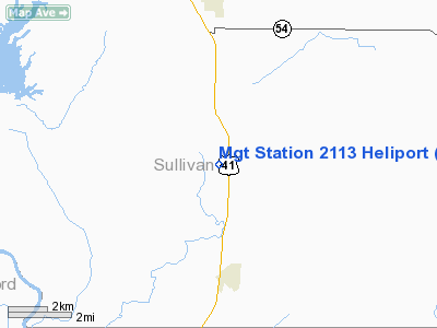
Mgt Station 2113 Heliport |
Location
& QuickFacts
|
FAA
Information Effective: |
2008-06-05 |
|
Airport
Identifier: |
IN97 |
|
Airport
Status: |
Operational |
|
Longitude/Latitude: |
087-24-26.0600W/39-00-49.1500N
-87.407239/39.013653 (Estimated) |
|
Elevation: |
460 ft / 140.21 m (Estimated) |
|
Land: |
0 acres |
|
From nearest
city: |
1 nautical miles SW of Paxton, IN |
|
Location: |
Sullivan County, IN |
|
Magnetic
Variation: |
01W (1990) |
Owner
& Manager
|
Ownership: |
Privately
owned |
|
Owner: |
Midwestern Gas Trans. Co |
|
Address: |
P.o. Box 216
Paris,
IL 61944 |
|
Phone
number: |
217-275-3291 |
|
Manager: |
Jack R. Logan |
|
Address: |
P.o. Box 216
Paris,
IL 61944 |
|
Phone
number: |
217-275-3291 |
Airport Operations
and Facilities
|
Airport
Use: |
Private |
|
Segmented
Circle: |
No |
|
Control
Tower: |
No |
|
Sectional
chart: |
St Louis |
|
Region: |
AGL - Great Lakes |
|
Boundary
ARTCC: |
ZID - Indianapolis |
|
Tie-in
FSS: |
HUF - Terre Haute |
|
FSS Toll
Free: |
1-800-WX-BRIEF |
|
Runway Information
Helipad H1
|
Dimension: |
200 x 200 ft
/ 61.0 x 61.0 m |
|
Surface: |
TURF, |
|
|
Runway H1 |
Runway |
|
Traffic
Pattern: |
Left |
Left |
|
Radio Navigation
Aids
|
ID |
Type |
Name |
Ch |
Freq |
Var |
Dist |
|
SIV |
NDB |
Sullivan |
|
326.00 |
02W |
6.3 nm |
|
PLX |
NDB |
Palestine |
|
391.00 |
00W |
10.9 nm |
|
OEA |
NDB |
Vincennes |
|
251.00 |
00E |
20.6 nm |
|
HU |
NDB |
Yinno |
|
245.00 |
02W |
22.5 nm |
|
DCY |
NDB |
Washington |
|
212.00 |
03W |
23.0 nm |
|
AJG |
NDB |
Mount Carmel |
|
524.00 |
02W |
28.4 nm |
|
CZB |
NDB |
Casey |
|
359.00 |
00E |
32.8 nm |
|
BM |
NDB |
Claye |
|
382.00 |
02W |
37.8 nm |
|
OLY |
NDB |
Olney |
|
272.00 |
00W |
40.0 nm |
|
PRG |
NDB |
Paris |
|
341.00 |
01E |
43.0 nm |
|
MT |
NDB |
Zebre |
|
347.00 |
00E |
44.0 nm |
|
BFR |
NDB |
Bedford |
|
344.00 |
02W |
46.6 nm |
|
RSV |
VOR/DME |
Robinson |
021X |
108.40 |
02E |
11.3 nm |
|
LWV |
VOR/DME |
Lawrenceville |
025X |
108.80 |
01W |
17.3 nm |
|
SAM |
VOR/DME |
Samsville |
113X |
116.60 |
03E |
45.0 nm |
|
MTO |
VOR/DME |
Mattoon |
031X |
109.40 |
03E |
49.5 nm |
|
TTH |
VORTAC |
Terre Haute |
100X |
115.30 |
02E |
29.5 nm |
|
OOM |
VORTAC |
Hoosier |
039X |
110.20 |
02W |
37.9 nm |
Remarks
- PRVDD
ALL APCH/DEP ROUTE HELICOPTER OPERTIONS ARE CONDUCTED FM 250 TO 070
DEG; AREA IS APPROPRIATELY MKD; AND A WIND INDICATOR IS MAINTAINED.
Mgt Station 2113
Address:
Sullivan County, IN
Tel:
217-275-3291
Images
and information placed above are from
http://www.airport-data.com/airport/IN97/
We
thank them for the data!
| General
Info |
| Country |
United
States |
| State |
INDIANA
|
| FAA ID |
IN97 |
| Latitude |
39-00-49.150N
|
| Longitude |
087-24-26.060W
|
| Elevation |
460 feet
|
| Near City |
PAXTON
|
We don't guarantee the information is fresh and accurate. The data may
be wrong or outdated.
For more up-to-date information please refer to other sources.
|
|


