 |
|
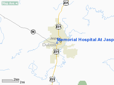
Memorial Hospital At Jasper Heliport |
Location
& QuickFacts
|
FAA
Information Effective: |
2008-06-05 |
|
Airport
Identifier: |
77IN |
|
Airport
Status: |
Operational |
|
Longitude/Latitude: |
086-56-27.0000W/38-23-38.0000N
-86.940833/38.393889 (Estimated) |
|
Elevation: |
531 ft / 161.85 m (Estimated) |
|
Land: |
0 acres |
|
From nearest
city: |
0 nautical miles W of Jasper, IN |
|
Location: |
Dubois County, IN |
|
Magnetic
Variation: |
02W (2000) |
Owner
& Manager
|
Ownership: |
Privately
owned |
|
Owner: |
Ed Roelle, Director |
|
Address: |
Meml Hospital And Health Care Cntr, 800 W.
9th St.
Jasper, IN 47546 |
|
Phone
number: |
812-482-0391 |
|
Manager: |
Ed Roelle, Director |
|
Address: |
Meml Hospital And Health Care Cntr, 800 W.
9th St.
Jasper, IN 47546 |
|
Phone
number: |
812-482-0391 |
Airport Operations
and Facilities
|
Airport
Use: |
Private |
|
Segmented
Circle: |
No |
|
Control
Tower: |
No |
|
Sectional
chart: |
St Louis |
|
Region: |
AGL - Great Lakes |
|
Boundary
ARTCC: |
ZAU - Chicago |
|
Tie-in
FSS: |
HUF - Terre Haute |
|
FSS Toll
Free: |
1-800-WX-BRIEF |
|
Runway Information
Helipad H1
|
Dimension: |
80 x 90 ft /
24.4 x 27.4 m |
|
Surface: |
CONC, |
|
|
Runway H1 |
Runway |
|
Traffic
Pattern: |
Left |
Left |
|
Radio Navigation
Aids
|
ID |
Type |
Name |
Ch |
Freq |
Var |
Dist |
|
FNZ |
NDB |
Ferdinand |
|
239.00 |
00E |
10.0 nm |
|
DCY |
NDB |
Washington |
|
212.00 |
03W |
20.3 nm |
|
RRJ |
NDB |
Oranj |
|
368.00 |
02W |
21.0 nm |
|
TEL |
NDB |
Tell City |
|
206.00 |
02W |
25.7 nm |
|
OEA |
NDB |
Vincennes |
|
251.00 |
00E |
34.0 nm |
|
PDW |
NDB |
Evansville |
|
284.00 |
00E |
35.1 nm |
|
BFR |
NDB |
Bedford |
|
344.00 |
02W |
35.7 nm |
|
AJG |
NDB |
Mount Carmel |
|
524.00 |
02W |
39.2 nm |
|
BM |
NDB |
Claye |
|
382.00 |
02W |
42.9 nm |
|
SIV |
NDB |
Sullivan |
|
326.00 |
02W |
49.3 nm |
|
PLX |
NDB |
Palestine |
|
391.00 |
00W |
49.6 nm |
|
MYS |
VOR |
Mystic |
|
108.20 |
01W |
44.6 nm |
|
HNB |
VOR/DME |
Huntingburg |
029X |
109.20 |
00E |
8.7 nm |
|
LWV |
VOR/DME |
Lawrenceville |
025X |
108.80 |
01W |
38.5 nm |
|
OWB |
VOR/DME |
Owensboro |
023X |
108.60 |
01E |
40.5 nm |
|
OOM |
VORTAC |
Hoosier |
039X |
110.20 |
02W |
47.6 nm |
|
PXV |
VORTAC |
Pocket City |
080X |
113.30 |
03E |
47.9 nm |
Remarks
- PRVDD
ARRIVAL ROUTES ARE 280 DEG OR 045 DEG AND DEP ROUTES ARE 100 DEG OR
225 DEG; AREA IS MARKED; WIND INDICATOR IS MAINTAINED; REMOVE LIGHT
LOCATED NEXT TO PAD.
Memorial Hospital At Jasper Heliport
Address:
Dubois County, IN
Tel:
812-482-0391
Images
and information placed above are from
http://www.airport-data.com/airport/77IN/
We
thank them for the data!
| General
Info |
| Country |
United
States |
| State |
INDIANA
|
| FAA ID |
77IN |
| Latitude |
38-23-38.000N
|
| Longitude |
086-56-27.000W
|
| Elevation |
531 feet
|
| Near City |
JASPER
|
We don't guarantee the information is fresh and accurate. The data may
be wrong or outdated.
For more up-to-date information please refer to other sources.
|
|


