 |
|
|
|
|
|
Location
& QuickFacts
|
FAA
Information Effective: |
2008-06-05 |
|
Airport
Identifier: |
52II |
|
Airport
Status: |
Operational |
|
Longitude/Latitude: |
086-15-48.0150W/41-20-20.1600N
-86.263338/41.338933 (Estimated) |
|
Elevation: |
824 ft / 251.16 m (Estimated) |
|
Land: |
0 acres |
|
From nearest
city: |
2 nautical miles E of Plymouth, IN |
|
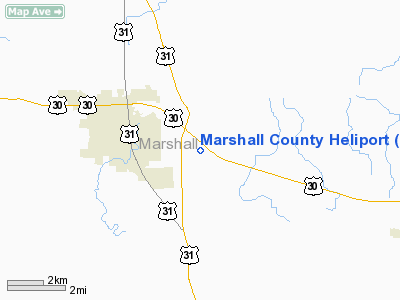
Location: |
Marshall County, IN |
|
Magnetic
Variation: |
02W (1985) |
Owner
& Manager
|
Ownership: |
Publicly
owned |
|
Owner: |
Marshall County Civil Defense |
|
Address: |
P.o. Box 456
Plymouth,
IN 46563-0456 |
|
Phone
number: |
219-936-3740 |
|
Manager: |
C Holderead/j D Rowe |
|
Address: |
P.o. Box 456
Plymouth,
IN 46563-0456 |
|
Phone
number: |
219-936-3740 |
Airport Operations
and Facilities
|
Airport
Use: |
Private |
|
Wind indicator: |
Yes |
|
Segmented
Circle: |
No |
|
Control
Tower: |
No |
|
Lighting
Schedule: |
RDO-CTL
ACTVT ROTG BCN AND PERIMETER LGTS - CTAF. |
|
Beacon
Color: |
Clear-Green-Yellow (heliport) |
|
Sectional
chart: |
Chicago |
|
Region: |
AGL - Great Lakes |
|
Boundary
ARTCC: |
ZAU - Chicago |
|
Tie-in
FSS: |
HUF - Terre Haute |
|
FSS Toll
Free: |
1-800-WX-BRIEF |
Airport
Communications
|
Runway Information
Helipad H1
|
Dimension: |
15 x 15 ft /
4.6 x 4.6 m |
|
Surface: |
CONC, |
|
|
Runway H1 |
Runway |
|
Traffic
Pattern: |
Left |
Left |
|
Radio Navigation
Aids
|
ID |
Type |
Name |
Ch |
Freq |
Var |
Dist |
|
CPB |
NDB |
Culver |
|
391.00 |
01W |
9.2 nm |
|
RCR |
NDB |
Rochester |
|
216.00 |
03W |
16.8 nm |
|
RWN |
NDB |
Winamac/dcmsnd |
|
335.00 |
00W |
21.3 nm |
|
IUL |
NDB |
La Porte |
|
356.00 |
03W |
24.8 nm |
|
VP |
NDB |
Sedly |
|
212.00 |
02W |
28.5 nm |
|
MGC |
NDB |
Michigan City |
|
203.00 |
01W |
33.3 nm |
|
GGP |
NDB |
Logansport |
|
263.00 |
01W |
38.2 nm |
|
IWH |
NDB |
Wabash |
|
329.00 |
03W |
40.5 nm |
|
MCX |
NDB |
White County |
|
377.00 |
03W |
44.0 nm |
|
HHG |
NDB |
Huntington |
|
417.00 |
03W |
46.4 nm |
|
IRS |
NDB |
Sturgis |
|
382.00 |
04W |
46.9 nm |
|
RZL |
NDB |
Rensselaer |
|
362.00 |
02W |
47.9 nm |
|
HAI |
NDB |
Three Rivers |
|
407.00 |
02W |
47.9 nm |
|
OLK |
VOR |
Wolf Lake |
|
110.40 |
03W |
35.0 nm |
|
OXI |
VOR/DME |
Knox |
103X |
115.60 |
00E |
17.4 nm |
|
ELX |
VOR/DME |
Keeler |
113X |
116.60 |
00E |
48.8 nm |
|
GSH |
VORTAC |
Goshen |
084X |
113.70 |
00E |
15.4 nm |
|
GIJ |
VORTAC |
Gipper |
101X |
115.40 |
00E |
25.9 nm |
|
GUS |
VORTAC |
Grissom |
21Y |
108.45 |
02W |
42.0 nm |
|
OKK |
VORTAC |
Kokomo |
082X |
113.50 |
00E |
49.6 nm |
Remarks
- PRVD
INGRESS/EGRESS FROM 240 DEGREES TO 040 DEGREES; AREA IS MARKED; WIND
INDICATOR IS MAINTAINED.
Based Aircraft
|
Aircraft
based on field: |
1 |
|
Helicopters: |
1 |
Marshall County Heliport
Address:
Marshall County, IN
Tel:
219-936-3740
Images
and information placed above are from
http://www.airport-data.com/airport/52II/
We
thank them for the data!
| General
Info |
| Country |
United
States |
| State |
INDIANA
|
| FAA ID |
52II |
| Latitude |
41-20-20.160N
|
| Longitude |
086-15-48.015W
|
| Elevation |
824 feet
|
| Near City |
PLYMOUTH
|
We don't guarantee the information is fresh and accurate. The data may
be wrong or outdated.
For more up-to-date information please refer to other sources.
|
|


