 |
|
|
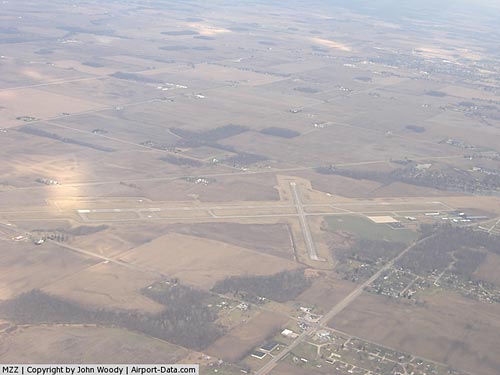 |
(Click on the photo to enlarge) |
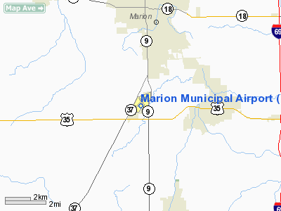
Location
& QuickFacts
|
FAA
Information Effective: |
2008-06-05 |
|
Airport
Identifier: |
MZZ |
|
Airport
Status: |
Operational |
|
Longitude/Latitude: |
085-40-47.0348W/40-29-23.5095N
-85.679732/40.489864 (Estimated) |
|
Elevation: |
859 ft / 261.82 m (Surveyed) |
|
Land: |
506 acres |
|
From
nearest city: |
3 nautical miles SW of Marion, IN |
|
Location: |
Grant County, IN |
|
Magnetic Variation: |
03W (1985) |
Owner
& Manager
|
Ownership: |
Publicly owned |
|
Owner: |
City Of Marion Boac |
|
Address: |
5904 S Western Ave
Marion, IN 46953 |
|
Phone
number: |
765-674-7777 |
|
Manager: |
Andy Darlington |
|
Address: |
5904 So Western Ave
Marion, IN 46953 |
|
Phone number: |
765-674-7777 |
Airport Operations and Facilities
|
Airport
Use: |
Open to public |
|
Wind
indicator: |
Yes |
|
Segmented Circle: |
Yes |
|
Control
Tower: |
No |
|
Lighting
Schedule: |
DUSK-DAWN
HIRL RY 04/22 & MIRL RY 15/33 PRESET LOW INTST; TO
INCR INTST & ACTVT REIL RY 22, 15/33 AND MALSR RY
04 - CTAF. PAPI
RYS 15 & 33 ON DURING DAY, AT NIGHT ACTVT - CTAF. |
|
Beacon
Color: |
Clear-Green (lighted land airport) |
|
Landing
fee charge: |
No |
|
Sectional chart: |
Chicago |
|
Region: |
AGL - Great Lakes |
|
Boundary
ARTCC: |
ZAU - Chicago |
|
Tie-in
FSS: |
HUF - Terre Haute |
|
FSS
on Airport: |
No |
|
FSS
Toll Free: |
1-800-WX-BRIEF |
|
NOTAMs
Facility: |
HUF (NOTAM-d service avaliable) |
|
Federal Agreements: |
NGY |
Airport Communications
|
CTAF: |
122.700 |
|
Unicom: |
122.700 |
Airport
Services
|
Fuel
available: |
100LLA |
|
Airframe
Repair: |
MAJOR |
|
Power
Plant Repair: |
MAJOR |
|
Bottled
Oxygen: |
LOW |
|
Bulk
Oxygen: |
LOW |
|
Runway
Information
Runway 04/22
|
Dimension: |
6000 x 100 ft / 1828.8 x 30.5 m |
|
Surface: |
ASPH, Good Condition |
|
Surface
Treatment: |
Saw-cut or plastic Grooved |
|
Weight
Limit: |
Single wheel: 40000 lbs.
Dual wheel: 48000 lbs.
Dual tandem wheel: 70000 lbs. |
|
Edge
Lights: |
High |
|
|
Runway 04 |
Runway 22 |
|
Longitude: |
085-41-12.9550W |
085-40-25.5920W |
|
Latitude: |
40-29-00.4860N |
40-29-47.4810N |
|
Elevation: |
859.00 ft |
851.00 ft |
|
Alignment: |
37 |
127 |
|
ILS
Type: |
ILS |
|
|
Traffic
Pattern: |
Left |
Left |
|
Markings: |
Precision instrument, Fair Condition |
Non-precision instrument, Good Condition |
|
VASI: |
|
2-box on left side |
|
Approach
lights: |
MALSR |
|
|
Runway
End Identifier: |
|
Yes |
|
Centerline
Lights: |
No |
No |
|
Touchdown
Lights: |
No |
No |
|
Obstruction: |
, 50:1 slope to clear |
67 ft trees, 1700.0 ft from runway, 22:1
slope to clear |
|
Runway 15/33
|
Dimension: |
3596 x 100 ft / 1096.1 x 30.5 m |
|
Surface: |
ASPH, Fair Condition |
|
Weight
Limit: |
Single wheel: 22000 lbs.
Dual wheel: 32000 lbs. |
|
Edge
Lights: |
Medium |
|
|
Runway 15 |
Runway 33 |
|
Longitude: |
085-40-54.8070W |
085-40-31.7920W |
|
Latitude: |
40-29-38.1580N |
40-29-07.2790N |
|
Elevation: |
858.00 ft |
850.00 ft |
|
Alignment: |
127 |
127 |
|
Traffic
Pattern: |
Left |
Left |
|
Markings: |
Basic, Good Condition |
Basic, Good Condition |
|
Crossing
Height: |
37.00 ft |
34.00 ft |
|
VASI: |
2-light PAPI on left side |
2-light PAPI on left side |
|
Visual
Glide Angle: |
3.25° |
3.00° |
|
Runway
End Identifier: |
Yes |
Yes |
|
Centerline
Lights: |
No |
No |
|
Touchdown
Lights: |
No |
No |
|
Obstruction: |
50 ft trees, 1200.0 ft from runway, 30 ft
right of centerline, 20:1 slope to clear |
57 ft trees, 600.0 ft from runway, 250 ft
right of centerline, 7:1 slope to clear |
|
Radio
Navigation Aids
|
ID |
Type |
Name |
Ch |
Freq |
Var |
Dist |
|
IWH |
NDB |
Wabash |
|
329.00 |
03W |
17.3 nm |
|
HHG |
NDB |
Huntington |
|
417.00 |
03W |
24.1 nm |
|
AI |
NDB |
Video |
|
371.00 |
03W |
26.4 nm |
|
PLD |
NDB |
Portland |
|
257.00 |
03W |
31.9 nm |
|
GGP |
NDB |
Logansport |
|
263.00 |
01W |
34.3 nm |
|
UMP |
NDB |
Metropolitan |
|
338.00 |
03W |
37.3 nm |
|
UWL |
NDB |
New Castle |
|
385.00 |
02W |
40.2 nm |
|
RCR |
NDB |
Rochester |
|
216.00 |
03W |
41.7 nm |
|
HZP |
NDB |
Zionsville |
|
248.00 |
03W |
42.2 nm |
|
FKR |
NDB |
Frankfort |
|
278.00 |
02W |
42.5 nm |
|
OLK |
VOR |
Wolf Lake |
|
110.40 |
03W |
46.3 nm |
|
MZZ |
VOR/DME |
Marion |
023X |
108.60 |
03W |
0.2 nm |
|
MIE |
VOR/DME |
Muncie |
091X |
114.40 |
03W |
20.0 nm |
|
OKK |
VORTAC |
Kokomo |
082X |
113.50 |
00E |
17.4 nm |
|
GUS |
VORTAC |
Grissom |
21Y |
108.45 |
02W |
23.5 nm |
|
FWA |
VORTAC |
Fort Wayne |
125X |
117.80 |
00E |
37.0 nm |
|
FWA |
VOT |
Fort Wayne Baer |
|
111.00 |
|
36.8 nm |
Remarks
-
RY
33: -8-12 FT DITCH 200 FT L OF CNTRLN; +8-10 FT GND 230 FT L OF
CNTRLN; PARALLELING S HALF OF RY.
Based
Aircraft
|
Aircraft
based on field: |
49 |
|
Single
Engine Airplanes: |
40 |
|
Multi
Engine Airplanes: |
5 |
|
Jet
Engine Airplanes: |
2 |
|
Ultralights: |
2 |
Operational
Statistics
Time Period: 2005-09-27 - 2006-09-26
|
Aircraft
Operations: |
59/Day |
|
Air
Taxi: |
7.0% |
|
General
Aviation Local: |
55.8% |
|
General
Aviation Itinerant: |
36.0% |
|
Military: |
1.2% |
Marion Municipal Airport
Address:
Grant County, IN
Tel:
765-674-7777
Images
and information placed above are from
http://www.airport-data.com/airport/MZZ/
We
thank them for the data!
| General Info |
| Country |
United
States |
| State |
INDIANA
|
| FAA
ID |
MZZ
|
| Latitude |
40-29-25.342N
|
| Longitude |
085-40-44.918W
|
| Elevation |
859
feet |
| Near
City |
MARION
|
We don't guarantee the information is fresh and accurate. The data may
be wrong or outdated.
For more up-to-date information please refer to other sources.
|
|


