 |
|
Location
& QuickFacts
|
FAA
Information Effective: |
2008-06-05 |
|
Airport
Identifier: |
5II6 |
|
Airport
Status: |
Operational |
|
Longitude/Latitude: |
085-26-42.8510W/38-35-41.2230N
-85.445236/38.594784 (Estimated) |
|
Elevation: |
791 ft / 241.10 m (Estimated) |
|
Land: |
0 acres |
|
From nearest
city: |
5 nautical miles NE of New Washington, IN |
|
Location: |
Jefferson County, IN |
|
Magnetic
Variation: |
02W (1985) |
Owner
& Manager
|
Ownership: |
Privately
owned |
|
Owner: |
Public Service Indiana |
|
Address: |
1000 East Main Street
Plainfield,
IN 46168 |
|
Phone
number: |
317-838-1575 |
|
Manager: |
James F. Friday |
|
Address: |
1000 East Main Street
Plainfield,
IN 46168 |
|
Phone
number: |
317-838-1575 |
Airport Operations
and Facilities
|
Airport
Use: |
Private |
|
Segmented
Circle: |
No |
|
Control
Tower: |
No |
|
Sectional
chart: |
St Louis |
|
Region: |
AGL - Great Lakes |
|
Boundary
ARTCC: |
ZID - Indianapolis |
|
Tie-in
FSS: |
HUF - Terre Haute |
|
FSS on
Airport: |
No |
|
FSS Toll
Free: |
1-800-WX-BRIEF |
|
Runway Information
Helipad H1
|
Dimension: |
20 x 20 ft /
6.1 x 6.1 m |
|
Surface: |
GRAVEL, |
|
|
Runway H1 |
Runway |
|
Traffic
Pattern: |
Left |
Left |
|
Radio Navigation
Aids
|
ID |
Type |
Name |
Ch |
Freq |
Var |
Dist |
|
IMS |
NDB |
Madison |
|
404.00 |
03W |
10.0 nm |
|
OVO |
NDB |
North Vernon |
|
374.00 |
02W |
28.3 nm |
|
EQZ |
NDB |
Captain |
|
308.00 |
02W |
29.7 nm |
|
FEU |
NDB |
Arnold |
|
521.00 |
03W |
37.3 nm |
|
UR |
NDB |
Burln |
|
321.00 |
04W |
41.5 nm |
|
BRY |
NDB |
Bardstown/dcmsnd |
|
248.00 |
02W |
44.9 nm |
|
GOI |
NDB |
Godman |
|
396.00 |
02W |
45.7 nm |
|
HLB |
NDB |
Batesville |
|
254.00 |
02W |
46.2 nm |
|
BA |
NDB |
Clifs |
|
410.00 |
03W |
47.1 nm |
|
BFR |
NDB |
Bedford |
|
344.00 |
02W |
48.8 nm |
|
FFT |
VOR |
Frankfort |
|
109.40 |
03W |
35.4 nm |
|
BQM |
VOR/DME |
Bowman |
059X |
112.20 |
01W |
24.2 nm |
|
FTK |
VOR/DME |
Fort Knox |
033X |
109.60 |
01W |
48.2 nm |
|
ABB |
VORTAC |
Nabb |
071X |
112.40 |
01E |
9.0 nm |
|
IIU |
VORTAC |
Louisville |
095X |
114.80 |
01E |
30.2 nm |
|
CVG |
VORTAC |
Cincinnati |
120X |
117.30 |
04W |
43.0 nm |
|
SDF |
VOT |
Louisville Standifd |
|
111.00 |
|
28.6 nm |
Remarks
- ALL
OPNS ARE FM 040-240 DEG CLKWS; AREA APROPLY MKD; WIND INDCR MAINTD;
NO NGT OPNS UNLESS AREA & WIND INDCR LGTD & BCN INSTLD.
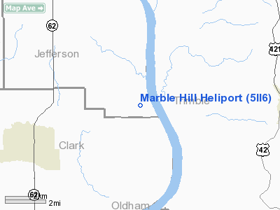
Marble Hill Heliport
Address:
Jefferson County, IN
Tel:
317-838-1575
Images
and information placed above are from
http://www.airport-data.com/airport/5II6/
We
thank them for the data!
| General
Info |
| Country |
United
States |
| State |
INDIANA
|
| FAA ID |
5II6 |
| Latitude |
38-35-41.223N
|
| Longitude |
085-26-42.851W
|
| Elevation |
791 feet
|
| Near City |
NEW WASHINGTON
|
We don't guarantee the information is fresh and accurate. The data may
be wrong or outdated.
For more up-to-date information please refer to other sources.
|
|


