|
|
Madison Municipal Airport |
| Madison Municipal Airport |
| IATA: MDN â ICAO: KIMS â FAA LID: IMS |
| Summary |
| Airport type |
Public |
| Owner |
Madison BOAC |
| Serves |
Madison, Indiana |
| Elevation AMSL |
819 ft / 250 m |
| Coordinates |
38°45â²36â³N 085°27â²53â³W / 38.76°N 85.46472°W / 38.76; -85.46472 |
| Runways |
| Direction |
Length |
Surface |
| ft |
m |
| 3/21 |
5,000 |
1,524 |
Asphalt |
| Statistics (2006) |
| Aircraft operations |
43,882 |
| Based aircraft |
52 |
| Source: Federal Aviation Administration |
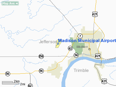
Madison Municipal Airport (IATA: MDN, ICAO: KIMS, FAA LID: IMS) is a city-owned public-use airport located four miles (6 km) west of the central business district of Madison, a city in Jefferson County, Indiana, United States.
Although most U.S. airports use the same three-letter location identifier for the FAA and IATA, Madison Municipal Airport is assigned IMS by the FAA and MDN by the IATA.
Facilities and aircraft
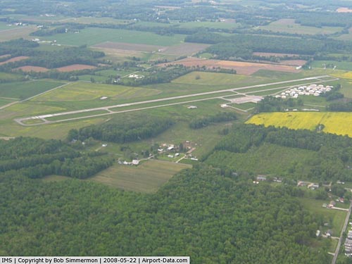
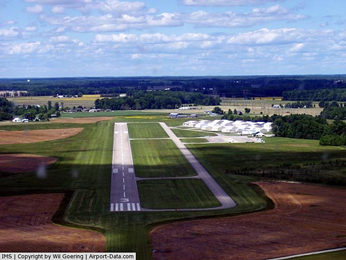
Madison Municipal Airport covers an area of 174 acres (70 ha) which contains one runway designated 3/21 with a 5,000 x 75 ft (1,524 x 23 m) asphalt pavement. For the 12-month period ending August 4, 2006, the airport had 43,882 aircraft operations, an average of 120 per day: 80% general aviation, 16% air taxi and 4% military. At that time there were 52 aircraft based at this airport: 90% single-engine, 8% multi-engine and 2% jet.
The above content comes from Wikipedia and is published under free licenses – click here to read more.
|
 |
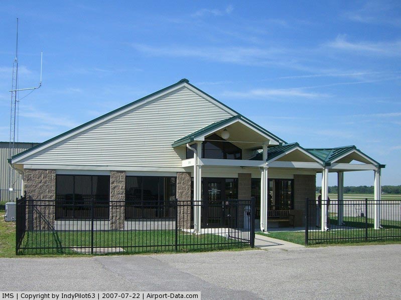
(Click on the photo to enlarge) |
|
 |
(Click on the photo to enlarge) |
|
 |
(Click on the photo to enlarge) |
|
 |
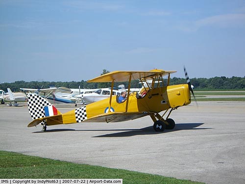
(Click on the photo to enlarge) |
Location
& QuickFacts
|
FAA
Information Effective: |
2008-06-05 |
|
Airport
Identifier: |
IMS |
|
Airport
Status: |
Operational |
|
Longitude/Latitude: |
085-27-52.9000W/38-45-35.7000N
-85.464694/38.759917 (Estimated) |
|
Elevation: |
819 ft / 249.63 m (Surveyed) |
|
Land: |
174 acres |
|
From nearest
city: |
4 nautical miles W of Madison, IN |
|
Location: |
Jefferson County, IN |
|
Magnetic
Variation: |
03W (1995) |
Owner
& Manager
|
Ownership: |
Publicly
owned |
|
Owner: |
Madison Boac |
|
Address: |
101 W. Main St.
Madison,
IN 47250 |
|
Phone
number: |
812-273-1914 |
|
Manager: |
Fred Wilkerson |
|
Address: |
3919 W. Ims Lane
Madison,
IN 47250 |
|
Phone
number: |
812-273-1914 |
Airport Operations
and Facilities
|
Airport
Use: |
Open
to public |
|
Wind indicator: |
Yes |
|
Segmented
Circle: |
No |
|
Control
Tower: |
No |
|
Lighting
Schedule: |
DUSK-DAWN
ACTVT HIRL RY 03/21 - CTAF. |
|
Beacon
Color: |
Clear-Green (lighted land airport) |
|
Landing
fee charge: |
No |
|
Sectional
chart: |
St Louis |
|
Region: |
AGL - Great Lakes |
|
Boundary
ARTCC: |
ZID - Indianapolis |
|
Tie-in
FSS: |
HUF - Terre Haute |
|
FSS on
Airport: |
No |
|
FSS Toll
Free: |
1-800-WX-BRIEF |
|
NOTAMs
Facility: |
LOU (NOTAM-d service avaliable) |
|
Federal
Agreements: |
NGY |
Airport Communications
|
CTAF: |
123.000 |
|
Unicom: |
123.000
|
Airport
Services
|
Runway Information
Runway 03/21
|
Dimension: |
5000 x 75 ft
/ 1524.0 x 22.9 m |
|
Surface: |
ASPH, Good Condition |
|
Weight Limit: |
Single wheel: 30000 lbs. |
|
Edge Lights: |
High |
|
|
Runway 03 |
Runway 21 |
|
Longitude: |
085-28-09.5192W |
085-27-36.2950W |
|
Latitude: |
38-45-14.6400N |
38-45-56.6668N |
|
Elevation: |
807.00 ft |
819.00 ft |
|
Alignment: |
31 |
127 |
|
Traffic
Pattern: |
Left |
Left |
|
Markings: |
Basic, Good Condition |
Basic, Good Condition |
|
Crossing
Height: |
48.00 ft |
40.00 ft |
|
Displaced
threshold: |
258.00 ft |
318.00 ft |
|
VASI: |
2-light PAPI on left side |
2-light PAPI on left side |
|
Visual Glide
Angle: |
3.00° |
3.00° |
|
Runway End
Identifier: |
Yes |
Yes |
|
Centerline
Lights: |
No |
No |
|
Touchdown
Lights: |
No |
No |
|
Obstruction: |
73 ft trees, 2100.0 ft from runway, 26:1 slope
to clear |
90 ft trees, 2200.0 ft from runway, 22:1 slope
to clear |
|
Radio Navigation
Aids
|
ID |
Type |
Name |
Ch |
Freq |
Var |
Dist |
|
IMS |
NDB |
Madison |
|
404.00 |
03W |
0.2 nm |
|
OVO |
NDB |
North Vernon |
|
374.00 |
02W |
18.6 nm |
|
EQZ |
NDB |
Captain |
|
308.00 |
02W |
24.7 nm |
|
UR |
NDB |
Burln |
|
321.00 |
04W |
36.6 nm |
|
HLB |
NDB |
Batesville |
|
254.00 |
02W |
36.7 nm |
|
BA |
NDB |
Clifs |
|
410.00 |
03W |
37.6 nm |
|
FEU |
NDB |
Arnold |
|
521.00 |
03W |
44.7 nm |
|
BFR |
NDB |
Bedford |
|
344.00 |
02W |
45.8 nm |
|
FFT |
VOR |
Frankfort |
|
109.40 |
03W |
43.5 nm |
|
BQM |
VOR/DME |
Bowman |
059X |
112.20 |
01W |
33.2 nm |
|
ABB |
VORTAC |
Nabb |
071X |
112.40 |
01E |
13.1 nm |
|
CVG |
VORTAC |
Cincinnati |
120X |
117.30 |
04W |
38.8 nm |
|
IIU |
VORTAC |
Louisville |
095X |
114.80 |
01E |
39.8 nm |
|
SDF |
VOT |
Louisville Standifd |
|
111.00 |
|
37.2 nm |
Remarks
- GCO
AVBL ON FREQ 121.725 THRU SDF CLNC AND FLIGHT SERVICES.
- IFR
CLNC NOT AVBL WHEN R-3403 IS ACTIVE.
Based Aircraft
|
Aircraft
based on field: |
52 |
|
Single Engine
Airplanes: |
47 |
|
Multi Engine Airplanes: |
4 |
|
Jet Engine Airplanes: |
1 |
Operational Statistics
Time
Period: 2005-08-05 - 2006-08-04
|
Aircraft
Operations: |
121/Day |
|
Air Taxi: |
16.0% |
|
General Aviation
Local: |
56.0% |
|
General Aviation
Itinerant: |
24.0% |
|
Military: |
4.0% |
Madison Municipal Airport
Address:
Jefferson County, IN
Tel:
812-273-1914
Images
and information placed above are from
http://www.airport-data.com/airport/IMS/
We
thank them for the data!
| General
Info |
| Country |
United
States |
| State |
INDIANA
|
| FAA ID |
IMS |
| Latitude |
38-45-32.000N
|
| Longitude |
085-27-55.900W
|
| Elevation |
817 feet
|
| Near City |
MADISON
|
We don't guarantee the information is fresh and accurate. The data may
be wrong or outdated.
For more up-to-date information please refer to other sources.
|
|