|
|
|
 |
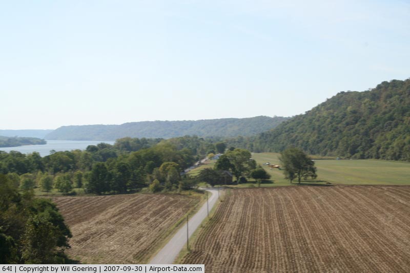
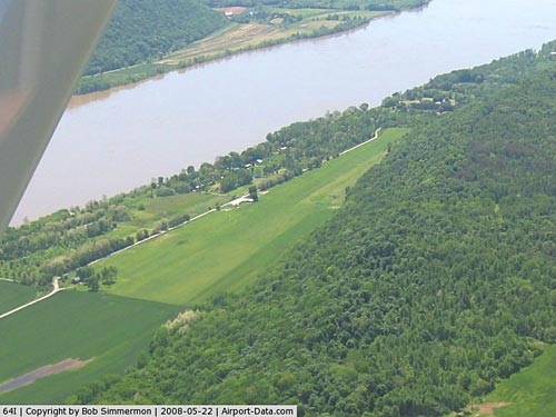
(Click on the photo to enlarge) |
|
 |
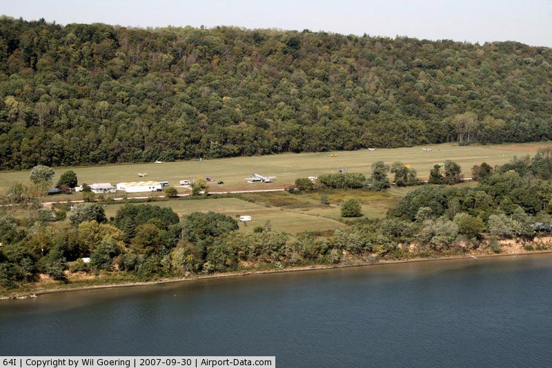
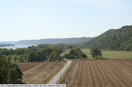
(Click on the photo to enlarge) |
|
 |
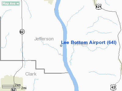
(Click on the photo to enlarge) |
|
 |
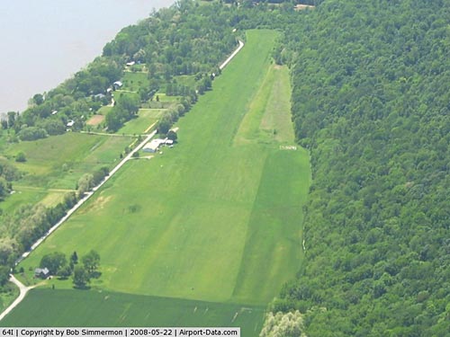
(Click on the photo to enlarge) |
Location
& QuickFacts
|
FAA
Information Effective: |
2008-06-05 |
|
Airport
Identifier: |
64I |
|
Airport
Status: |
Operational |
|
Longitude/Latitude: |
085-26-36.3100W/38-37-53.1900N
-85.443419/38.631442 (Estimated) |
|
Elevation: |
470 ft / 143.26 m (Estimated) |
|
Land: |
42 acres |
|
From nearest
city: |
6 nautical miles S of Hanover, IN |
|
Location: |
Jefferson County, IN |
|
Magnetic
Variation: |
02W (1985) |
Owner
& Manager
|
Ownership: |
Privately
owned |
|
Owner: |
Rich Davidson |
|
Address: |
7296 S River Bottom Road
Hanover,
IN 47243 |
|
Phone
number: |
812-866-3211 |
|
Manager: |
Ginger Davidson |
|
Address: |
7296 S River Bottom Road
Hanover,
IN 47243 |
|
Phone
number: |
812-866-3211 |
Airport Operations
and Facilities
|
Airport
Use: |
Open
to public |
|
Wind indicator: |
Yes |
|
Segmented
Circle: |
Yes |
|
Control
Tower: |
No |
|
Sectional
chart: |
St Louis |
|
Region: |
AGL - Great Lakes |
|
Boundary
ARTCC: |
ZID - Indianapolis |
|
Tie-in
FSS: |
HUF - Terre Haute |
|
FSS Toll
Free: |
1-800-WX-BRIEF |
|
NOTAMs
Facility: |
HUF (NOTAM-d service avaliable) |
Airport Communications
|
Runway Information
Runway 18/36
|
Dimension: |
4080 x 100 ft
/ 1243.6 x 30.5 m |
|
Surface: |
TURF, Good Condition |
|
|
Runway 18 |
Runway 36 |
|
Longitude: |
085-26-40.2400W |
085-26-32.3800W |
|
Latitude: |
38-38-13.1200N |
38-37-33.2600N |
|
Elevation: |
473.00 ft |
464.00 ft |
|
Traffic
Pattern: |
Left |
Right |
|
Displaced
threshold: |
0.00 ft |
800.00 ft |
|
Obstruction: |
64 ft trees, 2000.0 ft from runway, 31:1 slope
to clear
RWY 18 APCH SLOPE 34:1 AT THLD. |
45 ft trees, 100.0 ft from runway, 2:1 slope
to clear
APCH SLOPE 20:1 AT THLD. |
|
Radio Navigation
Aids
|
ID |
Type |
Name |
Ch |
Freq |
Var |
Dist |
|
IMS |
NDB |
Madison |
|
404.00 |
03W |
7.8 nm |
|
OVO |
NDB |
North Vernon |
|
374.00 |
02W |
26.2 nm |
|
EQZ |
NDB |
Captain |
|
308.00 |
02W |
28.6 nm |
|
FEU |
NDB |
Arnold |
|
521.00 |
03W |
38.6 nm |
|
UR |
NDB |
Burln |
|
321.00 |
04W |
40.1 nm |
|
HLB |
NDB |
Batesville |
|
254.00 |
02W |
44.0 nm |
|
BA |
NDB |
Clifs |
|
410.00 |
03W |
45.1 nm |
|
BRY |
NDB |
Bardstown/dcmsnd |
|
248.00 |
02W |
47.1 nm |
|
GOI |
NDB |
Godman |
|
396.00 |
02W |
47.6 nm |
|
BFR |
NDB |
Bedford |
|
344.00 |
02W |
48.2 nm |
|
FFT |
VOR |
Frankfort |
|
109.40 |
03W |
36.9 nm |
|
BQM |
VOR/DME |
Bowman |
059X |
112.20 |
01W |
26.3 nm |
|
ABB |
VORTAC |
Nabb |
071X |
112.40 |
01E |
9.4 nm |
|
IIU |
VORTAC |
Louisville |
095X |
114.80 |
01E |
32.4 nm |
|
CVG |
VORTAC |
Cincinnati |
120X |
117.30 |
04W |
41.7 nm |
|
SDF |
VOT |
Louisville Standifd |
|
111.00 |
|
30.6 nm |
Remarks
- RY
18/36 HAS A 30 FT DROPOFF AT SOUTH END OF RY.
- RY
18/36, 5-10 FT DROPOFF 25 FT EACH SIDE OF RY, STHRN 1700 FT.
- PRVDD
OBSTN LOWERED/CLRD OR DSPLD THLD; AREA 125 FT FM CNTRLN & 200 FT
OFF ENDS IS CLEAR; AREA 60 FT FM CNTRLN & 240 FT OFF ENDS HAS NO
SFC HAZARDS.
Based Aircraft
|
Aircraft
based on field: |
1 |
|
Single Engine
Airplanes: |
1 |
Operational Statistics
Time
Period: 2005-02-28 - 2006-02-27
|
Aircraft
Operations: |
29/Month |
|
General Aviation
Local: |
70.8% |
|
General Aviation
Itinerant: |
29.2% |
Lee Bottom Airport
Address:
Jefferson County, IN
Tel:
812-866-3211
Images
and information placed above are from
http://www.airport-data.com/airport/64I/
We
thank them for the data!
| General
Info |
| Country |
United
States |
| State |
INDIANA
|
| FAA ID |
64I |
| Latitude |
38-37-52.220N
|
| Longitude |
085-26-36.851W
|
| Elevation |
470 feet
|
| Near City |
HANOVER
|
We don't guarantee the information is fresh and accurate. The data may
be wrong or outdated.
For more up-to-date information please refer to other sources.
|
|