 |
|
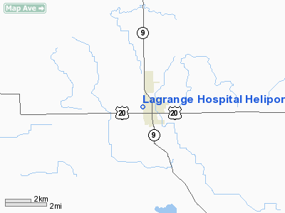
Lagrange Hospital Heliport |
Location
& QuickFacts
|
FAA
Information Effective: |
2008-06-05 |
|
Airport
Identifier: |
08II |
|
Airport
Status: |
Operational |
|
Longitude/Latitude: |
085-25-34.9290W/41-38-45.1800N
-85.426369/41.645883 (Estimated) |
|
Elevation: |
943 ft / 287.43 m (Estimated) |
|
Land: |
0 acres |
|
From nearest
city: |
0 nautical miles E of Lagrange, IN |
|
Location: |
Lagrange County, IN |
|
Magnetic
Variation: |
03W (1990) |
Owner & Manager
|
Ownership: |
Privately
owned |
|
Owner: |
Vencor Hospital Lagrange |
|
Address: |
0300 N 00ew
Lagrange, IN 46761 |
|
Phone
number: |
219-463-2143 |
|
Manager: |
Joseph A. Stuber |
|
Address: |
0300 N 00ew
Lagrange, IN 46761 |
|
Phone
number: |
219-463-2143 |
Airport
Operations and Facilities
|
Airport
Use: |
Private |
|
Segmented
Circle: |
No |
|
Control
Tower: |
No |
|
Sectional
chart: |
Chicago |
|
Region: |
AGL - Great Lakes |
|
Boundary
ARTCC: |
ZAU - Chicago |
|
Tie-in
FSS: |
HUF - Terre Haute |
|
FSS Toll
Free: |
1-800-WX-BRIEF |
|
Runway Information
Helipad H1
|
Dimension: |
30 x 30 ft /
9.1 x 9.1 m |
|
Surface: |
CONC, |
|
|
Runway H1 |
Runway |
|
Traffic
Pattern: |
Left |
Left |
|
Radio Navigation
Aids
|
ID |
Type |
Name |
Ch |
Freq |
Var |
Dist |
|
IRS |
NDB |
Sturgis |
|
382.00 |
04W |
10.1 nm |
|
ANQ |
NDB |
Angola |
|
347.00 |
05W |
15.3 nm |
|
HAI |
NDB |
Three Rivers |
|
407.00 |
02W |
20.2 nm |
|
BYN |
NDB |
Bryan |
|
260.00 |
04W |
44.3 nm |
|
BT |
NDB |
Batol |
|
272.00 |
04W |
44.4 nm |
|
HHG |
NDB |
Huntington |
|
417.00 |
03W |
47.5 nm |
|
DFI |
NDB |
Defiance |
|
246.00 |
05W |
48.7 nm |
|
RCR |
NDB |
Rochester |
|
216.00 |
03W |
49.1 nm |
|
OLK |
VOR |
Wolf Lake |
|
110.40 |
03W |
24.2 nm |
|
AZO |
VOR/DME |
Kalamazoo |
027X |
109.00 |
01W |
36.0 nm |
|
LFD |
VOR/DME |
Litchfield |
049X |
111.20 |
05W |
38.8 nm |
|
ELX |
VOR/DME |
Keeler |
113X |
116.60 |
00E |
43.2 nm |
|
GSH |
VORTAC |
Goshen |
084X |
113.70 |
00E |
28.0 nm |
|
BTL |
VORTAC |
Battle Creek |
031X |
109.40 |
02W |
40.7 nm |
|
GIJ |
VORTAC |
Gipper |
101X |
115.40 |
00E |
40.7 nm |
|
FWA |
VORTAC |
Fort Wayne |
125X |
117.80 |
00E |
41.5 nm |
|
FWA |
VOT |
Fort Wayne Baer |
|
111.00 |
|
41.5 nm |
Remarks
- PRVDD
ALL APCH/DEP OPS 250-305 DEGS & 355-085 DEGS; TAKEOFF/LDG AREA APPROPRIATELY
MKD & HOSPITAL TWR OBSTN LGTD FOR NGT OPS; NON-OBSTRUCTING WIND
INDICATOR MAINTAINED.
Lagrange Hospital Heliport
Address:
Lagrange County, IN
Tel:
219-463-2143
Images
and information placed above are from
http://www.airport-data.com/airport/08II/
We
thank them for the data!
| General
Info |
| Country |
United
States |
| State |
INDIANA
|
| FAA ID |
08II |
| Latitude |
41-38-45.180N
|
| Longitude |
085-25-34.929W
|
| Elevation |
943 feet
|
| Near City |
LAGRANGE
|
We don't guarantee the information is fresh and accurate. The data may
be wrong or outdated.
For more up-to-date information please refer to other sources.
|
|


