 |
|
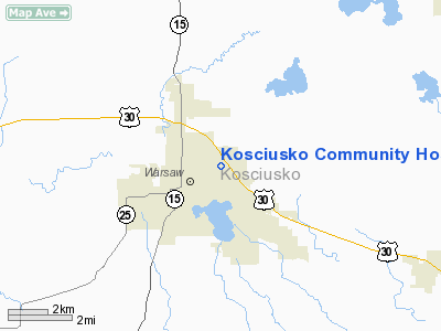
Kosciusko Community Hospital Heliport |
Location
& QuickFacts
|
FAA
Information Effective: |
2008-06-05 |
|
Airport
Identifier: |
84IN |
|
Airport
Status: |
Operational |
|
Longitude/Latitude: |
085-49-44.0000W/41-14-52.0000N
-85.828889/41.247778 (Estimated) |
|
Elevation: |
839 ft / 255.73 m (Estimated) |
|
Land: |
0 acres |
|
From nearest
city: |
0 nautical miles E of Warsaw, IN |
|
Location: |
Kosciusko County, IN |
|
Magnetic
Variation: |
03W (1995) |
Owner
& Manager
|
Ownership: |
Privately
owned |
|
Owner: |
Warsaw Health System Llc |
|
Address: |
2101 E Dubois Dr
Warsaw,
IN 46580 |
|
Phone
number: |
219-267-3200 |
|
Manager: |
Siobhan Davenport |
|
Address: |
2101 E Dubois Dr
Warsaw,
IN 46580 |
|
Phone
number: |
219-267-3200 |
Airport Operations
and Facilities
|
Airport
Use: |
Private
MEDICAL USE. |
|
Segmented
Circle: |
No |
|
Control
Tower: |
No |
|
Lighting
Schedule: |
DUSK-DAWN |
|
Sectional
chart: |
Chicago |
|
Region: |
AGL - Great Lakes |
|
Boundary
ARTCC: |
ZAU - Chicago |
|
Tie-in
FSS: |
HUF - Terre Haute |
|
FSS on
Airport: |
No |
|
FSS Toll
Free: |
1-800-WX-BRIEF |
|
Runway Information
Helipad H1
|
Dimension: |
50 x 50 ft /
15.2 x 15.2 m |
|
Surface: |
CONC, |
|
|
Runway H1 |
Runway |
|
Traffic
Pattern: |
Left |
Left |
|
Radio Navigation
Aids
|
ID |
Type |
Name |
Ch |
Freq |
Var |
Dist |
|
RCR |
NDB |
Rochester |
|
216.00 |
03W |
19.7 nm |
|
CPB |
NDB |
Culver |
|
391.00 |
01W |
25.2 nm |
|
HHG |
NDB |
Huntington |
|
417.00 |
03W |
28.8 nm |
|
IWH |
NDB |
Wabash |
|
329.00 |
03W |
29.1 nm |
|
RWN |
NDB |
Winamac/dcmsnd |
|
335.00 |
00W |
36.3 nm |
|
IRS |
NDB |
Sturgis |
|
382.00 |
04W |
38.4 nm |
|
GGP |
NDB |
Logansport |
|
263.00 |
01W |
40.7 nm |
|
ANQ |
NDB |
Angola |
|
347.00 |
05W |
40.9 nm |
|
HAI |
NDB |
Three Rivers |
|
407.00 |
02W |
44.0 nm |
|
IUL |
NDB |
La Porte |
|
356.00 |
03W |
45.1 nm |
|
VP |
NDB |
Sedly |
|
212.00 |
02W |
48.9 nm |
|
OLK |
VOR |
Wolf Lake |
|
110.40 |
03W |
15.0 nm |
|
OXI |
VOR/DME |
Knox |
103X |
115.60 |
00E |
37.3 nm |
|
MZZ |
VOR/DME |
Marion |
023X |
108.60 |
03W |
45.9 nm |
|
GSH |
VORTAC |
Goshen |
084X |
113.70 |
00E |
18.9 nm |
|
FWA |
VORTAC |
Fort Wayne |
125X |
117.80 |
00E |
33.2 nm |
|
GIJ |
VORTAC |
Gipper |
101X |
115.40 |
00E |
38.3 nm |
|
GUS |
VORTAC |
Grissom |
21Y |
108.45 |
02W |
39.1 nm |
|
OKK |
VORTAC |
Kokomo |
082X |
113.50 |
00E |
44.5 nm |
|
FWA |
VOT |
Fort Wayne Baer |
|
111.00 |
|
33.1 nm |
Remarks
- PRVDD
ALL APCH/DEP FM 055 CLOCKWISE TO 125 & 255 TO 360; AREA IS MKD &
PLINE TO THE WEST BE BALL MKD; WIND INDICATOR IS MAINTAINED; PILOTS
CTC FT WAYNE APCH CTL PRIOR TO OPNS.
Kosciusko Community Hospital Heliport
Address:
Kosciusko County, IN
Tel:
219-267-3200
Images
and information placed above are from
http://www.airport-data.com/airport/84IN/
We
thank them for the data!
| General
Info |
| Country |
United
States |
| State |
INDIANA
|
| FAA ID |
84IN |
| Latitude |
41-14-52.000N
|
| Longitude |
085-49-44.000W
|
| Elevation |
839 feet
|
| Near City |
WARSAW
|
We don't guarantee the information is fresh and accurate. The data may
be wrong or outdated.
For more up-to-date information please refer to other sources.
|
|


