 |
|
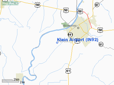
Location
& QuickFacts
|
FAA
Information Effective: |
2008-06-05 |
|
Airport
Identifier: |
IN92 |
|
Airport
Status: |
Operational |
|
Longitude/Latitude: |
087-33-49.0810W/38-39-10.1690N
-87.563634/38.652825 (Estimated) |
|
Elevation: |
412 ft / 125.58 m (Estimated) |
|
Land: |
8 acres |
|
From nearest
city: |
2 nautical miles SW of Vincennes, IN |
|
Location: |
Knox County, IN |
|
Magnetic
Variation: |
00W (1985) |
Owner & Manager
|
Ownership: |
Privately
owned |
|
Owner: |
Lawrence J. Vieck |
|
Address: |
450 Henderson Rd
Vincennes,
IN 47591 |
|
Phone
number: |
812-886-5339 |
|
Address: |
|
Airport Operations
and Facilities
|
Airport Use: |
Private |
|
Wind
indicator: |
Yes |
|
Segmented
Circle: |
No |
|
Control
Tower: |
No |
|
Landing
fee charge: |
No |
|
Sectional
chart: |
St Louis |
|
Region: |
AGL - Great Lakes |
|
Boundary
ARTCC: |
ZID - Indianapolis |
|
Tie-in
FSS: |
HUF - Terre Haute |
|
FSS on
Airport: |
No |
|
FSS Toll
Free: |
1-800-WX-BRIEF |
Airport Services
|
Airframe
Repair: |
NONE |
|
Power
Plant Repair: |
NONE |
|
Runway Information
Runway 06/24
|
Dimension: |
2600 x 100 ft
/ 792.5 x 30.5 m |
|
Surface: |
TURF, |
|
|
Runway 06 |
Runway 24 |
|
Traffic
Pattern: |
Right |
Left |
|
Obstruction: |
|
15 ft pline, 151.0 ft from runway |
|
Radio Navigation
Aids
|
ID |
Type |
Name |
Ch |
Freq |
Var |
Dist |
|
OEA |
NDB |
Vincennes |
|
251.00 |
00E |
2.4 nm |
|
AJG |
NDB |
Mount Carmel |
|
524.00 |
02W |
8.0 nm |
|
DCY |
NDB |
Washington |
|
212.00 |
03W |
20.4 nm |
|
PLX |
NDB |
Palestine |
|
391.00 |
00W |
22.0 nm |
|
SIV |
NDB |
Sullivan |
|
326.00 |
02W |
28.2 nm |
|
OLY |
NDB |
Olney |
|
272.00 |
00W |
28.9 nm |
|
PDW |
NDB |
Evansville |
|
284.00 |
00E |
36.9 nm |
|
FOA |
NDB |
Elm River |
|
353.00 |
00E |
41.8 nm |
|
FNZ |
NDB |
Ferdinand |
|
239.00 |
00E |
41.9 nm |
|
CUL |
NDB |
Carmi |
|
332.00 |
01W |
42.6 nm |
|
FWC |
NDB |
Wayne County |
|
257.00 |
01E |
43.0 nm |
|
CZB |
NDB |
Casey |
|
359.00 |
00E |
44.2 nm |
|
HU |
NDB |
Yinno |
|
245.00 |
02W |
44.9 nm |
|
RRJ |
NDB |
Oranj |
|
368.00 |
02W |
49.2 nm |
|
LWV |
VOR/DME |
Lawrenceville |
025X |
108.80 |
01W |
7.3 nm |
|
RSV |
VOR/DME |
Robinson |
021X |
108.40 |
02E |
22.3 nm |
|
SAM |
VOR/DME |
Samsville |
113X |
116.60 |
03E |
26.5 nm |
|
HNB |
VOR/DME |
Huntingburg |
029X |
109.20 |
00E |
37.4 nm |
|
PXV |
VORTAC |
Pocket City |
080X |
113.30 |
03E |
44.5 nm |
|
BIB |
VORTAC |
Bible Grove |
027X |
109.00 |
03E |
45.9 nm |
Based Aircraft
|
Aircraft
based on field: |
2 |
|
Single Engine
Airplanes: |
2 |
Klein Airport
Address:
Knox County, IN
Tel:
812-886-5339
Images
and information placed above are from
http://www.airport-data.com/airport/IN92/
We
thank them for the data!
| General
Info |
| Country |
United
States |
| State |
INDIANA
|
| FAA ID |
IN92 |
| Latitude |
38-39-10.169N
|
| Longitude |
087-33-49.081W
|
| Elevation |
412 feet
|
| Near City |
VINCENNES
|
We don't guarantee the information is fresh and accurate. The data may
be wrong or outdated.
For more up-to-date information please refer to other sources.
|
|


