 |
|
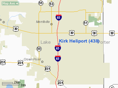
Location
& QuickFacts
|
FAA
Information Effective: |
2008-06-05 |
|
Airport
Identifier: |
43II |
|
Airport
Status: |
Operational |
|
Longitude/Latitude: |
087-19-08.1270W/41-27-08.1310N
-87.318924/41.452259 (Estimated) |
|
Elevation: |
710 ft / 216.41 m (Estimated) |
|
Land: |
2 acres |
|
From nearest
city: |
2 nautical miles SE of Merrillville, IN |
|
Location: |
Lake County, IN |
|
Magnetic
Variation: |
01W (1985) |
Owner
& Manager
|
Ownership: |
Privately
owned |
|
Owner: |
Kirk Leasing Corp |
|
Address: |
3313 East 83rd Place
Merrillville, IN 46410 |
|
Phone
number: |
219-942-0044 |
|
Manager: |
Joseph T Kirk |
|
Address: |
6670 E 85th Ct
Merrillville, IN 46410 |
|
Phone
number: |
219-942-2262 |
Airport
Operations and Facilities
|
Airport Use: |
Private |
|
Wind
indicator: |
Yes |
|
Segmented
Circle: |
No |
|
Control
Tower: |
No |
|
Lighting
Schedule: |
DUSK-DAWN |
|
Sectional
chart: |
Chicago |
|
Region: |
AGL - Great Lakes |
|
Boundary
ARTCC: |
ZAU - Chicago |
|
Tie-in
FSS: |
HUF - Terre Haute |
|
FSS
Toll Free: |
1-800-WX-BRIEF |
Airport
Communications
|
Runway Information
Helipad H1
|
Dimension: |
20 x 20 ft /
6.1 x 6.1 m |
|
Surface: |
CONC, |
|
|
Runway H1 |
Runway |
|
Traffic
Pattern: |
Left |
Left |
|
Markings: |
Basic, |
, |
|
Radio Navigation
Aids
|
ID |
Type |
Name |
Ch |
Freq |
Var |
Dist |
|
VP |
NDB |
Sedly |
|
212.00 |
02W |
19.9 nm |
|
MX |
NDB |
Kedzi |
|
248.00 |
01W |
24.1 nm |
|
IUL |
NDB |
La Porte |
|
356.00 |
03W |
24.8 nm |
|
MGC |
NDB |
Michigan City |
|
203.00 |
01W |
27.3 nm |
|
HK |
NDB |
Ermin |
|
332.00 |
01W |
28.3 nm |
|
RZL |
NDB |
Rensselaer |
|
362.00 |
02W |
31.0 nm |
|
RWN |
NDB |
Winamac/dcmsnd |
|
335.00 |
00W |
38.8 nm |
|
ME |
NDB |
Deana |
|
350.00 |
00E |
44.4 nm |
|
CPB |
NDB |
Culver |
|
391.00 |
01W |
44.5 nm |
|
OXI |
VOR/DME |
Knox |
103X |
115.60 |
00E |
31.2 nm |
|
IKK |
VOR/DME |
Kankakee |
053X |
111.60 |
00E |
33.0 nm |
|
ORD |
VOR/DME |
Chicago O'hare |
086X |
113.90 |
02E |
41.6 nm |
|
CGT |
VORTAC |
Chicago Heights |
089X |
114.20 |
02E |
11.9 nm |
|
EON |
VORTAC |
Peotone |
079X |
113.20 |
02E |
24.0 nm |
|
JOT |
VORTAC |
Joliet |
070X |
112.30 |
02E |
45.4 nm |
|
GIJ |
VORTAC |
Gipper |
101X |
115.40 |
00E |
48.8 nm |
|
MDW |
VOT |
Chicago Midway |
|
111.00 |
|
28.0 nm |
|
ORD |
VOT |
Chicago O'hare Intl |
|
112.00 |
|
41.4 nm |
Remarks
- PRVDD
OPERS ARE COND FM 060 TO 120 DEG & FM 300 TO 360 DEG; AREA IS MKD;
WND IND IS MAINTAINED.
Based Aircraft
|
Aircraft
based on field: |
1 |
|
Helicopters: |
1 |
Kirk Heliport
Address:
Lake County, IN
Tel:
219-942-0044,
219-942-2262
Images
and information placed above are from
http://www.airport-data.com/airport/43II/
We
thank them for the data!
| General
Info |
| Country |
United
States |
| State |
INDIANA
|
| FAA ID |
43II |
| Latitude |
41-27-08.131N
|
| Longitude |
087-19-08.127W
|
| Elevation |
710 feet
|
| Near City |
MERRILLVILLE
|
We don't guarantee the information is fresh and accurate. The data may
be wrong or outdated.
For more up-to-date information please refer to other sources.
|
|


