 |
|
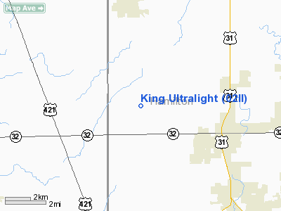
Location
& QuickFacts
|
FAA
Information Effective: |
2008-06-05 |
|
Airport
Identifier: |
02II |
|
Airport
Status: |
Operational |
|
Longitude/Latitude: |
086-12-37.9710W/40-03-44.1360N
-86.210548/40.062260 (Estimated) |
|
Elevation: |
925 ft / 281.94 m (Estimated) |
|
Land: |
40 acres |
|
From nearest
city: |
4 nautical miles NW of Westfield, IN |
|
Location: |
Hamilton County, IN |
|
Magnetic
Variation: |
02W (1990) |
Owner
& Manager
|
Ownership: |
Privately
owned |
|
Owner: |
Michael E King |
|
Address: |
19101 Centenial Rd
Westfield, IN 46074 |
|
Phone
number: |
317-896-5381 |
|
Manager: |
Michael E King |
|
Address: |
191101 Centenial Rd
Westfield, IN 46074 |
|
Phone
number: |
317-896-5281 |
Airport
Operations and Facilities
|
Airport
Use: |
Private |
|
Wind indicator: |
Yes |
|
Segmented
Circle: |
No |
|
Control
Tower: |
No |
|
Sectional
chart: |
Chicago |
|
Region: |
AGL - Great Lakes |
|
Boundary
ARTCC: |
ZAU - Chicago |
|
Tie-in
FSS: |
HUF - Terre Haute |
|
FSS Toll
Free: |
1-800-WX-BRIEF |
|
Runway Information
Runway 10/28
|
Dimension: |
1100 x 100 ft
/ 335.3 x 30.5 m |
|
Surface: |
TURF, |
|
|
Runway 10 |
Runway 28 |
|
Traffic
Pattern: |
Left |
Left |
|
Displaced
threshold: |
200.00 ft |
0.00 ft |
|
Obstruction: |
15 ft road, 100.0 ft from runway |
|
|
Radio Navigation
Aids
|
ID |
Type |
Name |
Ch |
Freq |
Var |
Dist |
|
HZP |
NDB |
Zionsville |
|
248.00 |
03W |
7.6 nm |
|
UMP |
NDB |
Metropolitan |
|
338.00 |
03W |
10.5 nm |
|
FKR |
NDB |
Frankfort |
|
278.00 |
02W |
20.5 nm |
|
HFY |
NDB |
Greenwood |
|
398.00 |
02W |
26.4 nm |
|
AI |
NDB |
Video |
|
371.00 |
03W |
32.2 nm |
|
CFJ |
NDB |
Crawfordsville |
|
388.00 |
02W |
32.8 nm |
|
TVX |
NDB |
Greencastle |
|
521.00 |
03W |
34.5 nm |
|
GGP |
NDB |
Logansport |
|
263.00 |
01W |
39.6 nm |
|
UWL |
NDB |
New Castle |
|
385.00 |
02W |
42.5 nm |
|
IWH |
NDB |
Wabash |
|
329.00 |
03W |
46.2 nm |
|
MCX |
NDB |
White County |
|
377.00 |
03W |
46.4 nm |
|
BA |
NDB |
Clifs |
|
410.00 |
03W |
48.0 nm |
|
MZZ |
VOR/DME |
Marion |
023X |
108.60 |
03W |
35.6 nm |
|
MIE |
VOR/DME |
Muncie |
091X |
114.40 |
03W |
39.0 nm |
|
VHP |
VORTAC |
Brickyard |
110X |
116.30 |
01E |
16.5 nm |
|
OKK |
VORTAC |
Kokomo |
082X |
113.50 |
00E |
28.8 nm |
|
SHB |
VORTAC |
Shelbyville |
057X |
112.00 |
01E |
31.4 nm |
|
GUS |
VORTAC |
Grissom |
21Y |
108.45 |
02W |
35.1 nm |
|
BVT |
VORTAC |
Boiler |
098X |
115.10 |
01E |
49.3 nm |
|
IND |
VOT |
Indianapolis Intl |
|
109.60 |
|
20.6 nm |
Remarks
- PRVDD
OBSTRUCTIONS REMOVED/LOWERED OR THR DSPLCD TO PROVIDE 20:1 CLEARANCE;
ALL OPERATIONS E OF CENTENNIAL RD.
Based Aircraft
|
Aircraft
based on field: |
1 |
|
Ultralights: |
1 |
King Ultralight
Address:
Hamilton County, IN
Tel:
317-896-5381,
317-896-5281
Images
and information placed above are from
http://www.airport-data.com/airport/02II/
We
thank them for the data!
| General
Info |
| Country |
United
States |
| State |
INDIANA
|
| FAA ID |
02II |
| Latitude |
40-03-44.136N
|
| Longitude |
086-12-37.971W
|
| Elevation |
925 feet
|
| Near City |
WESTFIELD
|
We don't guarantee the information is fresh and accurate. The data may
be wrong or outdated.
For more up-to-date information please refer to other sources.
|
|


