 |
|
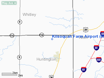
Location
& QuickFacts
|
FAA
Information Effective: |
2008-06-05 |
|
Airport
Identifier: |
8IS2 |
|
Airport
Status: |
Operational |
|
Longitude/Latitude: |
085-23-20.0000W/40-59-52.0000N
-85.388889/40.997778 (Estimated) |
|
Elevation: |
840 ft / 256.03 m (Estimated) |
|
Land: |
0 acres |
|
From nearest
city: |
3 nautical miles N of Roanoke, IN |
|
Location: |
Huntington County, IN |
|
Magnetic
Variation: |
() |
Owner
& Manager
|
Ownership: |
Privately
owned |
|
Owner: |
Kirk E. Masten |
|
Address: |
11677 N 300 E
Roanoke, IN 46783 |
|
Phone
number: |
260-672-2890 |
|
Manager: |
Kirk E. Masten |
|
Address: |
11677 N 300 E
Roanoke, IN 46783 |
|
Phone
number: |
260-672-2890 |
Airport
Operations and Facilities
|
Airport
Use: |
Private |
|
Control
Tower: |
No |
|
Sectional
chart: |
Chicago |
|
Region: |
AGL - Great Lakes |
|
Boundary
ARTCC: |
ZAU - Chicago |
|
Tie-in
FSS: |
HUF - Terre Haute |
|
FSS Toll
Free: |
1-800-WX-BRIEF |
|
Runway Information
Runway 09/27
|
Dimension: |
2000 x 55 ft
/ 609.6 x 16.8 m |
|
Surface: |
TURF, |
|
|
Runway 09 |
Runway 27 |
|
Traffic
Pattern: |
Right |
Left |
|
Radio Navigation
Aids
|
ID |
Type |
Name |
Ch |
Freq |
Var |
Dist |
|
HHG |
NDB |
Huntington |
|
417.00 |
03W |
9.2 nm |
|
IWH |
NDB |
Wabash |
|
329.00 |
03W |
23.3 nm |
|
VFU |
NDB |
Stanley |
|
411.00 |
05W |
36.1 nm |
|
RCR |
NDB |
Rochester |
|
216.00 |
03W |
36.6 nm |
|
PLD |
NDB |
Portland |
|
257.00 |
03W |
37.6 nm |
|
ANQ |
NDB |
Angola |
|
347.00 |
05W |
40.9 nm |
|
CPB |
NDB |
Culver |
|
391.00 |
01W |
47.0 nm |
|
DFI |
NDB |
Defiance |
|
246.00 |
05W |
48.0 nm |
|
GGP |
NDB |
Logansport |
|
263.00 |
01W |
48.0 nm |
|
CQA |
NDB |
Lakefield |
|
205.00 |
04W |
48.7 nm |
|
IRS |
NDB |
Sturgis |
|
382.00 |
04W |
49.1 nm |
|
OLK |
VOR |
Wolf Lake |
|
110.40 |
03W |
15.8 nm |
|
MZZ |
VOR/DME |
Marion |
023X |
108.60 |
03W |
33.1 nm |
|
MIE |
VOR/DME |
Muncie |
091X |
114.40 |
03W |
45.7 nm |
|
FWA |
VORTAC |
Fort Wayne |
125X |
117.80 |
00E |
9.2 nm |
|
GUS |
VORTAC |
Grissom |
21Y |
108.45 |
02W |
40.7 nm |
|
OKK |
VORTAC |
Kokomo |
082X |
113.50 |
00E |
41.5 nm |
|
GSH |
VORTAC |
Goshen |
084X |
113.70 |
00E |
42.9 nm |
|
FWA |
VOT |
Fort Wayne Baer |
|
111.00 |
|
9.0 nm |
Remarks
- PRVDD
CLEAR 20:1 APCHS, CLEAR OBSTL FREE ZONE, CLEAR RY SAFETY AREA, AND LETTER
OF AGREEMENT WITH GERIGS ARPT (R TFC).
Based Aircraft
|
Aircraft
based on field: |
1 |
|
Single Engine
Airplanes: |
1 |
Kilsoquah Farm Airport
Address:
Huntington County, IN
Tel:
260-672-2890
Images
and information placed above are from
http://www.airport-data.com/airport/8IS2/
We thank them for the
data!
We don't guarantee the information is fresh and accurate. The data may
be wrong or outdated.
For more up-to-date information please refer to other sources.
|
|


