 |
|
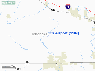
Location
& QuickFacts
|
FAA
Information Effective: |
2008-06-05 |
|
Airport
Identifier: |
11IN |
|
Airport
Status: |
Operational |
|
Longitude/Latitude: |
086-32-17.0000W/39-49-08.1620N
-86.538056/39.818934 (Estimated) |
|
Elevation: |
950 ft / 289.56 m (Estimated) |
|
Land: |
0 acres |
|
From nearest
city: |
3 nautical miles N of Danville, IN |
|
Location: |
Hendricks County, IN |
|
Magnetic
Variation: |
02W (1985) |
Owner
& Manager
|
Ownership: |
Privately
owned |
|
Owner: |
Dorel E. Graves, Jr. |
|
Address: |
4039 St Rd 39 North
Danville, IN 46122 |
|
Phone
number: |
UNLISTED |
|
Address: |
|
Airport
Operations and Facilities
|
Airport Use: |
Private |
|
Wind
indicator: |
Yes |
|
Segmented
Circle: |
No |
|
Control
Tower: |
No |
|
Landing
fee charge: |
No |
|
Sectional
chart: |
St Louis |
|
Region: |
AGL - Great Lakes |
|
Boundary
ARTCC: |
ZID - Indianapolis |
|
Tie-in
FSS: |
HUF - Terre Haute |
|
FSS
on Airport: |
No |
|
FSS
Toll Free: |
1-800-WX-BRIEF |
Airport
Services
|
Airframe
Repair: |
NONE |
|
Power
Plant Repair: |
NONE |
|
Runway Information
Runway E/W
|
Dimension: |
2675 x 90 ft
/ 815.3 x 27.4 m |
|
Surface: |
GRAVEL, |
|
|
Runway E |
Runway W |
|
Traffic
Pattern: |
Left |
Left |
|
Obstruction: |
|
5 ft fence |
|
Radio Navigation
Aids
|
ID |
Type |
Name |
Ch |
Freq |
Var |
Dist |
|
TVX |
NDB |
Greencastle |
|
521.00 |
03W |
13.9 nm |
|
HZP |
NDB |
Zionsville |
|
248.00 |
03W |
15.2 nm |
|
CFJ |
NDB |
Crawfordsville |
|
388.00 |
02W |
20.0 nm |
|
HFY |
NDB |
Greenwood |
|
398.00 |
02W |
23.5 nm |
|
UMP |
NDB |
Metropolitan |
|
338.00 |
03W |
23.6 nm |
|
FKR |
NDB |
Frankfort |
|
278.00 |
02W |
27.2 nm |
|
BA |
NDB |
Clifs |
|
410.00 |
03W |
44.8 nm |
|
BM |
NDB |
Claye |
|
382.00 |
02W |
45.9 nm |
|
HU |
NDB |
Yinno |
|
245.00 |
02W |
47.5 nm |
|
AI |
NDB |
Video |
|
371.00 |
03W |
49.7 nm |
|
VHP |
VORTAC |
Brickyard |
110X |
116.30 |
01E |
7.9 nm |
|
SHB |
VORTAC |
Shelbyville |
057X |
112.00 |
01E |
34.8 nm |
|
TTH |
VORTAC |
Terre Haute |
100X |
115.30 |
02E |
38.4 nm |
|
OOM |
VORTAC |
Hoosier |
039X |
110.20 |
02W |
40.7 nm |
|
OKK |
VORTAC |
Kokomo |
082X |
113.50 |
00E |
48.0 nm |
|
IND |
VOT |
Indianapolis Intl |
|
109.60 |
|
13.1 nm |
Based Aircraft
|
Aircraft
based on field: |
5 |
|
Single Engine
Airplanes: |
4 |
|
Multi Engine Airplanes: |
1 |
Jr's Airport
Address:
Hendricks County, IN
Tel:
Images
and information placed above are from
http://www.airport-data.com/airport/11IN/
We
thank them for the data!
| General
Info |
| Country |
United
States |
| State |
INDIANA
|
| FAA ID |
11IN |
| Latitude |
39-49-08.162N
|
| Longitude |
086-32-17.000W
|
| Elevation |
950 feet
|
| Near City |
DANVILLE
|
We don't guarantee the information is fresh and accurate. The data may
be wrong or outdated.
For more up-to-date information please refer to other sources.
|
|


