 |
|
Location
& QuickFacts
|
FAA
Information Effective: |
2008-06-05 |
|
Airport
Identifier: |
IG07 |
|
Airport
Status: |
Operational |
|
Longitude/Latitude: |
085-02-08.0000W/39-03-25.0000N
-85.035556/39.056944 (Estimated) |
|
Elevation: |
860 ft / 262.13 m (Estimated) |
|
Land: |
0 acres |
|
From nearest
city: |
5 nautical miles SE of Moores Hill, IN |
|
Location: |
Dearborn County, IN |
|
Magnetic
Variation: |
04W (1995) |
Owner
& Manager
|
Ownership: |
Privately
owned |
|
Owner: |
Joseph J Teuchert |
|
Address: |
11715 Chesterville Road
Moores Hill, IN 47032 |
|
Phone
number: |
812-744-6033 |
|
Manager: |
Joseph J Teuchert |
|
Address: |
11715 Chesterville Road
Moores Hill, IN 47032 |
|
Phone
number: |
812-744-6033 |
Airport
Operations and Facilities
|
Airport
Use: |
Private |
|
Segmented
Circle: |
No |
|
Control
Tower: |
No |
|
Sectional
chart: |
St Louis |
|
Region: |
AGL - Great Lakes |
|
Boundary
ARTCC: |
ZID - Indianapolis |
|
Tie-in
FSS: |
HUF - Terre Haute |
|
FSS on
Airport: |
No |
|
FSS Toll
Free: |
1-800-WX-BRIEF |
|
Runway Information
Runway 17/35
|
Dimension: |
1280 x 60 ft
/ 390.1 x 18.3 m |
|
Surface: |
TURF, |
|
|
Runway 17 |
Runway 35 |
|
Traffic
Pattern: |
Left |
Left |
|
Obstruction: |
25 ft trees, 500.0 ft from runway |
30 ft trees, 800.0 ft from runway |
|
Radio Navigation
Aids
|
ID |
Type |
Name |
Ch |
Freq |
Var |
Dist |
|
UR |
NDB |
Burln |
|
321.00 |
04W |
12.3 nm |
|
HLB |
NDB |
Batesville |
|
254.00 |
02W |
20.4 nm |
|
OVO |
NDB |
North Vernon |
|
374.00 |
02W |
26.4 nm |
|
IMS |
NDB |
Madison |
|
404.00 |
03W |
26.7 nm |
|
HAO |
NDB |
Hamilton |
|
260.00 |
04W |
28.7 nm |
|
OXD |
NDB |
Oxford |
|
282.00 |
04W |
29.6 nm |
|
ISZ |
NDB |
Cincinnati-blue Ash |
|
388.00 |
04W |
32.2 nm |
|
LUK |
NDB |
Cincinnati |
|
335.00 |
04W |
33.0 nm |
|
MDE |
NDB |
Madeira |
|
379.00 |
04W |
33.2 nm |
|
HKF |
NDB |
Hook Field |
|
239.00 |
04W |
38.1 nm |
|
PWF |
NDB |
Sportys |
|
245.00 |
04W |
38.3 nm |
|
BA |
NDB |
Clifs |
|
410.00 |
03W |
39.8 nm |
|
EQZ |
NDB |
Captain |
|
308.00 |
02W |
45.3 nm |
|
FLM |
VOR/DME |
Falmouth |
117X |
117.00 |
04W |
41.8 nm |
|
CVG |
VORTAC |
Cincinnati |
120X |
117.30 |
04W |
15.7 nm |
|
ABB |
VORTAC |
Nabb |
071X |
112.40 |
01E |
39.8 nm |
|
RID |
VORTAC |
Richmond |
043X |
110.60 |
03W |
42.9 nm |
|
LUK |
VOT |
Cincinnati Muni/lunken |
|
108.40 |
|
29.9 nm |
Remarks
- PRVDD
OBSTN ARE REMOVED OR LOWERED OR THLD DSPLCD; AREA 125 FT EITHER SIDE
OF RY CNTR LINE AND 200 FT OFF RY ENDS ARE CLEAR; AREA 60 FT EITHER
SIDE OF RY CNTR LINE AND 240 FT OFF RY ENDS IS CLEARED AND GRADED.
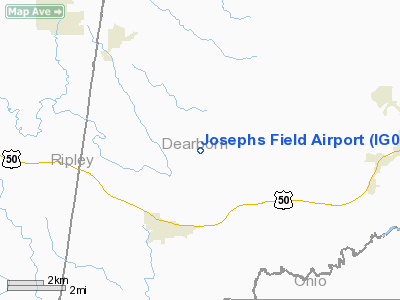
Josephs Field Airport
Address:
Dearborn County, IN
Tel:
812-744-6033
Images
and information placed above are from
http://www.airport-data.com/airport/IG07/
We
thank them for the data!
| General
Info |
| Country |
United
States |
| State |
INDIANA
|
| FAA ID |
IG07 |
| Latitude |
39-03-25.000N
|
| Longitude |
085-02-08.000W
|
| Elevation |
860 feet
|
| Near City |
MOORES
HILL |
We don't guarantee the information is fresh and accurate. The data may
be wrong or outdated.
For more up-to-date information please refer to other sources.
|
|


